Paddle Forward!

© 2018 Snapping the Globe, L.L.C. All rights reserved.

Rising early, I was hoping for a grand view of the Arenal volcano at sunrise before we set out for our whitewater rafting trip.  Low clouds…no luck!  In fact, we watched as it drizzled a bit while eating breakfast and wondered what our day might be like on the Balsa River.  I knew we were going to get wet, but, I was hoping for a little sun!

Having booked a whitewater rafting trip with Arenal Rafting, we set out down the little rocky mountain road to make the thirty minute trek into La Fortuna.  Although Arenal Rafting offers pick up at local hotels, we were a little too far from town so we had planned to check-in at the company’s office.  Arriving early, we learned a lot about the area and what our day would entail from Arenal Rafting’s owner, Danial Anchia, a local whitewater enthusiast, pioneer of the adventure industry and member of the Costa Rica National White Water Rafting Team.  We were definitely in good hands!

Used with permission, Arenal Rafting

Departing at 9:00, we joined a friendly group on the tour bus, making our way down scenic highways, past other attractions and quaint towns.  After a quick stop at a local restaurant for coffee and a bathroom break, we continued the journey to our starting point.

Even though I had done a short rafting trip (5 km) in Thailand in the Phang Nga province a few years ago, I felt a different dynamic here and was a bit nervous, especially when we were instructed on what to do within the raft…besides paddle.  There was so much to remember, depending on what the conditions were in the river.  If there were many rocks…“Get Down”…and we had to slide down to the floor of the raft and hold our paddles upright.  “Paddle Forward” and “Paddle Back” were the easiest.  Then, the scariest of the instructions…What To Do If You Fall Out of the Raft!  Surely that wasn’t going to happen?

The waters of the Balsa River are controlled by the government and released during certain times of the day, allowing suitable conditions for whitewater trips down the river.  As we waited for the river to rise to the appropriate level, we were divided into groups…my son and I were matched up with three lovely young ladies from Beijing and placed with Arenal Rafting guide, Melvin.

Stepping into the raft, we pushed off from the bank, the swift current carrying us rapidly down the river.

“Paddle Forward!”  We all paddled…some a little more forcefully than others and some keeping better time with each other.  It definitely took a little effort to get it down pat.

Used with permission from Arenal Rafting

When we entered the areas of stronger rapids, my nerves ramped up, especially when we heard Melvin yell, “Get Down”.  This took a few attempts, on my part, to remember the correct way to hold the paddle upright without decapitating my son who was with me, on my right, at the front of the boat.

The cold water continually splashed over the front of the boat, making us gasp and we relished the moments when the waters calmed for a few seconds.  Thankfully, we all managed to stay in the raft, though I can’t say another raft from another company was as fortunate.  As we swung around a large boulder, we watched their raft coming toward us, their smiles and elation turning to horror as they hit the boulder and flipped into the river…all while Melvin was yelling for us to “Paddle Forward!”.  As I turned around, I realized that our numbers had increased as we had fished some of their group out of the river.  A few scrapes and a drenching, but all were okay!

Used with permission from Arenal Rafting

Soon the waters steadied to a slow flow and we were able to marvel at the beauty of the Costa Rican terrain.  Breathtaking flowering trees, sloths hanging onto the occasional branch…we even spotted a toucan flying above us, making a river crossing. Truly, spectacular sights to behold!

Used with permission from Arenal Rafting

Pulling our rafts onto a nearby bank, we mingled with other rafters while our guides prepared a delicious snack of fresh fruit to enjoy as we rested our weary  arms.

A short while later, we headed back into the course, aiming to complete our journey.  Letting my guard down, I felt a tug on my life jacket and thanks to Melvin, took an involuntary swim.  I don’t know if I have ever experienced cold water like that…definitely takes your breath away!

Spotting our buses in the distance, parked under a bridge, we realized our intrepid journey had come to an end as our guides offered us warm, dry towels, waters and best of all, beer!  We could all toast to a successful trip!

After a stop at a local restaurant to dry off and change clothes, we were treated to a lunch of chicken, rice and beans.  Muy delicioso!

Our river journey had finally come to end.  Not having had any experience with any other companies or recommendations when booking our whitewater rafting trip, it was fortunate that I found Arenal Rafting.  A company that takes safety, as well as hospitality seriously, we couldn’t have enjoyed our adventure any more than we did!

For more pictures, check out Facebook, Snapping the Globe and Instagram, @snappingtheglobe.


Arenal Rafting

  • http://www.arenalrafting.com/
  • Balsa River Tour, Class II and III rapids.   Tour offered daily, departure 0900, return 1500.  Appropriate for ages 8 years and older.  $65 per person
  • Toro River Tour, Class III and IV rapids.  Tour offered daily, departure 0900, return 1500.  Appropriate for ages 12 years and older.  $85 per person.
  • Upper Balsa River Tour, Class III and IV rapids.  Tour offered daily, departure 0900, return 1500.  Appropriate for ages 12 years and older.  $85 per person.
  • Transportation offered from local La Fortuna hotels.

The Road Less Traveled

© 2018 Snapping the Globe, L.L.C. All rights reserved.

La Fortuna…here we come!

So you ask, what’s in La Fortuna?  I will be completely honest.  At the time we set out from Villas Calas, I really had no idea.  Friends had highly suggested we go there, however, and I had booked a white water rafting trip that we needed to get to.  I was ready to find out!

Turning on the GPS as we left Villas Calas, I discovered that it was sending me back toward San Jose and then up the western side of the country, something that was a bit confusing.  I always like to look at routing on a map before blindly letting Siri (or any other electronic voice) lead me and it appeared that we needed to continue north toward San Miguel.  Though my son (a child of the electronic navigation era) insisted we follow the directions coming from our GPS, I decided to go with my gut…I wanted to see some new landscapes after all!

Passing La Paz Waterfall Gardens, we crossed a bridge on Highway 126 and stopped along the roadway to admire the La Paz waterfall that we had seen the day before from within the park.   Continuing on, I soon discovered why GPS might have been trying to route us a different way…this was a winding road along the side of a mountain!  Adapting my race car driver persona, I swallowed the lump in my throat and drove carefully, yet as fast as my little rental would allow.

Before long, the steep drop offs on the side of the road didn’t terrify me and we even pulled over a few times for some stunning photos.

About three hours later, we were pulling into  La Fortuna, the small town in the northwestern part of the country which is home to Arenal Volcano National Park.  Indeed, as we drove down the main street, it was apparent that the stunning volcano takes center stage.

After a quick lunch at one of the many establishments lining the main street, we walked around investigating each of the souvenir shops located in the downtown area.  Finally securing a few beautiful masks for my collection and trinkets for our loved ones back home, we took a walk around Parque La Fortuna and took a quick look around the Catholic Church, La Parroquia San Juan Bosco La Fortuna.  Though the church lacks the opulence and history of many of the churches I have seen throughout the world, I loved that it was the center of the town…the center of life in La Fortuna.  Containing a prominent mural of Jesus Christ behind the altar, a red, black and yellow patterned floor, striped columns, and a beautiful stained glass over the front door depicting the patron saint, the church’s interior was a vibrant one.  Though I thoroughly enjoyed the interior, most visitor’s enjoy the view from the outside with the stunning Arenal volcano behind.

Finally, with mid-afternoon approaching, we decided to head toward our hotel, which would be our base of operations for the next couple of days, the Arenal Lodge.

Thirty minutes later, after driving across the dam on Lake Arenal and a treacherous climb up a steep, mountain road, we chuckled at the sign greeting us.  You made it!  Yes, we did!

The Arenal Lodge is located on 2,000 acres and is known for its stunning views of the Arenal volcano and Lake Arenal.  The rainforest surrounding it is home to  exotic birds, butterflies, frogs, small animals, tropical flowers and native trees which can be viewed from the walking trails leading from the lodge or from horseback rides led on the trails throughout the day.

The Lodge is rustic and casual and offers a infinity edge pool surrounded by a hummingbird garden, two heated jacuzzis, hidden within the garden’s blossoms and greenery, a game room, an outdoor playground and a gym.

If braving the steep, jagged road back to town in the dark isn’t appealing, especially after a few drinks, the lodge offers a full service bar and restaurant, serving international and casual Costa Rican cuisine with views of the volcano and a large outdoor seating area on the deck.  An extensive complimentary breakfast is also offered and rooms contain microwaves and refrigerators.

Sitting on my balcony, relaxing in the hanging swing, gazing out at the Arenal volcano, I sipped my Imperial beer, marveling that we had made it!  Two days ago, we had no idea where we would be and now, I was gazing out at one of Mother Nature’s marvels.

Life is good.

For more pictures, check out Facebook, Snapping the Globe and Instagram, @snappingtheglobe.


Parroquia San Juan Bosco

  • Address:  Alajuela Province, La Fortuna, Costa Rica
  • Hours:  0800-1800, daily
  • Admission:  free

Aremal Lodge

  • http://www.arenallodge.com/
  • Address:  142, 200 meters Northwest from the dam of the Arenal Lake, Fortuna de San Carlos, Alajuela, San José, 1250, Costa Rica
  • Room Rates vary by time of year and type of room requested;  Economy, Garden View, Family Suites, Junior Suites, Chalet, Honeymoon Suite and Master Suite, approximately $70-200 per night.   https://www.bookingplacecostarica.com/reservations/hotel/availability.aspx?hotelId=HA0416


Discovering Pura Vida

© 2018 Snapping the Globe, L.L.C. All rights reserved.

Rainforests?  Volcanoes?  Beaches?

If a vast array of nature’s offerings is what you are searching for in a vacation, then head down to Costa Rica, the rugged, rainforested country nestled between the Caribbean and Pacific. With a quarter of the area comprising protected jungle teeming with wildlife, many outdoor adventures await.

When my son and I departed from Richmond, early in the morning, we honestly did not know where we were going to end up that night.  Our suitcases were packed with a wide array of clothing options which would cover us from Alaska’s frigid temperatures to the Caribbean’s torridity.  Hoping to be able to escape winter’s wrath, we decided to try for the first flight with remaining space…San Jose, Costa Rica.  Though the flight was booked on the heavy side, we managed to secure two seats and were soon on our way.  Four hours later, our passports were being stamped and we were shuttled to our hotel for the night.

The plan was to pick up our car the next day and set out to see what we could find.  With suggestions from my flight attendant friends, we booked a room for the next night in Heredia and decided to visit the La Paz Waterfall Park.

Although we had a bit of a late start, we knew that our destination was only about an hour away and we would still have the entire afternoon to explore…or so we thought.  Traffic on the two lane highways was heavy as many tourists and locals made their way into the mountainous countryside.  We followed the other cars, passing coffee plantations, small restaurants and souvenir stands.  As traffic came to a standstill near the turn which would take us to the park, it was evident that the many locals we noticed in the lines of cars were not going to the same place as we were.

Inching our way up Highway 126, it soon became evident why our drive had tripled in time…a festival.  Cars were parked along the highway for miles and those departing walked with their children in strollers, carrying balloons, cotton candy and stuffed animals.  Eventually, we creeped past the carnival location, gaining speed and arriving at our destination with enough time, we were told, to see everything the park had to offer.

La Paz Waterfall Gardens is an eco park with five waterfalls, a cloud forest, a rain forest, hiking trails, an aviary with numerous species of birds, toucan feeding demonstrations, a butterfly observatory, monkeys, a hummingbird garden and snake, frog, jungle cat, insect, orchid and heliconia exhibits.

As we ventured into the well-manicured, but jungle-like landscape, we first encountered the aviary which contains some of the most exciting and colorful birds of Costa Rica.  The birds that reside here have been illegally captured by hunters and confiscated by the government or donated by their owners. Unfortunately, they all lack the basic skills to survive in the wild on their own, but are well cared for by the staff of the park.  Inside the aviary, we entered the toucan enclosure where we were assisted with feeding the toucans by holding food in our mouths.  Once we moved our hands and exposed the food, the friendly birds took the food straight from our lips!

One of the knowledgeable guides continued to walk with my son and I through the aviary, pointing our different species, including macaws, tanagers, parrots and finches.  Leading us to a caged enclosure, we discovered two sloths hanging from their wooden perches. This amazing guide not only took my camera into the enclosure to take some pictures for me, he then invited us into the cage after a group of onlookers had departed.  What a treat!  We were able to stand just below the sloths for great photo opportunities…one even reached down in an attempt to comb my hair with his long claws!

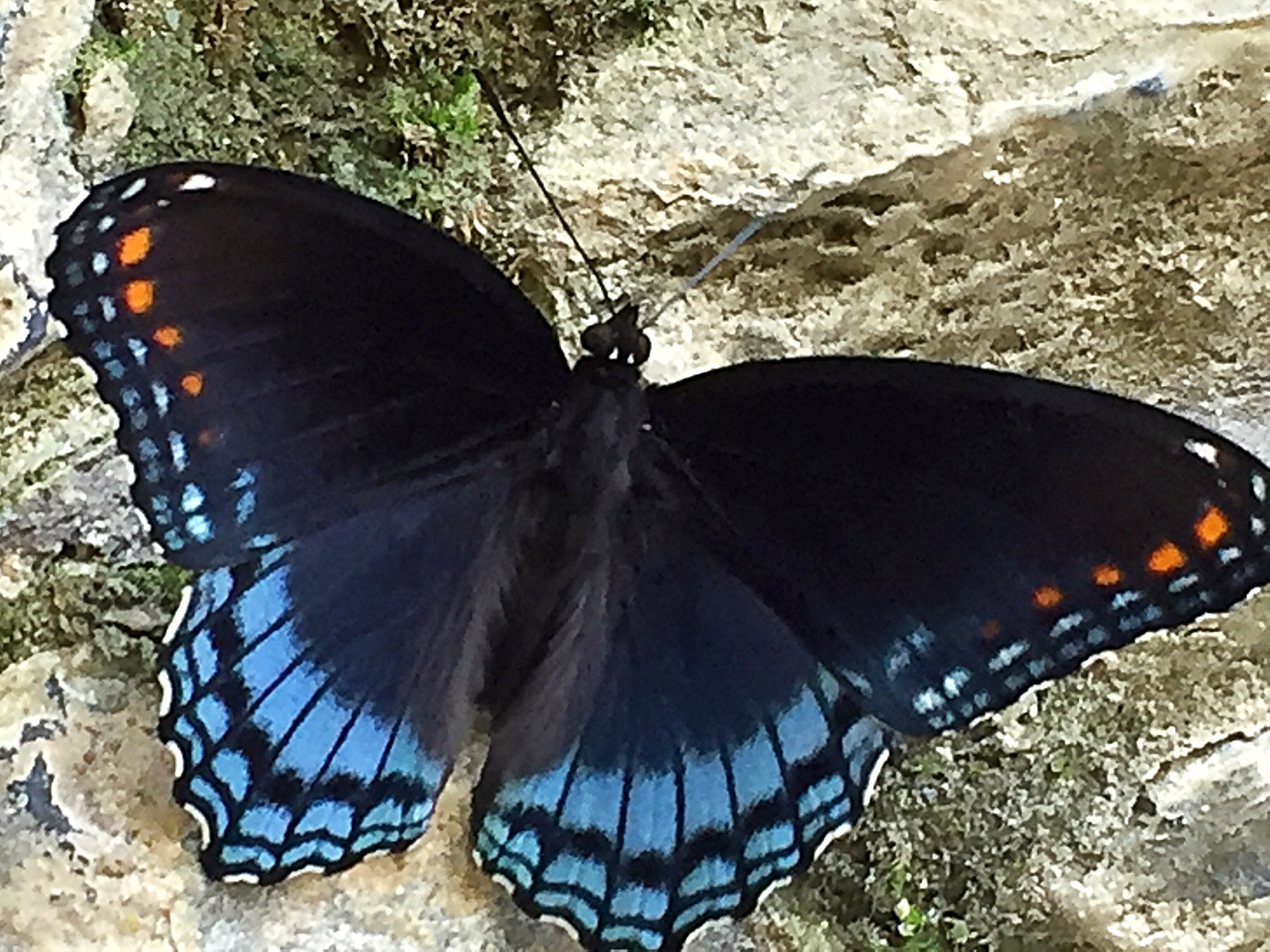
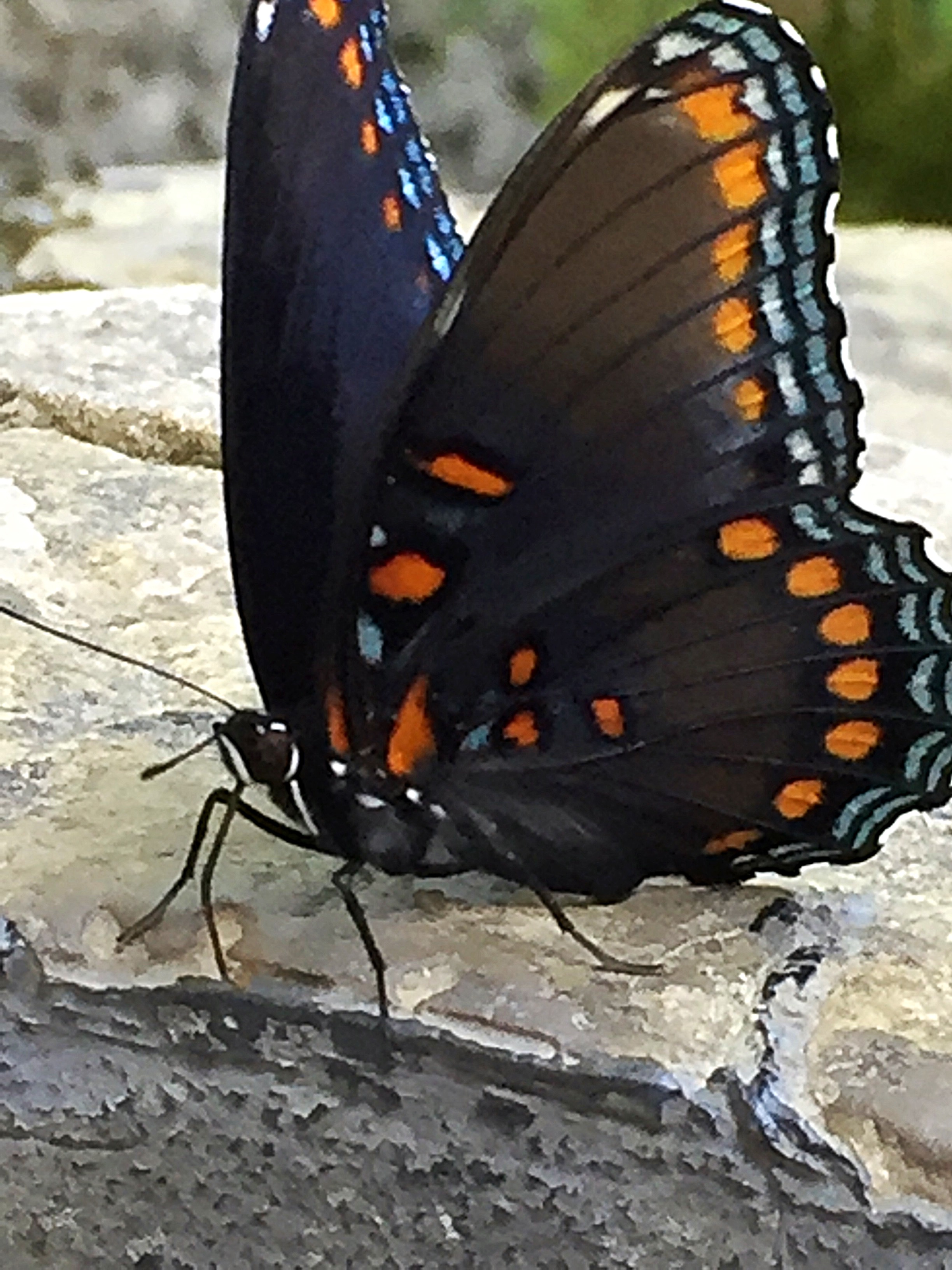
Thanking the guide, we continued on into the insect exhibit and the butterfly observatory where many of the 25 species of butterfly continually landed on our arms, heads and even my face.  My favorite part of the observatory was the laboratory area where we could observe the butterflies emerging from their chrysalis or in larva stages of their growth.

Exiting the observatory, we walked through Monkey Pass inspecting the spider and white-faced monkeys climbing and swinging through their exhibit.  These monkeys had once been illegally held and were confiscated by the Costa Rican Ministry of Wildlife.  Despite being abused and some near death, they have been successfully rehabilitated and have formed family units after being donated to the park.

Walking through the hummingbird garden, we then watched the diminutive feathered creatures flitting around amongst the trees and bushes while making our way to the serpentarium which showcases 30 of the most beautiful, yet deadly snakes of Costa Rica.  Here, we were able to view, up close and personal, boa constrictors, bushmasters, vipers and even the colorful yet venomous sea snake found off the Pacific Coast of the country.

The next exhibit displayed most of the six species of endangered Central American cats, including jaguars, pumas and ocelots which were placed in the care of the park after the Costa Rican Ministry of the Environment lost funding and the animals were unable to be released into the wild.  These animals reside in glass enclosures and can be viewed at close range.  Though beautiful to see at such a close distance, both my son and I were dismayed to see the jaguars pacing the cage continually…very sad to be in such close range to an area where they should be able to live free.

After departing the cat enclosures, we made our way to the orchid and frog exhibits.  The orchids were quite beautiful, but the frogs definitely stole the show.  In the humid ranarium, there are many species of native frogs that are allowed to roam (or hop) freely.  Here, you can find the Blue Jeans Poison Dart Frog, Caribbean Striped Poison Dart Frog, the Bullfrog and everyone’s favorite, the Red-Eyed Leaf Frog which looks very different while at rest.  When sleeping, the frog looks like a fat, green lump.  When awake, it is one of the most intriguing amphibians with its bright red, bulging eyes and red palms and soles.

Before moving on, make sure to visit Casita de la Paz, a farmhouse reproduction built using tools available to the average farmer a century ago.  See how water was collected and heated within the home, how the farmer would have lived within the home and two oxcarts, colorful vehicles used to transport coffee beans from Costa Rica’s central valley over the mountains to the Pacific coast.  Keep an eye out for the friendly mapaches, Costa Rica’s raccoon, that run around, and sometimes through, the cabin.

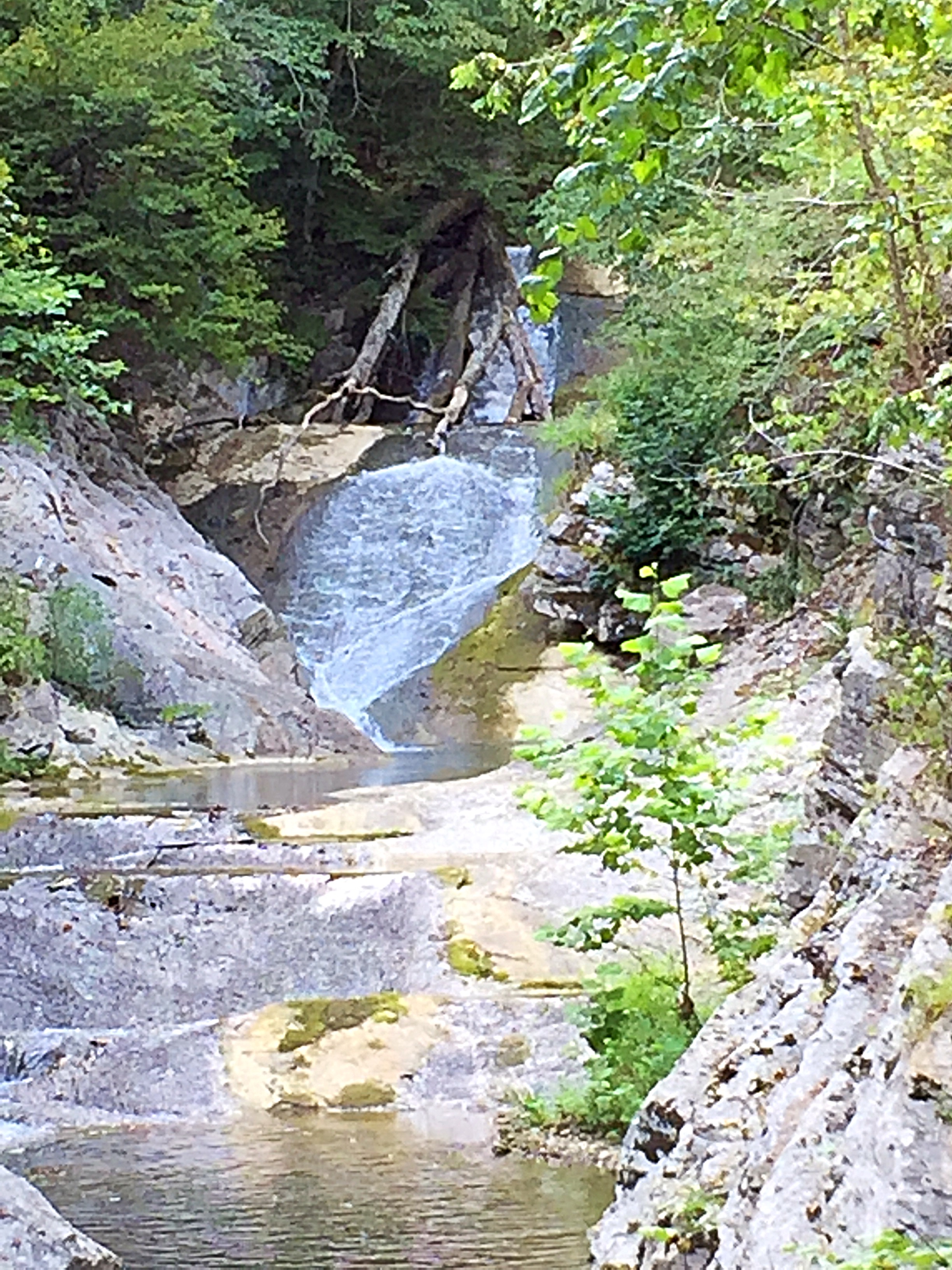
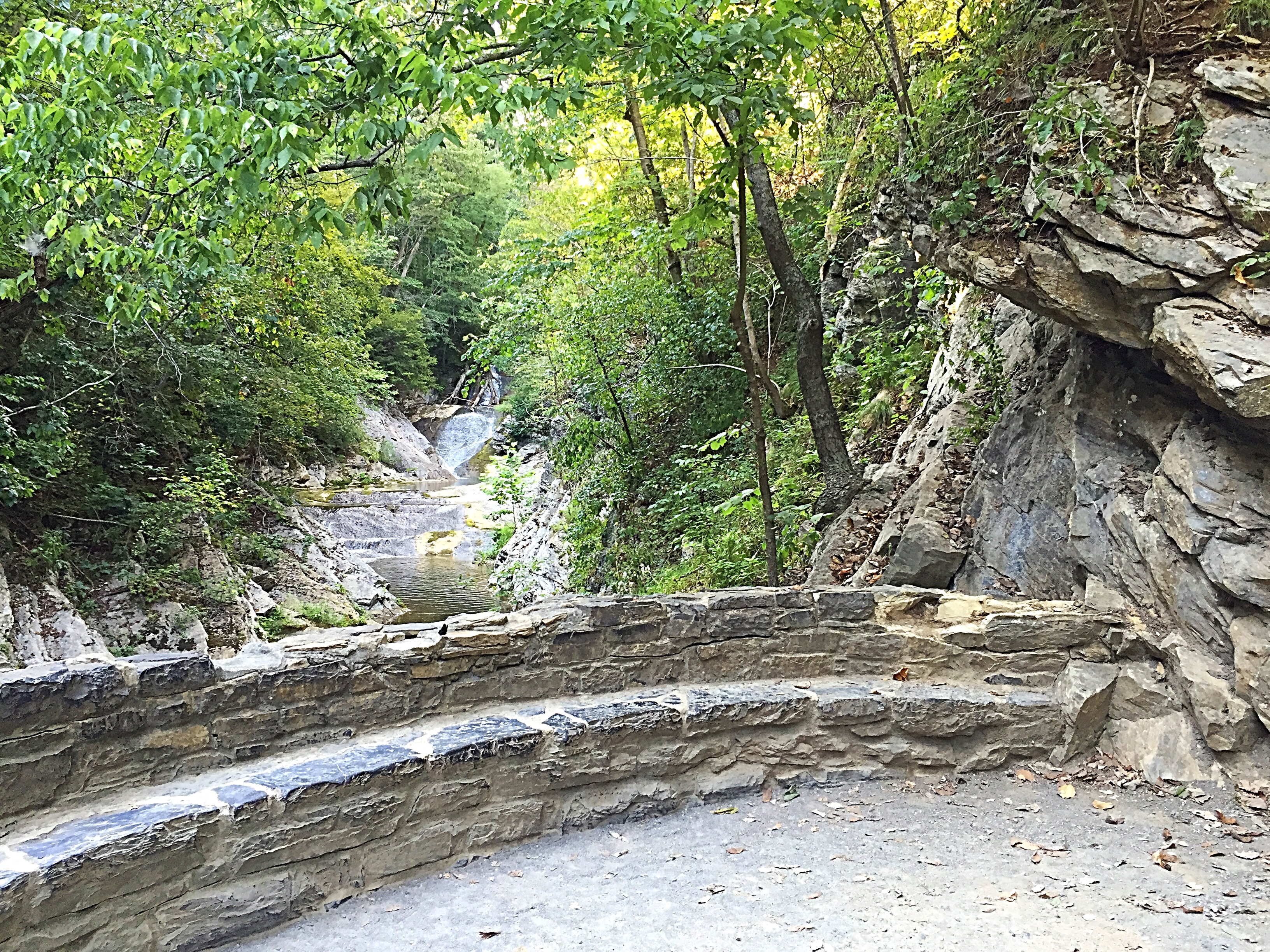
Finally, we were ready to hit the trails and make our way to the five waterfalls located in the park.  Well constructed viewing platforms allow for amazing photo opportunities and a cooling, mist shower whether you need it or not!  The Trail of Falls allows visitors to see five different cascades via trails and metal staircases following the Rio La Paz as it flows almost 5,000 feet down the slopes of the Poas Volcano.  The first waterfall, El Templo, plunges 104 feet into a pool of clear water surrounded by lush tropical vegetation.  Magia Blanca (White Magic), the tallest of the five, descends 131 feet and you can observe it from above and below the drop-off.  Continuing downriver, you can gaze upon Escantada (65 feet) and the much smaller, Escondido Falls.  The final deluge can be seen from the park, however, to get the full effect, it is best viewed from the end of the trail, walking along the highway (or drive the short distance upon departure from the park).  After all that climbing, if you are not up to returning the way you came (and my shaky legs were not), you can descend 400 steps to the gift shop and bus stop where a free shuttle bus is provided by the Gardens that takes you back to the reception area.

Usually, I am not a fan of attraction gift shops, but take some time to take a look at the Boruca masks sold here.  They are quite beautiful, made of balsa and feature three dimensional carvings of animals and other creatures indigenous to Costa Rica.  The ones offered in La Paz’s gift shop were not cheap, but some of the best quality that I found in Costa Rica.  I am sure there are many other places that sell this quality, however, I decided to wait and the ones I found in La Fortuna were not up to the standards that these were.

It was the end of our day, the park was closing and the weather was deteriorating rapidly, so sadly, we had to leave.  We truly enjoyed the park and wished that we had been able to secure reservations at the Peace Lodge located on the premises.  However, traveling the winding roads, we made our way back part of the way we had traveled a few hours earlier and to Villas Callas, our home for the night.

These cabañas are located a short drive from the waterfall gardens and are very reasonably priced.  Opting for a two-story unit, with the bedroom upstairs, we found it to be modest, but comfortable, and set in a well-landscaped expanse.  Each unit contains a fully equipped kitchen, bathroom, fireplace (great for cool evenings) and bedroom.  Make sure to stop by the small food stand at the entrance to the property for some amazing empañadas and take advantage of their complimentary breakfast at the property’s restaurant.

This part of Costa Rica is very beautiful and offers mountainous views, rolling hillsides and a major tourist attraction, Poas Volcano.  Though still closed since its eruption last year, the government is hoping for a re-opening (with some implemented restrictions) later this year.

So with a full day under our belt, we shut our eyes, readying ourselves for the long drive through the mountains to La Fortuna.  Dreaming of the long trek, I wondered what we would find!

For more pictures, check out Facebook, Snapping the Globe and Instagram, @snappingtheglobe.


La Paz Waterfall Gardens

  • http://www.waterfallgardens.com/index.php
  • Address:  La Paz Waterfall Gardens & The Peace Lodge, Vara Blanca, Alajuela, Costa Rica
  • Hours:  0800-1700, daily
  • Admission:  Adults, $44, Children, 3-12 years, $28, Under 3, free
  • Getting There:  Located 6 km, north, from Vara Blanca gas station

Villas Callas

Shut Up and Fish!

© 2017 Snapping the Globe, L.L.C. All rights reserved.

When you head to one of the greatest deep sea fishing locations in the Pacific…well…

you FISH!

While in Puerto Vallarta, my husband decided that we absolutely needed to book a fishing trip.  Checking around on the internet, we had yet to make a decision on a charter and were lying around on the beach, when we were approached by a gentleman offering to take us out on his boat.

After speaking with him a bit about the expedition, he seemed sincere and we decided to book the trip with him.  Paying him a $100 deposit, we arranged to meet him the next morning at the nearby marina.  A little later, however, I must admit, that the idea that he may have just collected money from us and would not actually show entered my mind!  Probably not the savviest decision on my part!

A quick cab ride the next morning, while the sun was rising, deposited us at the marina and thankfully, Hector was there…loading up his boat and waiting for us!

Boarding Hector’s thirty-six foot cabin cruiser, The Miramar, we made ourselves comfortable and were soon motoring out of the harbor into the open water.

As the sun ascended, the calm blue water spread before us like an open road.  Half asleep, we suddenly heard the captain shout.  Opening our eyes and following his gaze, we spotted spray shooting up from the ocean’s surface.  A Bryde’s whale was breaking the surface and we spied it’s slender, bluish-grey body make its way through the water.  It surfaced and dove a few times before we were unable to locate it any longer.  Such excitement!  Not to be outdone, a pod of bottle nose dolphin decided that it would be fun to follow the boat.  More fun for us as we watched them from the confines of our craft.

Excitement aside, Hector began placing the fishing rods in their holders at the rear of the boat…five in all…trailing the lures in the dark blue water behind us.

It didn’t take long…the bonitas were biting!  A strong, fighting fish, we all took turns struggling to pull them in one by one, even though they were not the largest fish we had ever caught.  A few Spanish mackerel even took the bait!  Pretty soon, the sun was high, the air was warm and our live well was teeming with a multitude of fish.

After three full hours of fishing, it was finally time to turn and make the return hour-long journey.  One of the best parts of the day, however, was yet to come.  Unable to take our catch home with us, Hector had brought the necessities to make cerviche.  We marveled as he made quick work of cleaning our haul throwing the entrails out into the water…the seagulls swooping in for a free meal.

We watched, mouths watering, as he chopped red onions, white onions, jalapeno, tomatoes, cucumbers and limes.  Letting the concoction marinate for a bit, it was soon time to taste the fruit of Hector’s labor…

Muy delicioso!  Hector’s cerviche was spicy and probably the best I had ever tasted!  SO good that I had to steal his recipe (which I fixed when I got home with some fresh fish we caught in our lake)!

Enjoying our light lunch, we sailed back into the marina.  Our fishing adventure had come to an end!  Thanking (and tipping) Hector and his captain, we gathered our belongings and disembarked The Miramar, hopping onto a local bus for the short journey back to our hotel.

Though we did not venture out for an entire day’s trip, nor did we catch any larger game fish, the journey out on the Bay of Banderas was a fun and exciting one!

Things to keep in mind…

A valid Mexican Sport Fishing License is required before fishing in Mexican waters.  Fishing license are usually included in the booking price (as ours was) or can be purchased from the charter operator.

One rod per person in the water at all times.

It is prohibited to sell the catch.

You need to be at least 250 meters away from swimmers in order to practice sporfishing.

For smaller fish, expect to book a four or five hour charter and remain in the Bay of Banderas.  For larger, sport fish, expect to book a full day’s charter and a lot more time in the boat making your way out to the fishing grounds.

For more pictures, check out Facebook, Snapping the Globe and Instagram, @snappingtheglobe.


Puerto Vallarta Fishing Charters


The Land of Plenty

© 2017 Snapping the Globe, L.L.C. All rights reserved.

What’s on your bucket list?

My list is quite extensive and encompasses many countries.  Some items on my checklist include:

exploring the Galapagos Islands

driving a husky sled

bungee jumping

watching the sunset from Santorini

gazing upward at the northern lights

I had hoped to check off the northern lights on my recent trip to Reykjavik, but the conditions weren’t optimum and my tour was cancelled during the afternoon.  Another item was meant to be, however…glacier hiking.

Glaciers and ice caps cover over 11% of the land area of Iceland and contribute to the economy with tourists flocking to see the glaciers on snowmobiles and glacier hiking tours.   Never having had the time to make it to this part of Iceland, I was eager to rise early and join a tour to fulfill one of my dreams.

Soon on our way, after an early departure, rain threatened our journey on and off until we arrived at our first stop, Skogafoss Waterfall.  Though there wasn’t sufficient time to climb the long winding stairway to admire the largest waterfall in the country from the top (82 feet and a 200 foot drop), I was able to photograph the cascading waters very near its base, only getting slightly wet from the massive amounts of spray that the waterfall produces.  As the rain temporarily cleared and the sun peeked out around the clouds, a beautiful rainbow was visible near the base of the waterfall.

Local legend states that the first Viking settlers buried a treasure behind the waterfall.  Locals supposedly found the chest years later, but lost it immediately, leaving it lurking in the water’s depths for some lucky individual to find.  Skogafoss has gained notoriety in recent years as a location for the filming of the movies, Thor:  The Dark World and The Secret Life of Walter Mitty.

Reboarding our all-terrain vehicle once again, we were soon arriving at our next destination, the village of Vík í Mýrdal and the Reynisfjara black sand beach, considered one of the most beautiful beaches on earth.

Signs line the pathway to the beach warning of danger from the rogue waves that roll in with full force from the Atlantic, but when you arrive at the beach, there is no shortage of people daring the tide…laying on the beach, trying to get their best photgraphic shots of the rolling waves and getting as close to these monsters as possible.  Spying a few soaked tourists, I stayed as far away as possible.

Looking out to the water, the Reynisdrangar basalt spires that lurk just offshore provide amazing photo opportunities.  Legend has it that these spires are actually trolls frozen in place while attempting to drag three ships out of the sea under the cover of night.  As the morning dawn surprised them, they were turned to stone.

Many caves also line the beach area and the rocky areas along the beachfront display interesting hexagonal forms which were formed from the contraction of flowing and cooling lava.  The formations here appear as a sort of staircase and all visitors seem to try their hand climbing as high as they can for photo-ops and selfies.  I even tried it…it is not as easy as it looks!

The adjacent, small village of Vík í Mýrdal, with 450 inhabitants, lies directly under the Myrdalsjokull glacier, which sits atop the volcano Katla.  Speculation is that since there has not been an eruption since 1918, another may be brewing causing glacier melt and flash flooding which could decimate the village.  Regular drills are held in the village directing residents to the local church which sits atop a hill hopefully protecting it from the floodwaters.  If you are driving the ring road around the island, it is important to keep this village in mind as it is the only service center between Skógar and the west edge of the Mýrdalssandur glacial outwash.

Leaving Vík í Mýrdal, we were finally on our way to Sólheimajökull glacier, driving past beautiful countryside views.   Donning my ski pants, hat and gloves while enroute, I readied myself for what we would encounter.

Upon our arrival, we were greeted by our glacier guides and outfitted with crampons, helmets, harnesses and ice axes.  I was also fitted for my hiking boots that were reserved with my booking.

Soon, we were making our way up the trail, heading toward the glacier.  Carrying our crampons on our axes, we walked along the edge of the glacial lake to our staging area.  A beautiful rainbow stretched like a bridge across the lake and we could not wait to make the climb up to the glacier.  After a quick lesson in strapping on our crampons, we were ready.

A staircase and trail had been cut into side of the glacier and although I am regularly active at the gym, walking in heavy hiking boots and crampons took a little getting used to.  Panting for breath, I was happy when we reached the top of the glacier.   Walking in single file behind our guide, the beauty around us was indescribable.   The glacier (8 kilometers long and 1-2 kilometers wide) spread out in front of us with lots of blue ice, crevasses, sink holes, ice ridges and even another rainbow!  After a long walk and lots of photo opportunities, however, it was time to head down…a much easier journey than the trip up.

Although I was a participant in this awesome experience, it was a bit sad to watch the rivers of water run down the glacier into the lake below, highlighting the glacier melt taking place every day.   The glacier, sensitive to climate change is also being affected by the large numbers of tourists every day.  From 1930 to 1969, this glacier retreated 977 meters but then the weather cooled and the glacier advanced 495 feet and thickened by 100 meters.  The glacier then retreated again and in 2010, it was almost one kilometer further up the valley than in 1930 and was 120 to 140 meters thinner than in 1960.  According to our guide, if the warming trend continues, the glacier may potentially disappear in 100 to 200 years.

Happy to have a break (and a snack) on the bus, we were soon headed to our final destination, Seljalandsfoss waterfall.  Due to our later than anticipated arrival, the first thing I noticed as we pulled into the parking lot, were park officials closing off the trail.  Sadly, the trail that make this waterfall famous, as it makes its way behind the cascading waters, was closed off.  Jumping the rope, I did make it as far as the top of the stairway to the viewing platform and got some amazing shots of the waterfall.

Finally, heading back to Reykjavik, tired and exhausted, it was time to pull out my phone and place another check on my Bucket List.  One of the most interesting places in the world, I enjoyed nature’s beauty but learned how much more there is to see.  Slowly I typed in another item on my list.  Rent a car, drive Iceland’s Ring Road.

Check out additional pictures on Facebook, Snapping the Globe and Instragram, @snappingtheglobe.


Grayline Tours Southcoast, Waterfalls and Glacier Hike


Pretty As A Postcard

© 2017 Snapping the Globe, L.L.C. All rights reserved.

Planes are full and people are flocking to…

Reykjavik!

A few years ago, my airline starting flying to Iceland.  Though our flights were heavy, it seemed like a place that only those seeking extreme adventure traveled to.  Waterfalls, rock climbing, glacier hiking, geysers, volcanoes, horseback riding, whales, geothermal spas, northern lights…you can find it all in Iceland.

Today, our planes are continually full, even in winter, and Iceland seems to be the new travel hotspot.  Everyone wants to go!

The first time I ever traveled to Reykjavik, we hit the ground running.  With only twenty-four hours, we quickly changed clothes, grabbed a rental car and drove the entire Golden Circle (the popular tourist route that includes stops at the Strokkur Geyser and the Gullfoss waterfall) and visited the Blue Lagoon, the famous, geothermal spa.  On my other two visits, whale watching and Icelandic horseback riding were on the agenda.

What I especially love, however, is just walking around the town and appreciating the cleans lines of the architecture, the random sculpture scattered throughout, how tidy everything is and how friendly the Icelandic people are.

Recently while visiting, I took the afternoon to wander around the during the clear winter day, stopping to marvel at the lake near Town Hall.  Frozen solid, it reflected the colorful buildings that surrounded it, and I wished that I had brought my ice skates to join the locals enjoying themselves on the beautiful, sunny afternoon.

The Church of Hallgrímur, my next stop, is located near the center of the city and is an absolute must-see.  A Lutheran church, Hallgrímskirkja was completed in 1940, and is the largest church in Iceland, as well as the tallest structure in the country.  The unique building was designed by Architect  Guðjón Samúelsson and is said to have been designed to resemble the trap rocks, mountains and glaciers of the Icelandic landscape.  At the forefront of the building is a statue of explorer Leif Eriksson which predates its construction.  A gift from the United States in 1930, it commemorated the 1000 anniversary of Iceland’s parliament at Þingvellir in 930 A.D.

Having visited the church once before, I took more time to inspect the interior of the church as well as the large pipe organ, constructed by German organ builder Johannes Klais of Bonn.  The massive organ is 15 meters tall and weighs a whopping 25 tons.

The church also serves as an observation tower and I decided to brave the interminable line to ascend the elevator to the viewing deck.  With such a clear and sunny day, I was able to view the entire city as well as the harbor and surrounding mountains.

There are many restaurants and bars throughout the city center.  Many first time visitors, however, are shocked at the costs of dining out and of alcoholic beverages.  Since Reykjavik is an island, of course everything must be shipped in adding to the overall price.  On one of my previous visits, a pizza, half a salad and a beer totaled up to about $45.  There are some cheaper options out there, just ask around.  And, keep an eye open for Happy Hour specials in many of the hotels and watering holes.

Whenever you decide to visit this amazing country, summer or winter, be prepared for many things to occupy your time…so many that you may have to pick and choose and save some for a later visit.  But, no matter what time of year you decide to visit, be prepared for the large number of visitors also checking out what this fascinating country has to offer!

Check out Facebook, Snapping the Globe and Instagram, @snappingtheglobe for more pictures.


Church of Hallgrímur (Hallgrimskirkja)

  • http://www.hallgrimskirkja.is/
  • Address:  Hallgrímstorg 101, 101 Reykjavík, Iceland
  • Hours:  Winter (October-April): 09:00-17:00. Tower closes 16:30.  Summer (May-September): 09:00-21:00. Tower closes 20:30.  The tower is closed on Sundays from 10:30-12:15 for mass at 11:00.
  • Tower Admission:  Adults, ISK 900, Children (ages 7-14) ISK 100, Under 7, free.  Tickets are sold in the church shop.


A Monumental Resting Place

© 2017 Snapping the Globe, L.L.C. All rights reserved.

Some people just don’t like the idea of cemeteries, feeling uneasy knowing that they are surrounded by so many long, lost departed souls.  Me?  I love them and have visited a great many in cities around the world.  A place of remembrance, it gives solace to those who visit their loved ones, but it can also tell you so much about the culture and history of a city or country.

My favorite cemetery, second only to La Recoleta in Buenos Aires, is located in Milan.  A couple of years ago, my friend Judy and I ventured out on the new subway line in search of what this place had to offer.  We were blown away!  The extravagance and opulence were more than we ever expected!

Opened in 1866, the largest cemetery in Milan can be described as more of a museum or park.  Filled with contemporary and classical Italian sculptures and tombs, it also features Greek temples, elaborate obelisks and many original works from a vast array of famous artists.  Many notable Italian citizens are interred throughout the property, including conductor and cellist, Arturo Toscanini, actor, Walter Chiari and Nobel prize winner, Salvatore Quasimodo.

Just recently, I found myself in Milan again on a beautiful, warm and sunny day.  Heading out by myself, I decided that Monumentale would be the perfect location to take in the lovely afternoon and capture its beauty with my camera.

Entering through the main Famedio, a Neo Medieval style memorial chapel made of marble and stone, I first stopped to gaze upon the beautiful blue ceiling and the tomb of novelist, Alessandro Manzoni before making my way through each of the hallways.  I particularly loved walking along the outer edges of the open-aired corridors so that I could admire the building’s architecture, the courtyard and the ornate tombs that line the area.

Before making my way into the cemetery’s immaculately groomed grounds, I then walked the full length of the building’s lower level, exiting at the center, where I could examine the map and the locations of the cemetery’s famous occupants.  In this area is also a structure comprised of metal tubes and black and white stones centered with a small clay bowl placed inside the main formation.  Surrounded by memorial plaques, I was informed by a fellow bystander that it is a monument to the 800 Italians who perished in Nazi concentration camps and the bowl was filled with soil from the Mauthausen concentration camp.

Wandering the grounds, through the avenues of trees, should be reserved for an unhurried pace as to absorb entire beauty of the surroundings and that’s just what I did.  It was impossible not to want to stop and inspect each monument, so detailed and individualized were they.  Many of the tombs and funerary monuments are of such an extravagant size, it is almost as through you are walking through a neighborhood of homes.

At the rear of the property is the Jewish section which contains its own entrance, and a central building which was once the original entrance for Monumentale.  There are many monuments of artistic value in this section by famous architects and sculptors.  When walking through this area, be sure not to miss the artistic windows in the central building which represent the twelve tribes of Israel by artist Diego Pennacchio Ardemagni.

Three other sites that absolutely cannot be missed are Mausoleum of Antonio Bernocchi (designed by Giannino Castiglioni), where you can lean inside and gaze at the upward spiral design of the monument, the full-size casting of the Last Supper for the Campari family tomb and the monument to the Besenzanica family, “L’Aratura” designed by Enrico Butti.

Even with the lesser known and less famous gravesites, beautifully detailed sculpture can be found.  My favorites were of people of all walks of life…sailors, soldiers, children…but I especially enjoyed the flying girls and the grave with the scooter as they were so different.

My second time in Monumentale, I enjoyed as much as my first, staying for more than three hours.  Many people always tell first-timers to visit the Duomo and the Last Supper, but honestly, this ranks right up there as an extremely important Milanese tourist destination.

So…when in Milan, skip the fashion shows…spend a day surrounded by art in Milan’s open-aired museum…I mean cemetery!

For more pictures, check out Facebook, Snapping the Globe and Instagram, @snappingtheglobe.


Monumentale Cemetery

  • https://www.comune.milano.it/wps/portal/ist/en
  • Piazzale Cimitero Monumentale, 20154 Milano, Italy
  • Hours:  0800-1800, except Mondays, entrance permitted up to 30 minutes before closing.
  • Admission:  free
  • Getting There:  Metro, line M5, station Monumentale.  Tram lines 2, 4, 12 and 14.  Bus 37.

Arthur’s Seat

© 2017 Snapping the Globe, L.L.C. All rights reserved.

In 1850, an apostle of Church or Jesus Christ of Latter-day Saint,  Orson Pratt, climbed Arthur’s Seat to pray to God for more converts.

In 1884, Emile Rey, an alpine mountain guide, estimated that climbing Arthur’s seat would take much of an entire day to reach the top, before he did so in a shorter time period.

In 2016, Leah and Ethan, two American tourists, climbed the hill in record time (theirs anyway) trying to summit and then enter Holyrood Palace before closing time.

Okay, so we are not prominent figures in history!  But we did climb Arthur’s Seat… the hard way…in record time!

My son and I had spent the morning at Edinburgh Castle.  Heading down the Royal Mile, we made it to Holyrood Palace around half past one.  The day had cleared and as we approached the palace, we could see many people along the ridgeline of Arthur’s Seat.  Watching the tiny figures, my son said, “I wish it didn’t get so dark so early, we could have climbed Arthur’s Seat after we finished touring the palace.”

image

Wanting to make sure that he enjoyed his time in Edinburgh, I suggested that we verify the closing time of the palace and see if we couldn’t fit it in first.  Surely climbing that hill wouldn’t take that long!

The ticket agent at the palace let us know that the palace was closing at 3:30 that day and the last ticket would be sold fifteen minutes prior.  We told her what we wanted to do and she gave us her input.  Climbing the hill would take about 45 minutes to the top and about 30 minutes to get back down and to the palace.

If we hurried, we could make it.

Hurrying out of the palace gates, we turned left towards the hill and crossed the car park toward the start of the path.

image

Only…there were two paths.

One to the left and one to the right.  People were walking off both ways and we weren’t quite sure what to do.  Well, we wanted to climb and the one on the right appeared to ascend.  Right…we’ll go right!

image

The path was pretty steep and even though I like to think I am in shape, I began to realize that I’m not.  My son, the much better athlete, began to pace himself and wait every now and then to let me catch up.  Stopping every now and then, however, not only gave me a chance to catch my breath, but gave us the chance to appreciate the astonishing views.

image

image

image

As we neared a bend, we assumed the path would continue upward, only when we turned, the path leveled off and then descended.  Wait..what?  We continued down and could see on the next hill where people were climbing a much steeper route.  As we got to the bottom of the path, we looked to the left and could see a trail that appeared to have wound itself around the hill we had just climbed and then descended…and…it was pretty level.  Could this have been where the people who walked to the left ended up?  That’s what it looked like!

image

We moved on to the next hill, climbing slowly, breathing heavy.  Watching the time carefully, we realized that it had taken us a lot longer to get to this point than we had anticipated.  Deciding that my son could possibly make it without me, I sent him on ahead.  I would get to whatever point I could and hopefully meet him on his way back.

At the top point of the hill, I did meet up with him, however, he pointed over to another elevation in the distance…the summit.  I decided that we would continue.  We were so close and even turning back now did not guarantee us making the closing of the palace.

image

Taking another path, we found ourselves at the base of the final push.  After a treacherous rock scramble, we made it!  823 feet high!  On the summit, there was a trig point and beautiful views of the city and along the coast to the east.  Breathtaking!

imageFighting the strong winds, we managed to snap a couple of pictures and with a glance at our watches, we decided that if that path we missed on the way here was indeed a quicker, shorter way, we then had thirty minutes to make it back to the palace before the ticket counter closed.

Scrambling down the rocky route, quicker than any mountain goat could, we quickly reached the level path and began to sprint in intervals.  As we finally neared the end of the walkway, it did indeed take us back to where we started (the hard way) and the car park.

image

image

Crossing the car park, we had about four minutes to spare.  Stumbling into the ticket office, sweating and gasping for breath, I expected the staff to be closing up. Instead, I found a group of Chinese tourist standing in line.  Taking our place behind them, we breathed a sigh of relief!  We did it!

For more pictures, check out Facebook, Snapping the Globe and Instagram, @snappingtheglobe.

Arthur’s Seat


Getting High On the Way to Hue

© 2016 Snapping the Globe, L.L.C. All rights reserved

The first time I ever heard of the city of Hue was during the planning stages of my trip to Vietnam.  My friend sent me a text with a picture and right then, I knew I had to make time in my schedule to travel there.

Taking the bus from Hoi An would have been a cheaper option (about $5), however, there were a few things that I wanted to see along the way as well as arrive in Hue with enough time to see the Citadel during the afternoon.

Hiring a driver on my own was a little cheaper than booking through my hotel. Ironing out the details through email, I agreed to a driver that spoke enough English to communicate effectively, but not act as a tour guide. I also informed the car company that I wanted to stop at the Marble Mountains, China Beach, Hai Van Pass and Lang Co Beach.

After my last, amazing breakfast and a final look around the Ha An Hotel, I met my driver at the front gate. Expecting a long ride, I settled into my seat and watched Hoi An disappear behind me. About a half an hour later, I noticed the driver turning off of the main highway. A few minutes later, he pulled up to the curb, came around the car and opened up my door, “Madam, Marble Mountain”. Taken off guard, I hadn’t expected to be there that soon. Grabbing my bag, I jumped out of the car and headed up the steep steps to the ticket booth. Paying my entry fee and purchasing a map, I climbed more stairs, not quite knowing what to expect.

The Marble Mountains are a cluster of five hills made from limestone and marble and named for the elements; metal, wood, water, fire and earth. The area that these mountains lay in is known for stone cutting and sculpture. A much visited spiritual site, Water Mountain houses numerous paths leading to a host of Buddhist sanctuaries, temples and places of worship, some in caves.

imageMaking my way up the steep, marble stairs (I later learned later that an elevator was available), I turned a corner and to my utmost surprise was a beautiful garden with a large dragon statue and many small Buddhas. To the right, was a large, white seated Buddha. Standing next to the Buddha, looking out from the mountain, were views of the beaches and the coastline.

image

Through an entrance gate and located on the eastern side of Water Mountain, was the Linh Ung Pagoda. Constructed during the Nguyen Dynasty, it contains representations of the three Buddhas; The Buddha of the Past (Amitabha), Buddha of the Present (Sakyamuni) and Buddha of the Future (Maitreya). The pagoda has been designated a national historical and cultural site by the Ministry of Culture, Sports and Tourism.

image

image

image

image

image

image

To the right of the pagoda is Vong Hai Dai, the sea-viewing pavilion, which offers an amazing view of Non Nuoc Beach and behind the pagoda is Tang Chon Cave, which has a impressive standing Buddha and Chua Linh Ung Temple. Also in this area is the Xa Loi Tower, a 15 meter tower, built of stone, overlooking the coast.

image

image

image

image

image

image

image

Climbing the mountain further, I encountered Am Phu and Van Thong Caves.

After entering Van Thong Cave, known for its huge statue of Buddha, I found the ascent to be extremely steep and I decided to head on to Am Phu.

image

Am Phu, meaning “hell” in Vietnamese was opened to tourists in 2006. The natural rock formations, stalactites and dark tunnels are enhanced with terrifying figures and altars designed by local artists. Not for the faint of heart, visitors can confess their sins and repent at the temple shrine.

image

image

imageFurther on Water Mountain, upon entering the Hoa Nghiem Cave you are greeted by a large lady Buddha statue, the goddess of mercy. Descending twenty steps, you enter Huyen Khong Cave which contains various Buddist and Confucian shrines. Opposite the entrance is a large Buddha, carved by the famous craftsman, Nguyen Chat in 1960. Below the statue is the altar of “Dia Tang Vuong Bo Tat” (the most powerful Buddha in hell) and to the left, the shrine of “Ngoc Phi” (the goddess of wealth) and on the right, the shrine of “Loi Phi” (the goddess of Mountain and forests).

image

image

image

image

Not only having spiritual value, the cave also has great historical value. When Vietnam was at war with the French, the cave was used as a secret base for local communist leaders and guerrillas. Later, during the Vietnam War, the American military used it as a commando training area and a garrison of the Old South Government and American units.

imageAlthough I was given an hour, it was definitely not enough time to see all that there was to offer. Skipping Linh Nham Cave, I stopped to inspect the Tam Thai Pagoda. Looking out to the west, the pagoda was built in the 17th century and has three stories; Thuong Thai, Trung Tai and Ha Thai. Most interesting to check out is the old, mossy entrance gate. Pho Dong Tower, Tu Lam Pagoda and Vong Giang Dai (river view pavilion) are adjacent to the Tam Thai Pagoda. Amazing views of the Truong Giang and Cam Le rivers can be seen from Vong Giang Dai.

image

image

image

image

image

image

image

image

image

imageimageMaking my way from Tam Thai pagoda, I soon found myself heading down the mountain, only, not to the eastern gate. I had moved downhill toward the Tam Ton pagoda. Although I was happy to have seen this tall, beautiful pagoda, time was up and I was needed back at my car to continue our journey. Asking a couple of workers in the area to direct me the right way, they pointed in a general direction and said, “That way.” Seeing no path, I asked again, Pointing toward a field, I walked that way, still seeing no path. Looking upward, I realized that I did not have the time or energy to make my way up toward the Tam Thai pagoda and back down to the eastern gate. Again, I asked another worker and was shown what to do. Now why didn’t I think to climb a small hill of slabs of marble and trudge through a field of weeds where some poisonous snake or rabid animal was surely hiding and waiting to strike?

image

imageTime was a ticking…so I climbed and ran like the wind through the field. Arriving at the main road, I looked to the mountain to get my bearings and made my way back to where I believed my driver was waiting…and thankfully, I found him!

imageSoon we were on our way, once again, towards Danang. My driver pulled over so that I could take some snapshots of My Khe Beach. This twenty mile stretch of white sandy beach was used by the American troops during the Vietnam War. Nicknamed China Beach, it is considered to be one of Vietnam’s most picturesque beaches.

imageCrossing Danang’s Dragon Bridge over the River Han, we continued into the mountains. The dark clouds that had been threatening all day, soon opened up and offered a light rain. Climbing higher into the mountains, the clouds settled around us and the views of the coast below us became obscured.

image

imageBefore long, I noticed the traffic growing heavier both forward and aft of us. Pulling into a tight space between two tour buses, I realized that we were not just at a rest stop. My driver didn’t really communicate with me as to where we were and I glanced around, a little confused. Clouds were low and whipping by making it hard to see the area, but I noticed other tourists crossing the street. Following suite, I climbed the stairs and stood among the many visitors taking pictures in the foggy atmosphere of the ancient Tran Dynasty’s Hai Van Gate, wartime gun towers and French built fort that was later used as a bunker during the Vietnam War.

image

image

image

Crossing a spur of the Annamite Range, Hai Van Pass is an approximately 21 km long mountain pass on National Route 1A near Bach Ma National Park.  The name Hai Van refers to the mists that rise from the sea, reducing visibility, and that’s just what we had today.  Snapping a few pictures, I could only imagine what it would look like here on a clear day.

We continued on the twisting road, the rain hampering our progress.  Closing my eyes, I rested while we drove on.  Soon, my driver pulled over again, and informed me that we were looking down on Lang Co Beach.  Since it was still drizzly, I quickly snapped a few photos, thinking that it would be a nice place to visit at another time.

image

image

image

Jumping back into the car, I checked my watch and noted that we had made better time than I had expected.  Knowing that Lang Co Beach was not far from Hue, I anticipated another half hour’s journey.

As we left the mountains and rice paddies, I began to see more buildings and businesses.  Checking the map on my phone, I realized that we were entering the city of Hue. A few minutes later, we were pulling onto Chu Van An Street and in front of the Orchid Hotel, my base of operations for the next day.  Excitedly, I gathered my belongings and headed inside, ready to begin my exploration of Hue.


For more pictures, check out Facebook, Snapping the Globe and Instagram, @snappingtheglobe.


The Marble Mountains

  • Address: Hòa Hải, Ngũ Hành Sơn, Da Nang, Vietnam
    Hours: 0700-1700
  • Admission: 15,000 Vietnamese Dong (about US $ .67)
  • Map:  Admission: 15,000 Vietnamese Dong (about US $ .67)
  • Elevator: 30,000 Vietnamese Dong (about US $1.30)
  • Getting There: Bus #1 stops in front of the Marble Mountains and covers the journey from Danang to Hoi An. Catch the bus from the bus station in Danang (Dien Bien Phu no. 33) or from the Hoi An bus station (Le Hong Phong Street junction with Nguyen Tat Thanh). 20,000 Vietnamese Dong (less than US $1). The bus takes 15 minutes from Danang and 40 minutes from Hoi An. Taxi from Danang costs approximately 50,000 Vietnamese Dong. From Hoi An, approximately 200,000 Vietnamese Dong.

marble_mountains_map


Bridge of the Gods

© 2016 Snapping the Globe, L.L.C. All rights reserved.

Its wonderful to travel to distant cities and countries.  There are so many things to see and do in this world, though, sometimes it is easy to forget to look in your own backyard at the many magnificent things available nearby.

Many years ago, a hurricane was coming. Growing up in Louisiana, I was accustomed to hurricanes, however after moving to Virginia, it never really occurred to me that we might be subject to an occasional storm…but that’s just what happened.

With three young children and a husband out of town on business, I decided to seek shelter in the western part of our state.  This is how I came to know the Natural Bridge of Virginia.

image

After the storm had passed, we were heading back to a home with no power.  Three cranky children had no desire to sit in a car for the long ride, so when I spied the exit for Natural Bridge of Virginia, I decided that it would be a great place to let them stretch their legs.

Years later, driving home exhausted after a long college visit, my son and I needed a place to stretch our legs.  Spying the sign, we decided it was time to revisit this state treasure.

The Natural Bridge was formed when a cavern collapsed leaving the span that exists today, however, a different story comes from the Monacan Indians.  They relate a tale of the bridge appearing before them…The Bridge of the Gods, as they called it…when they needed an escape from an approaching enemy.  In 1750, George Washington surveyed the land for Lord Fairfax and the initials GW, which were carved into the side of the bridge, can still be seen today.  At the end of the century, Thomas Jefferson built a two-room log cabin, reserving one room for guests.  This began the property’s development as a retreat.  Eventually, after the sale of the cabin, a new inn was built to accommodate the increasing number of visitors.  These visitors still continue to this day.

Pulling into the parking lot, the red brick building was pretty much how I remembered it.  What had changed was the admission price.  $20 for adult admission seemed a bit steep, but thankfully, I was able to secure a student discount for my son.
natural-bridge

imageAs we made our way down the steep, rocky path, we soon found ourselves wandering along the small stream which led us to the thing we had come to see, the Natural Bridge.  Funny thing was…last time we had visited, I thought that I had remembered seeing the Natural Bridge last, the culmination of a long walk. Either the path had changed or my memory is not as good as I think! Nevertheless, we took many photographs and gazed upon this spectacular marvel.

image

image

Continuing on the Cedar Creek Nature Trail, we enjoyed being out in nature and reveled in the sun and amazing views.

image

Soon we came to the Monacan Indian Village, a living history exhibit and a joint venture between the Monacan Indian Nation and the Park.  This exhibit gives guests the opportunity to step back in time to visualize what life was like in a typical Monacan Indian settlement.  Visitors can learn about cooking, tool production, pottery, basket weaving, venture into reproductions of Indian structures.

image

image

After walking for another two hundred yards, we soon came to the Saltpetre Mine, which is a large hole in the canyon wall formed by flowing water and erosion.  During the War of 1812 and the Civil War, workmen made gunpowder from the nitrates that were mined and from bird and bat droppings.  The cave is now closed, however, you can walk across the bridge and look into the dark opening.

saltpetre-cave

Further along the trail, we came to the Lost River, an underground river, which is located about half a mile upstream from the bridge.

Finally, the culmination of our easy hike was the Lace Waterfalls.  A small, round, walled area, gives visitors a place to gaze upon the small waterfall and rest for a short time before returning to the trail and the Visitor’s Center.  As we rested, we were lucky to be able to enjoy the many colorful butterflies flitting around the area!

image

image

image

image

Despite the hefty admittance price, the trail was extremely scenic and historic and we thoroughly enjoyed our time on the premises.  Shortly after our visit, however, I came across an interesting article informing that the Natural Bridge Park will officially become the 37th of Virginia’s State Parks on September 24, 2016.

“At long last, this historic site will be under public management, operated by Virginia State Parks as a state park in perpetuity.  Visitors will immediately see changes with new signs, new Virginia State Park staff, new state park branded items in the gift shop, and lower daily admission fees.”  Plans include increased programming and activities, and new hiking trails.    From the website:  Bearing Drift  https://bearingdrift.com/2016/09/22/natural-bridge-becomes-virginias-newest-state-park-free-admission-saturday/

Great news!  Virginia’s state parks are extremely well run and great places to spend time.  So with this announcement, put on your walking shoes, pack a lunch, grab your family and go out and visit the Natural Bridge Park!  With a lower entrance fees, cooler weather and changing foliage, now is a great time to visit the Natural Bridge State Park.

For more pictures check out Facebook, Snapping the Globe and Instagram, @snappingtheglobe.


Natural Bridge State Park

  • 15 Appledore Lane, Natural Bridge, VA, 24578
  • Hours:  08:00 until dusk, daily
  • Admission:  Adults (13 and over) $8, Children (6-12 years) $6  http://www.dcr.virginia.gov/state-parks/document/feesadmprk.pdf
  • How to Get There:  From I-81, take exit 175 or 180A to U.S. 11 and follow signs to the park.  From Northern Virginia, driving time, three and a half hours; Richmond, two hours; Tidewater/Norfolk/Virginia Beach, four hours; Roanoke, 30 minutes.