The Big Fat Greek Island

© 2019 Snapping the Globe, L.L.C. All rights reserved.

As Greek sunshine flooded our Naxos hotel room, we opened our balcony doors and looked out into the quiet streets, breathing in the salty sea air. It’s amazing to be in the Greek Isles!

After a quick breakfast, we headed into town to explore the multitude of passageways that headed uphill and the Venetian castle that keeps watch over the town. Because of the early hour, many of the shops we passed were not open and as we neared the castle, I was surprised to find it was not the typical castle that I had visited in other cities. What I mean is that I expected a ticket booth and an actual entrance into the fortification. This castle can be accessed wholly without a ticket and if you aren’t really paying attention, you might miss the fact that you are actually on the castle’s grounds as there are so many buildings that make up the complex.

That being said, the castle of Chora is a medieval monument, built by Venetian Duke Markos Sanoudos in 1207. It has two entrances, the Great Gate (Trani Porta) and the Wicket (Paraporti). Inside the castle, there are many medieval buildings such as the boarding school of the Ursulines, the School of Commerce founded by the Jesuit monks, the Kapela Kazatza, a chapel of the Duke, the Catholic Cathedral and the Tower of Krispi or Glezos (housing the Byzantine Museum).

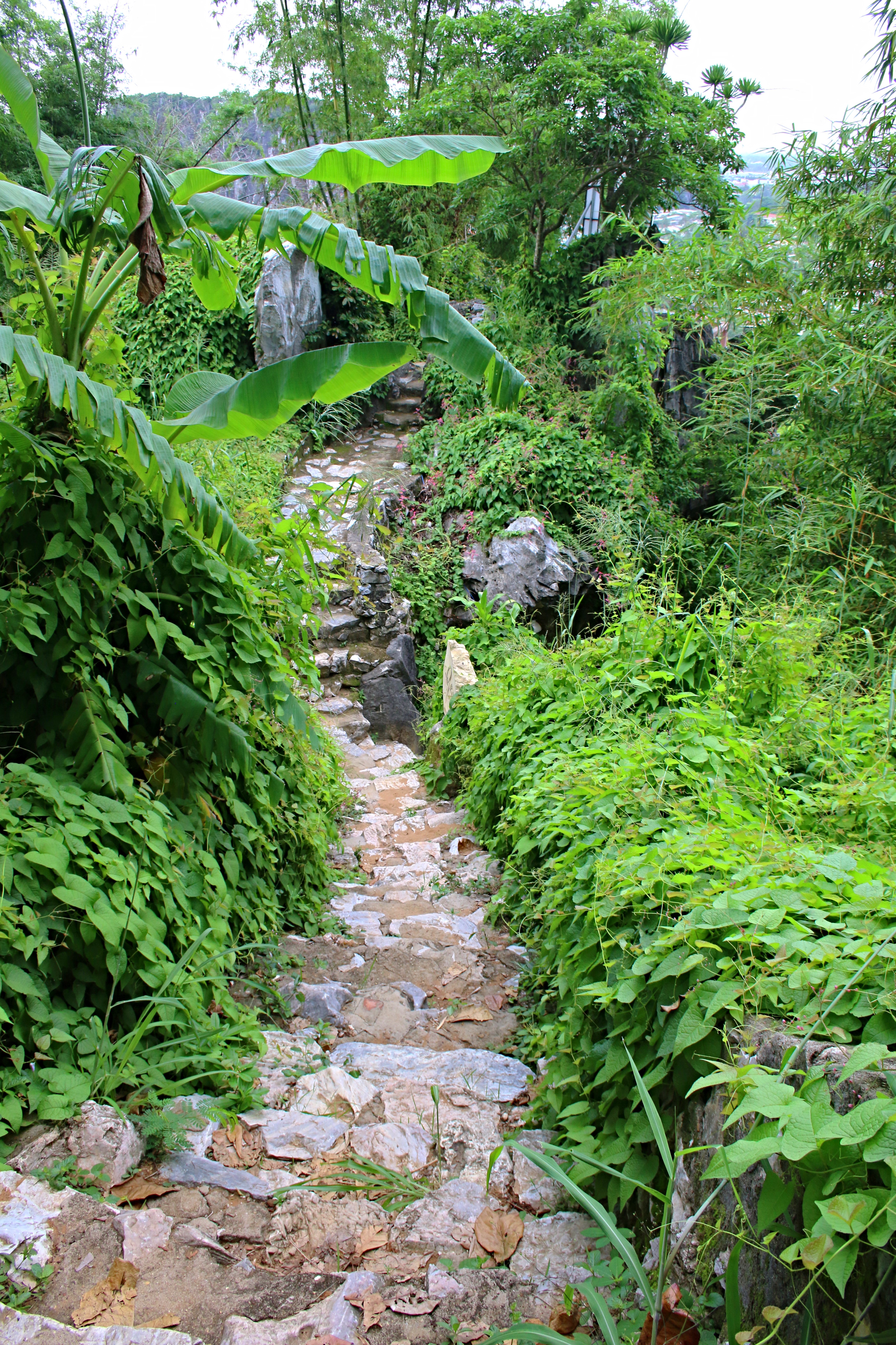
It was an amazing adventure to travel amidst the winding passageways, that snake between the homes, shop and restaurants that make up this area. And believe me…it was not easy making progress as there was a picture to be taken at every turn!

Knowing that there was so much more to see on the island, we headed to a car rental shop and secured a car for the day. Getting out of the city was a bit of a challenge, but once we had traveled a few miles, it was fairly easy navigation.

Traveling through the western part of the island, we passed near the salt lakes where hundreds of windsurfers and kitesurfers meet each day to test their skill. In this area, we also were aware that there were many beautiful beaches, however, our mission was to explore the interior of the island before laying down our towels in the sun.

As we drove through the countryside, passing old windmills high on arid peaks, we soon came to the town of Vivlos, where we noticed one of the historical monument signs. Advertising the location of the Old Wash House that the villagers once used before the advent of Maytag, the site was still in relatively good shape and we could only image the villagers meeting here each day to do their laundry.

Continuing on, we soon found ourselves in Kato Sagri. A ruined building next to a church my eye. Pulling over, we walked around the property which is located at the settlement of Kanakari. The complex consisted of a tower house and bakery, both in ruins, with washers and a water well, formerly used for the needs of the buildings. This area was once used as a gathering point for the inhabitants of the village and the small church of the Annunciation, which is still in excellent condition, has served as a church for both Christian Catholics and Orthodox Christians. There is also a small complex of rooms, Kanakari1656, to rent behind the church offering a private getaway for visitors to the area.

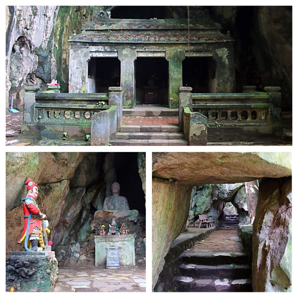
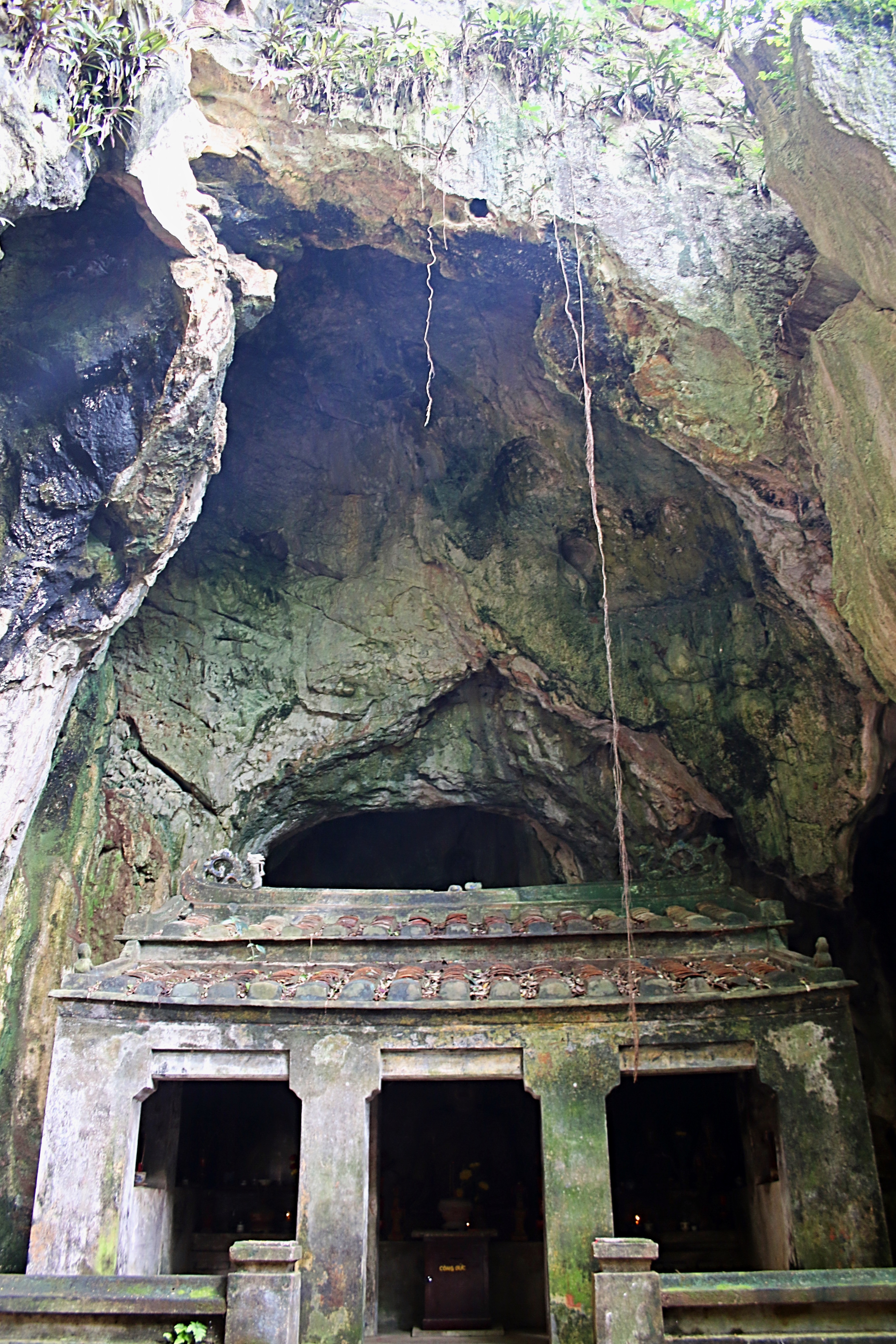
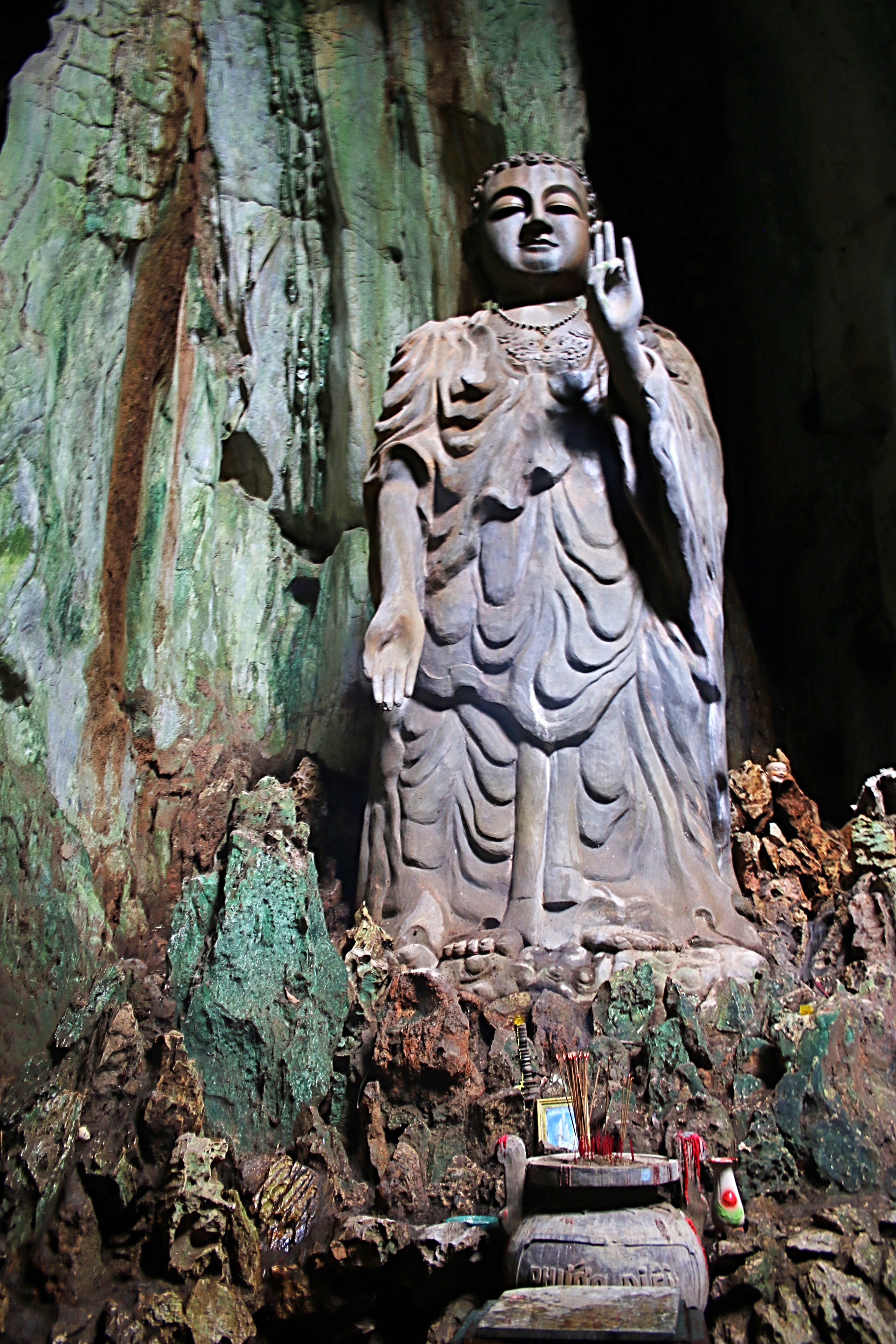
Our next destination was the Temple of Demeter (Dimitras), however, it was nearing lunchtime and we decided to grab a bite to eat at the Cafe Bar Mylos, which sported a couple of old windmills on the premises. Spotting a sign across the road directing visitors to the historic site of Church of Agios Nikolaos, we decided to take a walk down the narrow, dusty road to check it out. A longer walk than we anticipated, we tried to enjoy the warm, clear day and the beauty of the countryside.

After turning onto a small path along a stone fence, we arrived at the small church which is located all alone in a field surrounded by the mountainous beauty. Though we were unable to view the interior, I later learned that it is a single-aisle church with an interior covered by successive layers of frescoes. These frescoes depict the birth and baptism of Jesus with the most recent layer dates back to 1270.

After the long walk back to our car, we resumed our trek to the Temple of Demeter, located not far near the village of Sangri.

The marble temple dedicated to Demeter, the ancient goddess of grain, dates back to the 6th century BC in the classical architectural style. Built near fertile areas, it was used for a religious purpose since the late Mycenaean Era.

Around the 3rd century BC, the temple was turn into a Christian religious center and a small chapel, dedicated to Agios Ioannis, was built on the premises, using marble from the ancient temple. Ruined in the 6th century, it was rebuilt in 1977.

After the remains of the temple were discovered in 1949, excavations lasted almost twenty years, beginning in 1976. Restored to its original glory by German archaeologists in the 1990s, the temple is now open to visitors.

Although a bit of a drive from Naxos Town, the temple is quite beautiful in its natural setting and accessible from its entire perimeter. After we had walked around the temple and checked out the chapel, I then took a walk to the rear of the property, past the ticket booth, to the museum which displays many remnants of the ruins that were not used in the reconstruction.

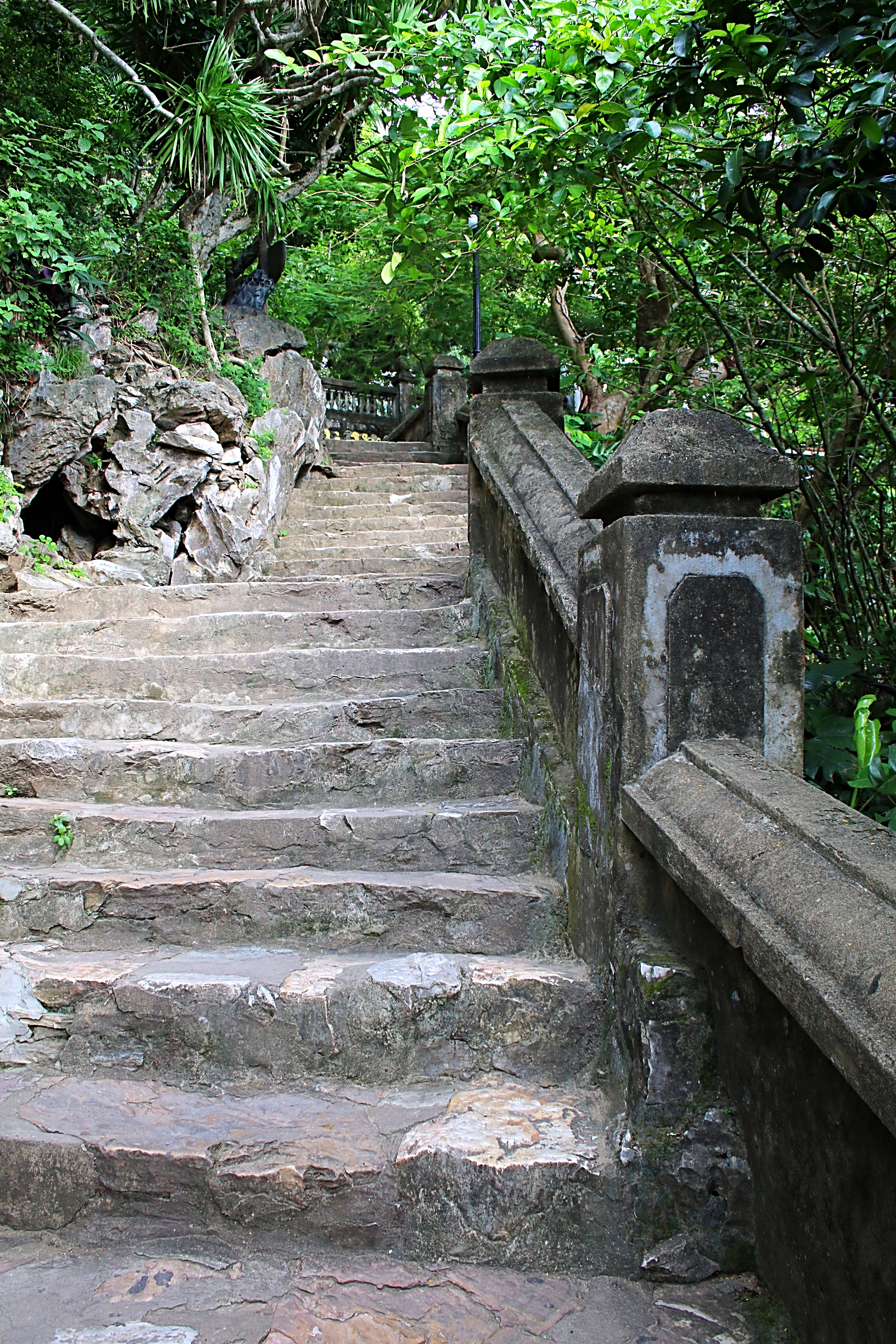
We continued our drive through the towering mountains in the middle of the island admiring the white-washed towns the cascade down the slopes and the countless churches that dot the countryside. After a quick hike down the side of a steep cliff, I even visited a simple little chapel that offered phenomenal views of the rich island.

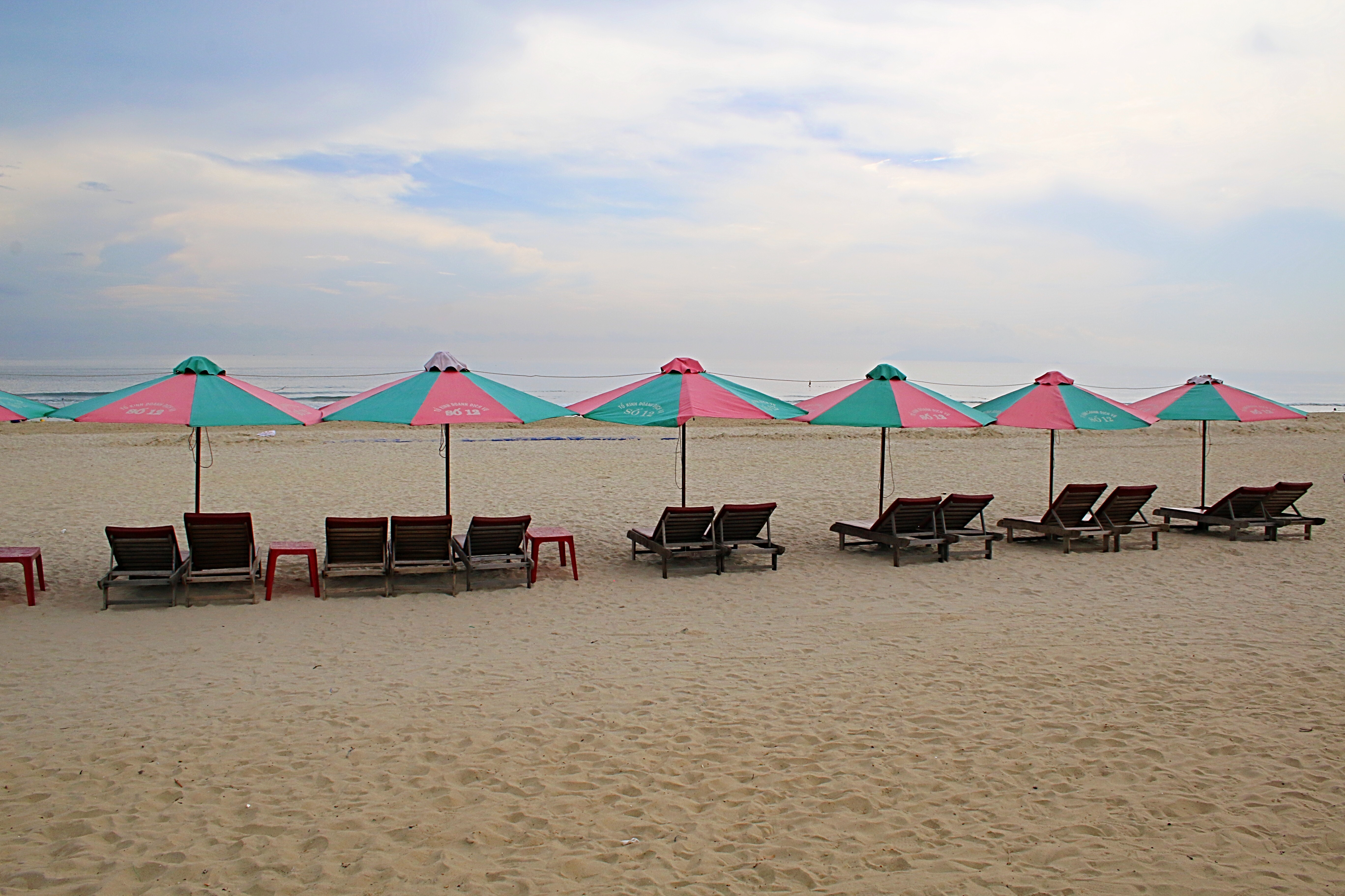
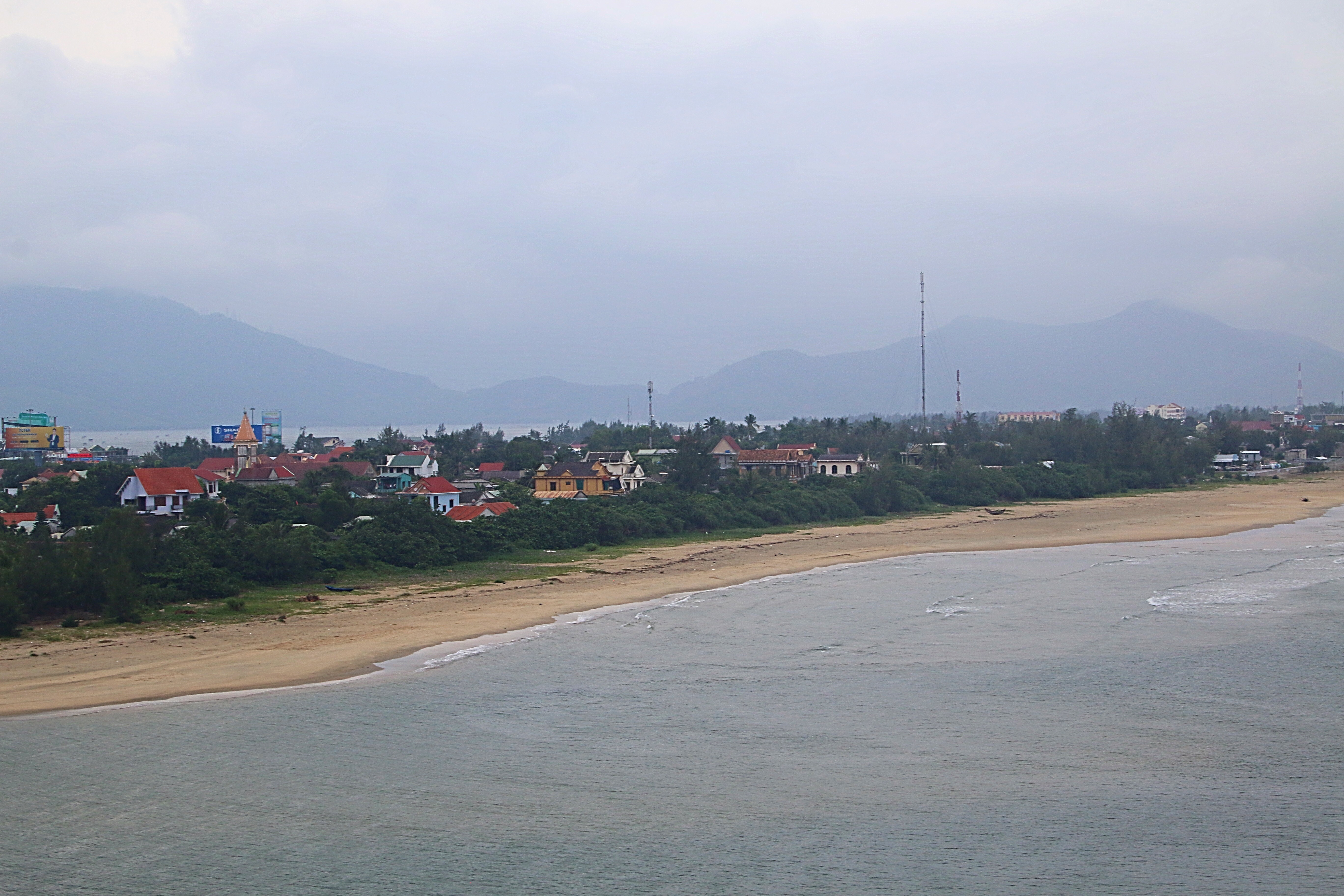
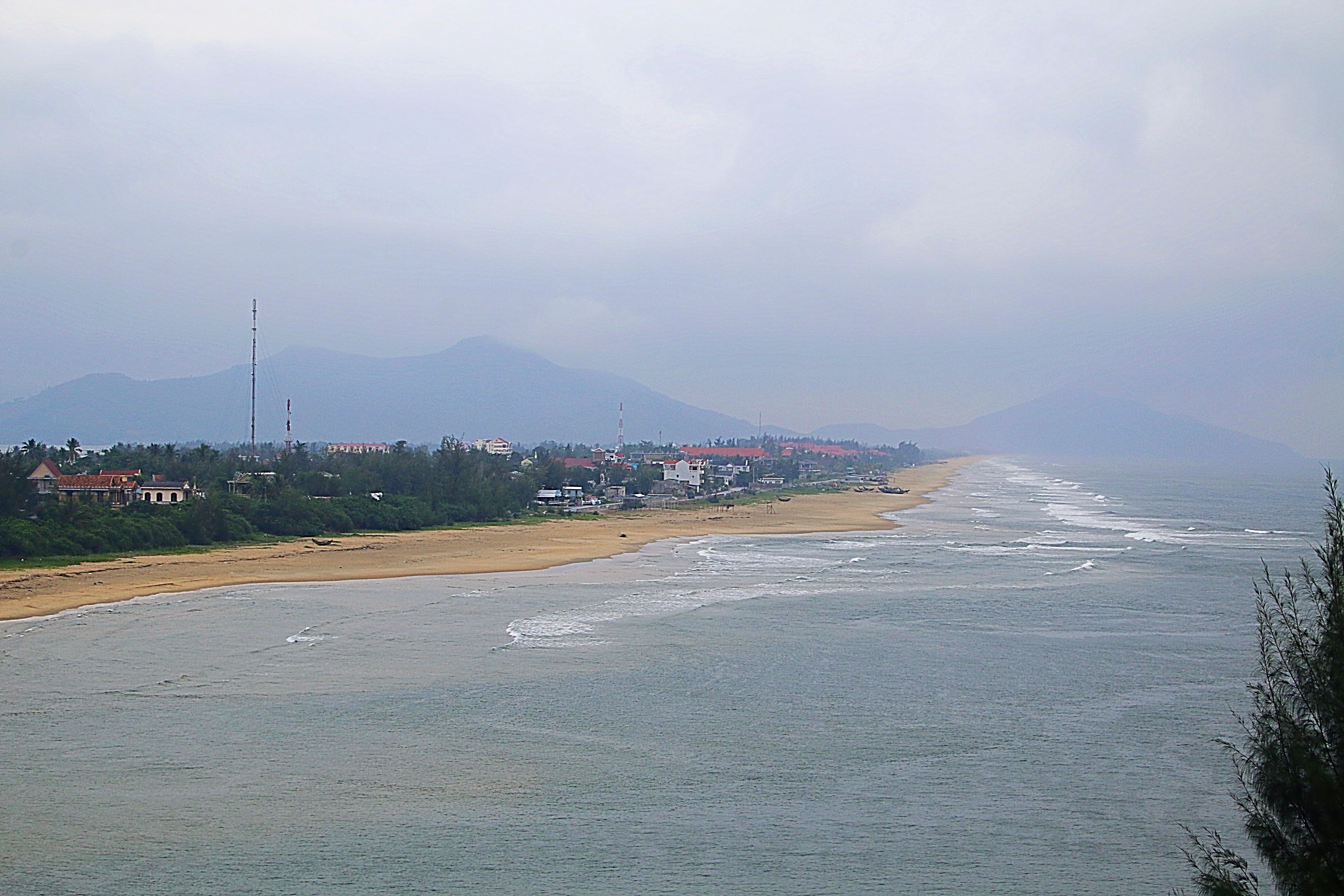
Finally, after much driving, we decided that it was time to head to the coast for some much needed relaxation. Beginning at Plaka beach, we took a walk to the water to see what was available. Though the water was relatively calm, clear and blue, it did not appear as though there were any chairs for rent in this area. Driving further up the road, we soon found ourselves at Agia Anna. Here, there was plenty of parking and the water appeared similar to what we had just seen at Plaka Beach. A quick chat with a gentleman on the beach, secured us three beach chairs and an umbrella!

Though the water was pretty chilly, it was wonderful to see how clear it was and the beach was not overly crowded. Many restaurants and a small grocery store across the street provided some nourishment and we proceeded to enjoy the remainder of the afternoon enjoying the views and warmth of the Greek sun.

As the day drew to a close, the realization that our time in Naxos was coming to an end and yet, I felt as though there was so much more see on this “great big fat greek island”!

What an unexpected surprise!

For more pictures, check out Facebook, Snapping the Globe and Instagram, @snappingtheglobe.

Old Wash House

  • Address: Βίβλος 843 00, Greece
  • Hours: 24 hours, daily
  • Admission: free

Site of Kanakari

  • Address: Κανακάρι, Sangrí 843 00, Greece

Cafe Bar Mylos

  • Address: Άνω Σαγκρί 843 00, Greece
  • Hours: unknown

Aghios Nikolaos

  • Address: Naxos 843 00, Greece
  • Hours: 24 hours, daily
  • Admission: interior not open to public

Temple of Demeter

  • Address: Drimalia 843 02, Greece
  • Hours: 0900-1600, closed Tuesday
  • Admission: 4€
  • Getting There: By car, from Hora, follow the road to Filoti. After about 6 miles turn onto the road signposted for Ano Sangri and the Temple of Demeter. Follow the signs for about 2 more miles to the temple.

Journey to the Highlands

© 2017 Snapping the Globe, L.L.C. All rights reserved.

Small doses.  This is how you learn to see cities when on layovers.

Having usually less than a day, it’s like winning the lottery when visiting on your own and knowing that you have more time to see everything you want to see.  And the bonus?  Time to venture out and see what else the country has to offer!

Excited to have that extra time in Edinburgh, we decided to book a tour…to the Scottish Highlands.

Our first inclination was to take the tour to Loch Ness.  Learning that it involved a twelve and a half hour day, much of which would be after sunset, we decided to alter our plans.  After much discussion and perusal of the tour company’s brochure, we finally decided on a shorter day…an adventure to West Highland Lochs, Mountains & Castles.

Departing from the center of Edinburgh, we boarded our tour bus at 9:15 a.m. in front of Ensign Ewart’s pub.  The large coach was a little more than half full of other tourists also anxious to see the Scottish countryside.

IMG_4343Setting out on the highway, we first passed Stirling Castle and the William Wallace Monument standing tall on the nearby summit of Abbey Craig.  On the right, our tour guide pointed out the Kelpies, 30-meter high horse-head sculptures near the River Carron.

Soon, we were crossing the Ardoch Burn river and heading through the town of Stirlingshire.  Minutes after, driving down a narrow lane, we arrived at Doune Castle, the first stop on our itinerary.

IMG_4447

For movie and television fans, this fortress is a must-see!  Doune, the 14th century courtyard castle, is well known for being featured in the cult classic, Monty Python and the Holy Grail, as well as television series, Game of Thrones and Outlander.

IMG_5520

Though more primitive than most other castles I have visited in Scotland and other countries, it boasts one of the best preserved great halls in Scotland.  Despite this illustrious fact, the castle does not have electricity and is only lit by daylight, making it quite difficult to see all facets of the building, especially on cloudy and rainy days.

IMG_5518

Due to the rain, the courtyard was also closed, thus preventing us from entering the cellar.

IMG_4390

After a quick walk around the property, it was time to depart and make our way to our next destination.

On we traveled, through the beautiful countryside, finally pulling over to the side of the road.  Not seeing any castles or ruins nearby, we weren’t sure what we were stopping for…there were just a bunch of funny looking cows in a field.  Stepping off of the bus, our tour guide informed us that these cows were what we were here to see!

IMG_4719

The Highland Cattle are a Scottish breed.  They have long horns and long wavy coats (colored black, brindle, red, yellow, white and silver) which keep them warm during the cold winters. They originated in the Highlands and Western Isles of Scotland and are bred for their high quality meat which is lower in cholesterol than other varieties and is exported worldwide.   We enjoyed watching them scratch their heads on the power lines and appear to pose.

IMG_5522

After lunch at a local establishment, the Green Welly, the only restaurant for many miles around, we then stopped along the road to admire Kilchurn Castle which sits on a piece of ground jutting into Loch Awe.  Once one person jumped the fence and decided to trudge through the bog to get a closer look at the castle…we all did.  Thankfully, I had worn my waterproof boots, as I squished through the spongy ground and mud to stand at the water’s edge and photograph the ruined castle framed by the cloud shrouded mountains.

IMG_5524

Kilchurn Castle, one of the most photographed castles in Scotland, looks out over Loch Awe, was built by Sir Colin Campbell and was once the base of the Campbells of Glenorchy.  It was built in the 1400s and contains the oldest surviving barracks on the British mainland.

Although the castle can be visited, it is only open during the warmest months of the year.

IMG_5526Onward we traveled to the next destination, Inveraray, home of a beautiful castle on the shores of Loch Fyne.  Although the tour brochure stated that we would visit the town of Inveraray for Highland souvenirs, we only stopped near a bridge so that we could photograph Inveraray Castle.

IMG_5527

Construction on Iveraray Castle, home to the Duke of Argyll, was begun in 1746 and took 43 years to complete.  The castle as it is today resulted from a fire in 1877, when the third floor was added as well as conical roofs on the corner towers. Sitting on 60,000 acres, it was the setting for the 2012 Christmas episode of Downton Abbey.  Only open from April to October, we were once again disappointed that we were unable to visit this magnificent palace, shrouded in the late afternoon mist.

IMG_5525IMG_5529IMG_5528

The Arrochar Alps were the next thing we were to see…were being the key word.   With all of the fog, mist and low hanging clouds, we could not even get a glimpse of the rocky peaks after parking at the vantage point.

IMG_5022

Continuing on, we finally headed for Loch Lomand and the charming village of Luss.  Though daylight was waning, we quickly jumped off the bus and headed down the narrow lanes of the community.  Small and quaint, I could only imagine the villagers all knowing each other and saying hello over the walls of their fenced-in yards each day.

IMG_5531

At the rear of the village, we stumbled upon Luss Parish Church.  A Church of Scotland, dedicated to St. Kessog, it was founded by the saint and has stood on the site for 1500 years.

IMG_5056

Walking through the churches gates, we explored the 15 historical grave sites in the churchyard as the light dwindled.

IMG_5533

Finally, we headed toward the shores of Loch Lomond and the village pier.  Snapping a few pictures before it became completely dark, we looked out on the picture perfect lake and some of the small islands situated in the basin.

IMG_5095

Making our way to our tour bus, we climbed in and walked back to our seats.  After a long day, of driving around, it was nice to know that we would soon be on our way back to Edinburgh.

Although we had a nice day getting to see a different part of Scotland, I reflected on about how much driving was involved that day and how little time we actually had a chance to explore.  See, yes.  Explore, no.

The Highlands are quite beautiful and I enjoyed seeing the small villages and rolling hillsides dotted with sheep. It was disappointing, however, that things we would have been able to see during other months of the year, were not available to us on this visit, such as Kilchurn and Inveraray Castles.  The Arrochar Alps…well, that has to be hit or miss, any time of the year as the clouds could be quite low during the summer months.  The silver lining of a winter tour, however, is that we were able to book the tour at the last minute, the tour bus not was as full and we arrived back in Edinburgh a little early than planned…and since the Christmas market was going on at this time…we still had time to ride some rides and do some holiday shopping!

But, for any time spent in Scotland, winter or sumer, time should definitely be taken to venture outside of the city limits to the Highlands.  Simply breathtaking!

For more pictures, check out Facebook, Snapping the Globe and Instagram, @snappingtheglobe.


Timberbush Tours

  • http://www.timberbush-tours.co.uk/
  • West Highland Lochs, Mountains & Castles Tour, Departure/Arrival, 0915-1900
  • Cost:  Adults, £43, Children (5-16), £41, Seniors (60+), £41, Students, £41

Doune Castle

Kilchurn Castle

Inveraray Castle

  • http://www.inveraray-castle.com/
  • Address:  Inveraray Castle, Inveraray, Argyll PA32 8XE
  • Hours:  1000-1745, Monday to Sunday, March 5-October 31
  • Admission:  Adults, £10.00, Senior Citizens and Students, £9.00, Children (5-16 years), £7.00, Children (under 5 years), free, Family Ticket (2 adults, 2 children), £32.00

Luss Parish Church

  • http://lusschurch.com/
  • Address:  The Manse, Luss, Alexandria G83 8NZ, United Kingdom
  • Sunday worship:  1145


Getting High On the Way to Hue

© 2016 Snapping the Globe, L.L.C. All rights reserved

The first time I ever heard of the city of Hue was during the planning stages of my trip to Vietnam.  My friend sent me a text with a picture and right then, I knew I had to make time in my schedule to travel there.

Taking the bus from Hoi An would have been a cheaper option (about $5), however, there were a few things that I wanted to see along the way as well as arrive in Hue with enough time to see the Citadel during the afternoon.

Hiring a driver on my own was a little cheaper than booking through my hotel. Ironing out the details through email, I agreed to a driver that spoke enough English to communicate effectively, but not act as a tour guide. I also informed the car company that I wanted to stop at the Marble Mountains, China Beach, Hai Van Pass and Lang Co Beach.

After my last, amazing breakfast and a final look around the Ha An Hotel, I met my driver at the front gate. Expecting a long ride, I settled into my seat and watched Hoi An disappear behind me. About a half an hour later, I noticed the driver turning off of the main highway. A few minutes later, he pulled up to the curb, came around the car and opened up my door, “Madam, Marble Mountain”. Taken off guard, I hadn’t expected to be there that soon. Grabbing my bag, I jumped out of the car and headed up the steep steps to the ticket booth. Paying my entry fee and purchasing a map, I climbed more stairs, not quite knowing what to expect.

The Marble Mountains are a cluster of five hills made from limestone and marble and named for the elements; metal, wood, water, fire and earth. The area that these mountains lay in is known for stone cutting and sculpture. A much visited spiritual site, Water Mountain houses numerous paths leading to a host of Buddhist sanctuaries, temples and places of worship, some in caves.

imageMaking my way up the steep, marble stairs (I later learned later that an elevator was available), I turned a corner and to my utmost surprise was a beautiful garden with a large dragon statue and many small Buddhas. To the right, was a large, white seated Buddha. Standing next to the Buddha, looking out from the mountain, were views of the beaches and the coastline.

image

Through an entrance gate and located on the eastern side of Water Mountain, was the Linh Ung Pagoda. Constructed during the Nguyen Dynasty, it contains representations of the three Buddhas; The Buddha of the Past (Amitabha), Buddha of the Present (Sakyamuni) and Buddha of the Future (Maitreya). The pagoda has been designated a national historical and cultural site by the Ministry of Culture, Sports and Tourism.

image

image

image

image

image

image

To the right of the pagoda is Vong Hai Dai, the sea-viewing pavilion, which offers an amazing view of Non Nuoc Beach and behind the pagoda is Tang Chon Cave, which has a impressive standing Buddha and Chua Linh Ung Temple. Also in this area is the Xa Loi Tower, a 15 meter tower, built of stone, overlooking the coast.

image

image

image

image

image

image

image

Climbing the mountain further, I encountered Am Phu and Van Thong Caves.

After entering Van Thong Cave, known for its huge statue of Buddha, I found the ascent to be extremely steep and I decided to head on to Am Phu.

image

Am Phu, meaning “hell” in Vietnamese was opened to tourists in 2006. The natural rock formations, stalactites and dark tunnels are enhanced with terrifying figures and altars designed by local artists. Not for the faint of heart, visitors can confess their sins and repent at the temple shrine.

image

image

imageFurther on Water Mountain, upon entering the Hoa Nghiem Cave you are greeted by a large lady Buddha statue, the goddess of mercy. Descending twenty steps, you enter Huyen Khong Cave which contains various Buddist and Confucian shrines. Opposite the entrance is a large Buddha, carved by the famous craftsman, Nguyen Chat in 1960. Below the statue is the altar of “Dia Tang Vuong Bo Tat” (the most powerful Buddha in hell) and to the left, the shrine of “Ngoc Phi” (the goddess of wealth) and on the right, the shrine of “Loi Phi” (the goddess of Mountain and forests).

image

image

image

image

Not only having spiritual value, the cave also has great historical value. When Vietnam was at war with the French, the cave was used as a secret base for local communist leaders and guerrillas. Later, during the Vietnam War, the American military used it as a commando training area and a garrison of the Old South Government and American units.

imageAlthough I was given an hour, it was definitely not enough time to see all that there was to offer. Skipping Linh Nham Cave, I stopped to inspect the Tam Thai Pagoda. Looking out to the west, the pagoda was built in the 17th century and has three stories; Thuong Thai, Trung Tai and Ha Thai. Most interesting to check out is the old, mossy entrance gate. Pho Dong Tower, Tu Lam Pagoda and Vong Giang Dai (river view pavilion) are adjacent to the Tam Thai Pagoda. Amazing views of the Truong Giang and Cam Le rivers can be seen from Vong Giang Dai.

image

image

image

image

image

image

image

image

image

imageimageMaking my way from Tam Thai pagoda, I soon found myself heading down the mountain, only, not to the eastern gate. I had moved downhill toward the Tam Ton pagoda. Although I was happy to have seen this tall, beautiful pagoda, time was up and I was needed back at my car to continue our journey. Asking a couple of workers in the area to direct me the right way, they pointed in a general direction and said, “That way.” Seeing no path, I asked again, Pointing toward a field, I walked that way, still seeing no path. Looking upward, I realized that I did not have the time or energy to make my way up toward the Tam Thai pagoda and back down to the eastern gate. Again, I asked another worker and was shown what to do. Now why didn’t I think to climb a small hill of slabs of marble and trudge through a field of weeds where some poisonous snake or rabid animal was surely hiding and waiting to strike?

image

imageTime was a ticking…so I climbed and ran like the wind through the field. Arriving at the main road, I looked to the mountain to get my bearings and made my way back to where I believed my driver was waiting…and thankfully, I found him!

imageSoon we were on our way, once again, towards Danang. My driver pulled over so that I could take some snapshots of My Khe Beach. This twenty mile stretch of white sandy beach was used by the American troops during the Vietnam War. Nicknamed China Beach, it is considered to be one of Vietnam’s most picturesque beaches.

imageCrossing Danang’s Dragon Bridge over the River Han, we continued into the mountains. The dark clouds that had been threatening all day, soon opened up and offered a light rain. Climbing higher into the mountains, the clouds settled around us and the views of the coast below us became obscured.

image

imageBefore long, I noticed the traffic growing heavier both forward and aft of us. Pulling into a tight space between two tour buses, I realized that we were not just at a rest stop. My driver didn’t really communicate with me as to where we were and I glanced around, a little confused. Clouds were low and whipping by making it hard to see the area, but I noticed other tourists crossing the street. Following suite, I climbed the stairs and stood among the many visitors taking pictures in the foggy atmosphere of the ancient Tran Dynasty’s Hai Van Gate, wartime gun towers and French built fort that was later used as a bunker during the Vietnam War.

image

image

image

Crossing a spur of the Annamite Range, Hai Van Pass is an approximately 21 km long mountain pass on National Route 1A near Bach Ma National Park.  The name Hai Van refers to the mists that rise from the sea, reducing visibility, and that’s just what we had today.  Snapping a few pictures, I could only imagine what it would look like here on a clear day.

We continued on the twisting road, the rain hampering our progress.  Closing my eyes, I rested while we drove on.  Soon, my driver pulled over again, and informed me that we were looking down on Lang Co Beach.  Since it was still drizzly, I quickly snapped a few photos, thinking that it would be a nice place to visit at another time.

image

image

image

Jumping back into the car, I checked my watch and noted that we had made better time than I had expected.  Knowing that Lang Co Beach was not far from Hue, I anticipated another half hour’s journey.

As we left the mountains and rice paddies, I began to see more buildings and businesses.  Checking the map on my phone, I realized that we were entering the city of Hue. A few minutes later, we were pulling onto Chu Van An Street and in front of the Orchid Hotel, my base of operations for the next day.  Excitedly, I gathered my belongings and headed inside, ready to begin my exploration of Hue.


For more pictures, check out Facebook, Snapping the Globe and Instagram, @snappingtheglobe.


The Marble Mountains

  • Address: Hòa Hải, Ngũ Hành Sơn, Da Nang, Vietnam
    Hours: 0700-1700
  • Admission: 15,000 Vietnamese Dong (about US $ .67)
  • Map:  Admission: 15,000 Vietnamese Dong (about US $ .67)
  • Elevator: 30,000 Vietnamese Dong (about US $1.30)
  • Getting There: Bus #1 stops in front of the Marble Mountains and covers the journey from Danang to Hoi An. Catch the bus from the bus station in Danang (Dien Bien Phu no. 33) or from the Hoi An bus station (Le Hong Phong Street junction with Nguyen Tat Thanh). 20,000 Vietnamese Dong (less than US $1). The bus takes 15 minutes from Danang and 40 minutes from Hoi An. Taxi from Danang costs approximately 50,000 Vietnamese Dong. From Hoi An, approximately 200,000 Vietnamese Dong.

marble_mountains_map


Über Üetliberg

© 2016 Snapping the Globe, L.L.C. All rights reserved.

Uber: term with literal meaning of “above” in German (Urban Dictionary), being a superlative example of its kind or class (Merriam Webster)

Unless you speak German, the name Üetliberg may throw you for a loop (prounounced Oot-lee-berg).  And unless you’ve been to Zurich, you may have never heard of the Swiss plateau mountain…or as some refer to it, “Zurich’s own little mountain”.

A few years ago, one of my crew members asked if we wanted to take the train to Üetliberg, do some hiking and have a picnic.  Of course, being a beautiful warm day, we all decided that was a fantastic idea.  Grabbing some goodies and drinks at the grocery store, we set off for our outdoor adventure.

Although not much hiking took place that day, we did find a great spot for our picnic and then finally went to the summit to admire to outstanding views of the city and Lake Zurich.

Last weekend, my oldest son, having just finished his first year of college, decided to accompany me to Zurich.  He got to ride in style while I worked, but that was okay…I was excited that the flight was not very full and that we could spend some quality time together before he started his summer job.

Remembering my Üetliberg experience, I thought that it was a place he might enjoy, but after checking the forecast during the week, the weather did not look promising.  When we landed, however, the skies were bright and sunny and the temperature hovered in the high 70s.  A perfect day for Üetliberg!

imageFinding the ticket counter in the Hauptbahnhof, the main train station, was a little challenging, however, after asking around, tickets were soon in hand and we were on our way.  A quick 20 minutes later, we were disembarking and heading toward the trail-head and the summit, some 2851 feet above sea level.

imageThe paths were filled with hikers, mountain bikers, families and individuals enjoying the outdoor balmy temperatures and clear skies.  The trails are not extremely steep and wide enough to accommodate a large number of visitors. Amusing lamp posts lines the way…though we never could figure out if they were some sort of deer or giraffe!  As we finally reached the top, we were rewarded with outstanding panoramas of Zurich, Lake Zurich and the snow covered Alps.

image

image

image

At the top of Üetliberg presides Uto Kulm, a hotel and restaurant, an observation tower and nearby a TV tower.  Surprisingly, there now resides a Christ the Redeemer Statue designed by a Lithuanian artist, though from news articles I’ve read, it is unclear how long the statue will remain in its current location.  Still, it was fun to see and take a few photographs with especially since I have not yet been to Rio (on my bucket list!).

image

image

After gazing admiringly at the white-peaked Alps and then skipping the climb to the top of the observation tower, we decided to relax and have a couple of cool beverages.  What more can you ask for…beer and beauty!

image

With so many trails available on this mountain and beyond, it was regrettable that we were unable to discover more of the natural exquisiteness of this area. With only 24 hours at our disposal, it was finally time to hike back down to the train station for our return to the city…for there was was lots more for my son and I to discover in Zurich!  But if the outdoors is your thing…Üetliberg has much to offer, even in winter, when you can don your boots and bring your sled!

Check out more pictures on Facebook, Snapping the Globe and Instagram, @snappingtheglobe.


Uetliberg

  • Getting there:  From Zurich Hauptbahnhof (Zurich Main Station), take the S-Bahn Zurich service S10.  Trains usually run every half hour during the weekdays and three times an hour on the weekends.  Travel time is approximately 20 minutes.
  • Train fare:  approximately 9 Swiss francs
  • http://www.uetliberg.ch/en/