
© 2016 Snapping the Globe, L.L.C. All rights reserved
The first time I ever heard of the city of Hue was during the planning stages of my trip to Vietnam. My friend sent me a text with a picture and right then, I knew I had to make time in my schedule to travel there.
Taking the bus from Hoi An would have been a cheaper option (about $5), however, there were a few things that I wanted to see along the way as well as arrive in Hue with enough time to see the Citadel during the afternoon.
Hiring a driver on my own was a little cheaper than booking through my hotel. Ironing out the details through email, I agreed to a driver that spoke enough English to communicate effectively, but not act as a tour guide. I also informed the car company that I wanted to stop at the Marble Mountains, China Beach, Hai Van Pass and Lang Co Beach.
After my last, amazing breakfast and a final look around the Ha An Hotel, I met my driver at the front gate. Expecting a long ride, I settled into my seat and watched Hoi An disappear behind me. About a half an hour later, I noticed the driver turning off of the main highway. A few minutes later, he pulled up to the curb, came around the car and opened up my door, “Madam, Marble Mountain”. Taken off guard, I hadn’t expected to be there that soon. Grabbing my bag, I jumped out of the car and headed up the steep steps to the ticket booth. Paying my entry fee and purchasing a map, I climbed more stairs, not quite knowing what to expect.
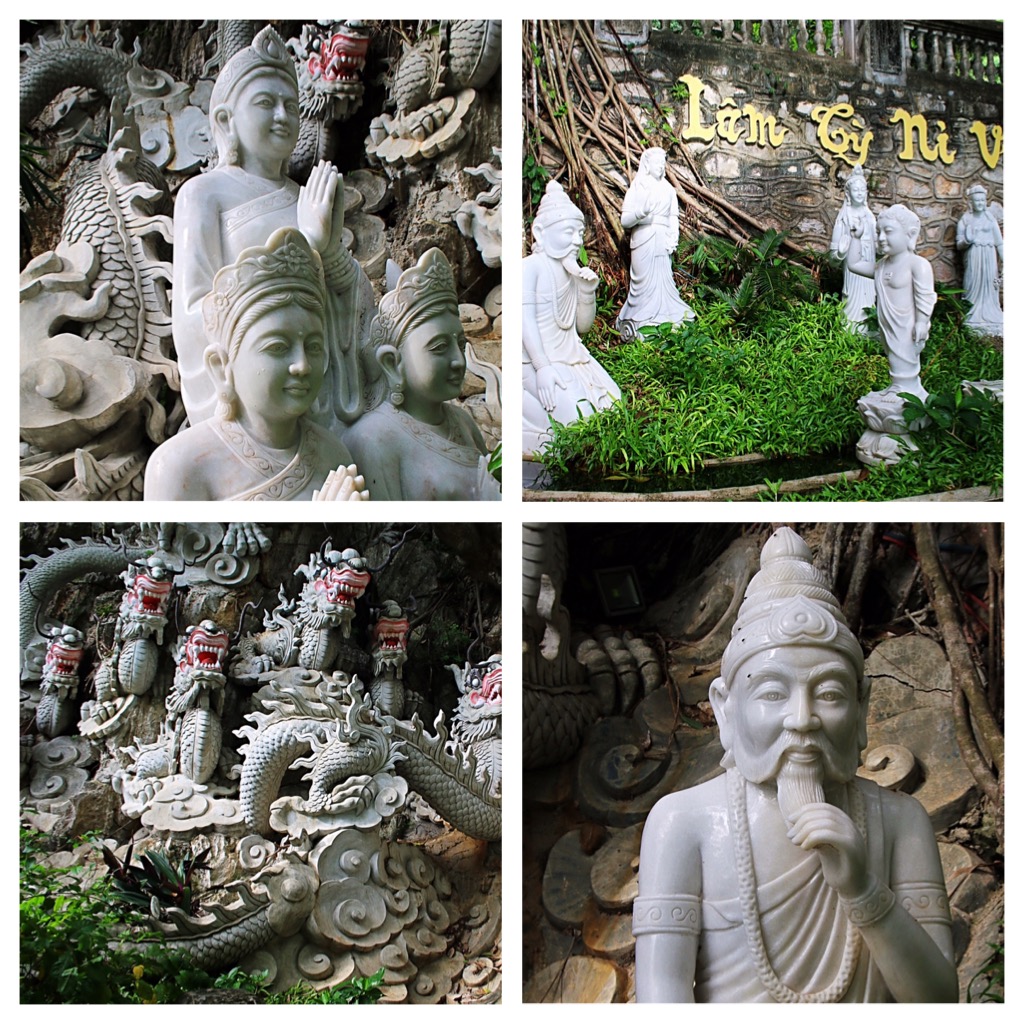
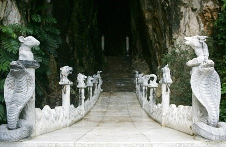
The Marble Mountains are a cluster of five hills made from limestone and marble and named for the elements; metal, wood, water, fire and earth. The area that these mountains lay in is known for stone cutting and sculpture. A much visited spiritual site, Water Mountain houses numerous paths leading to a host of Buddhist sanctuaries, temples and places of worship, some in caves.
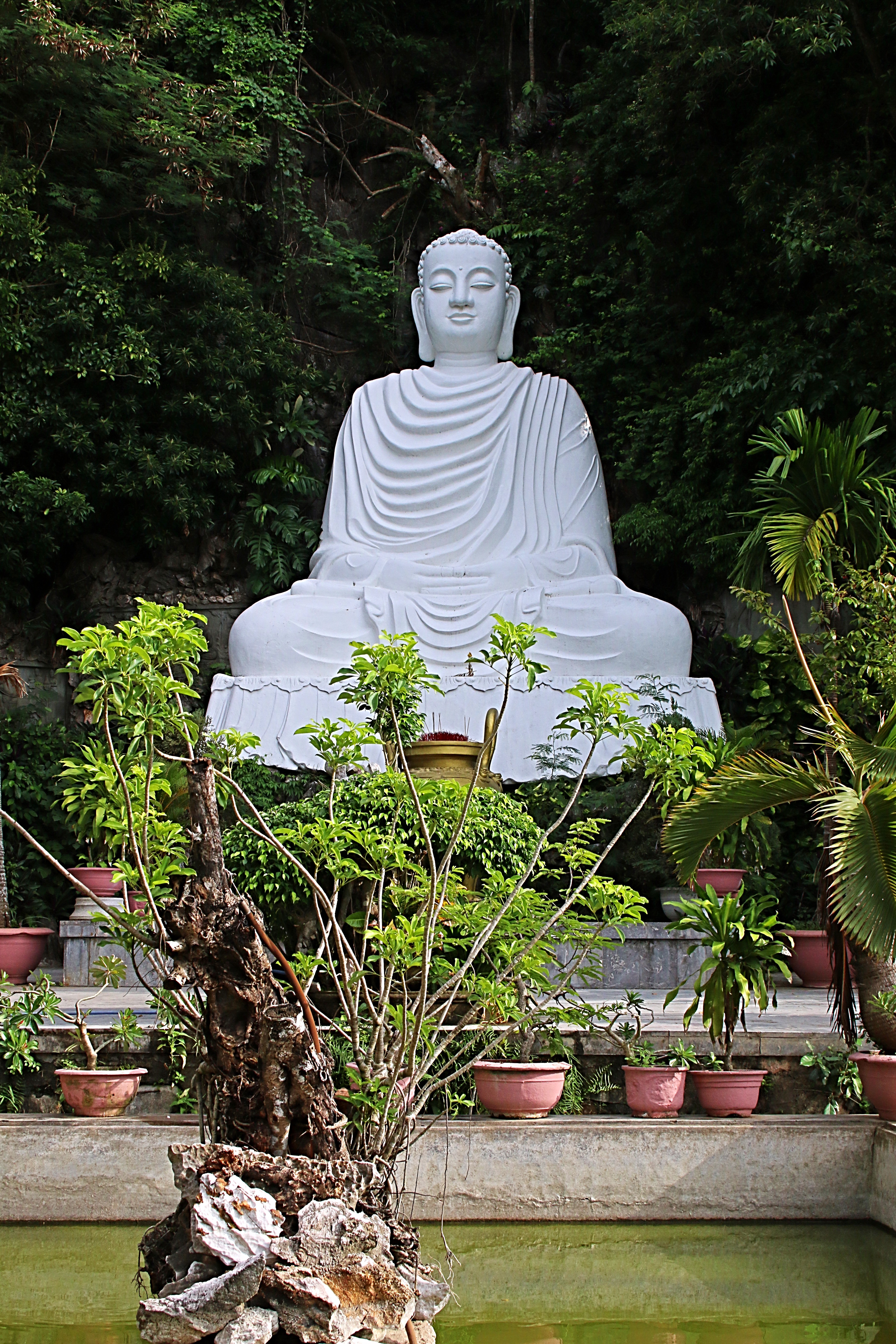
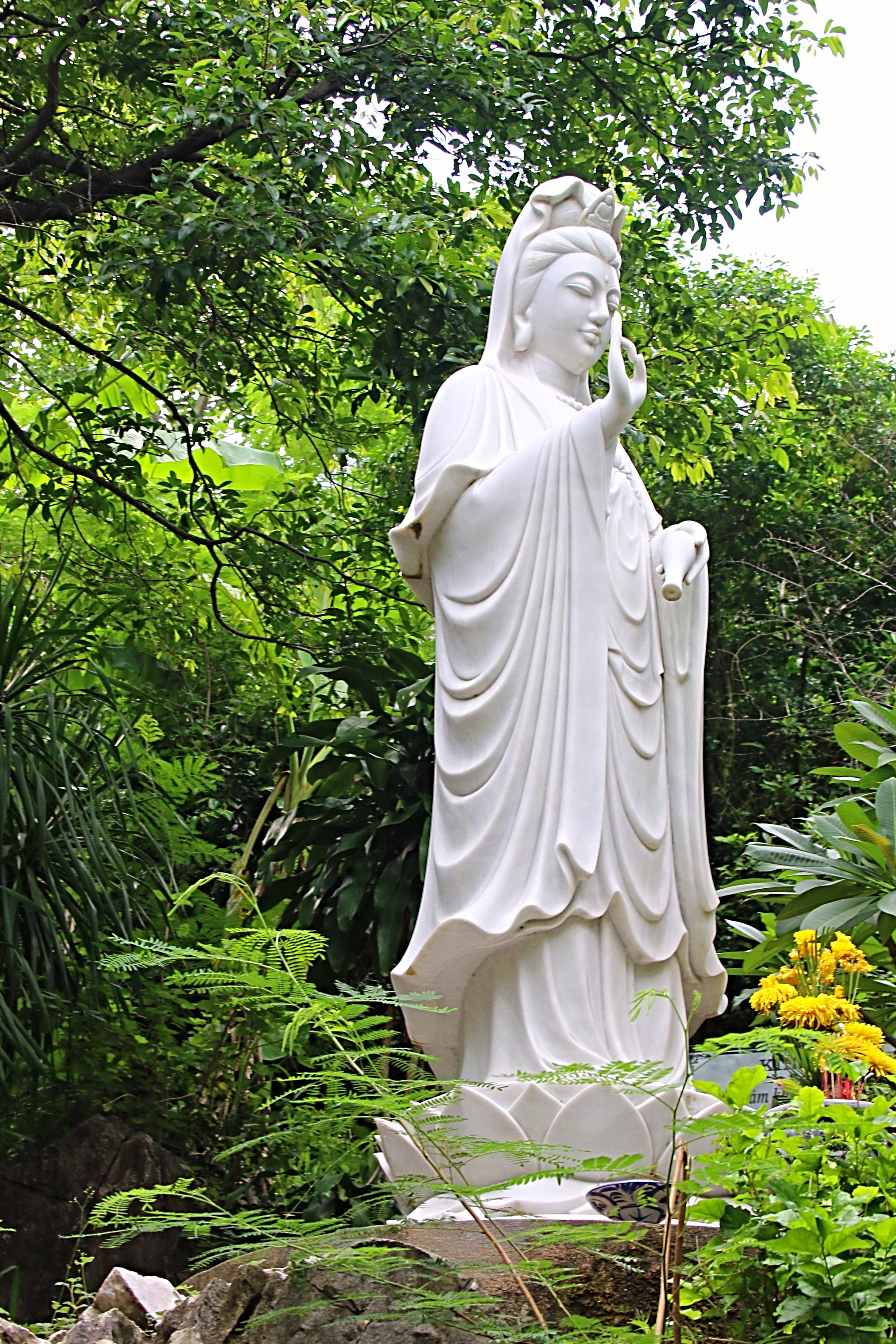
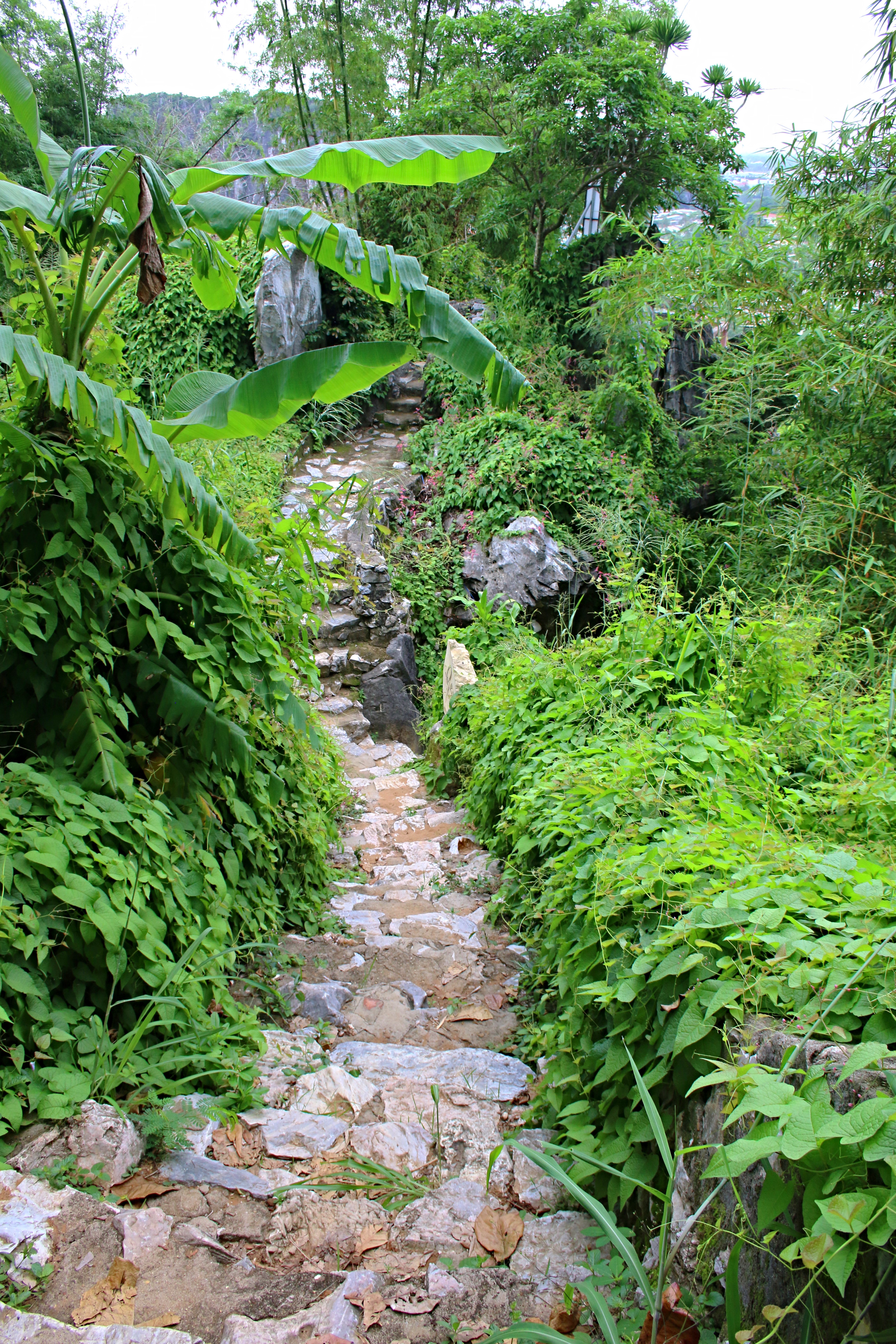
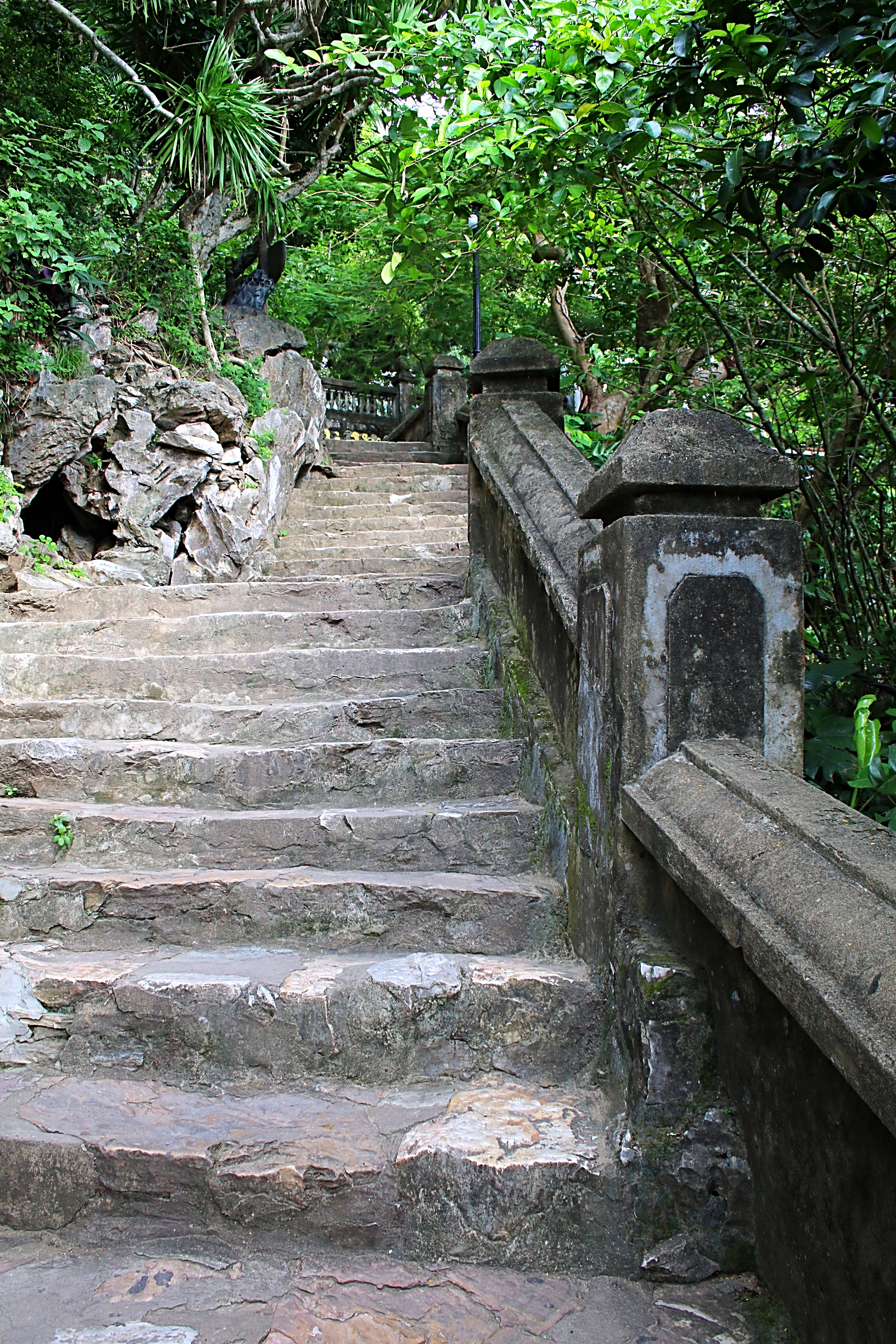 Making my way up the steep, marble stairs (I later learned later that an elevator was available), I turned a corner and to my utmost surprise was a beautiful garden with a large dragon statue and many small Buddhas. To the right, was a large, white seated Buddha. Standing next to the Buddha, looking out from the mountain, were views of the beaches and the coastline.
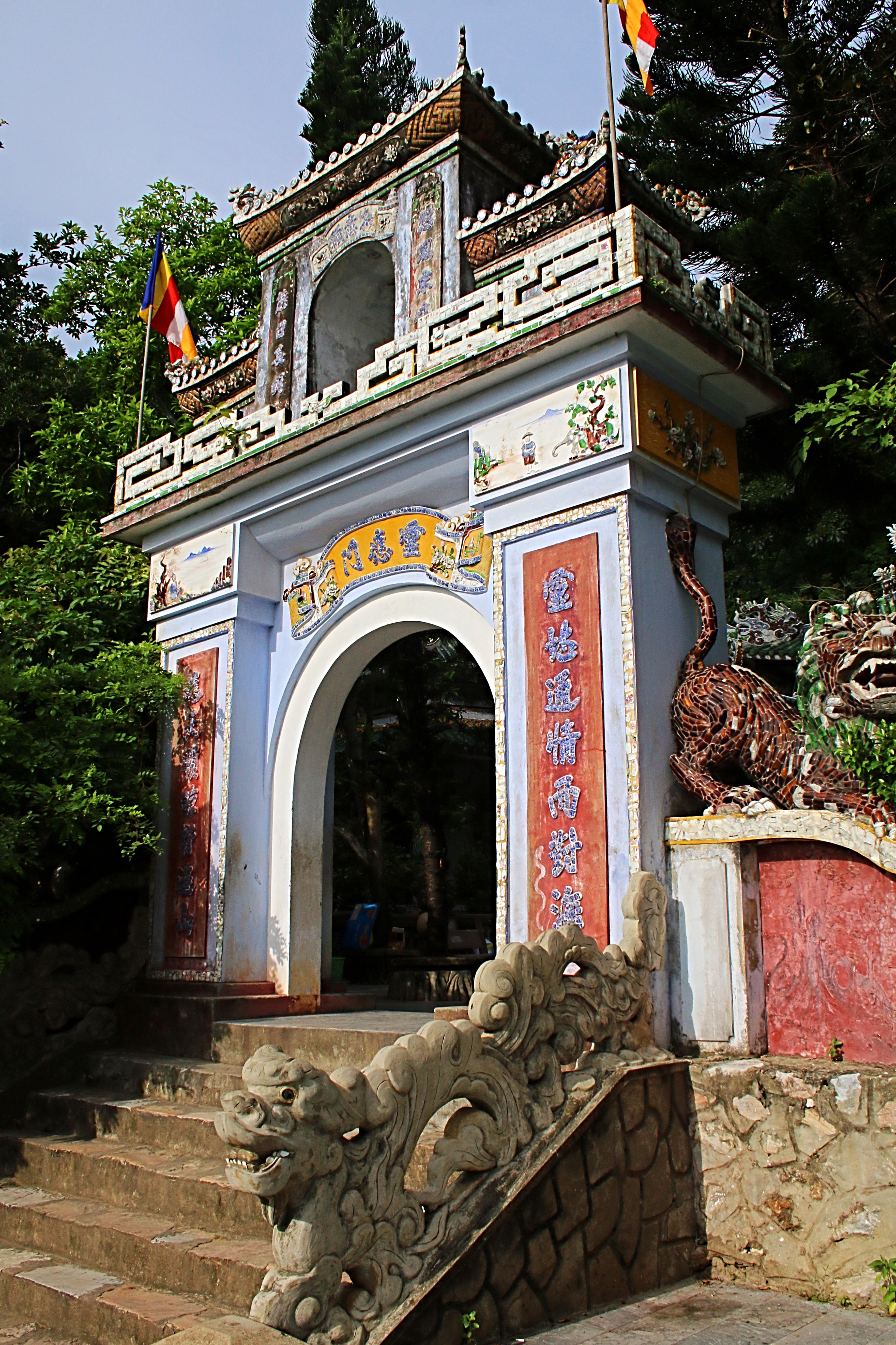
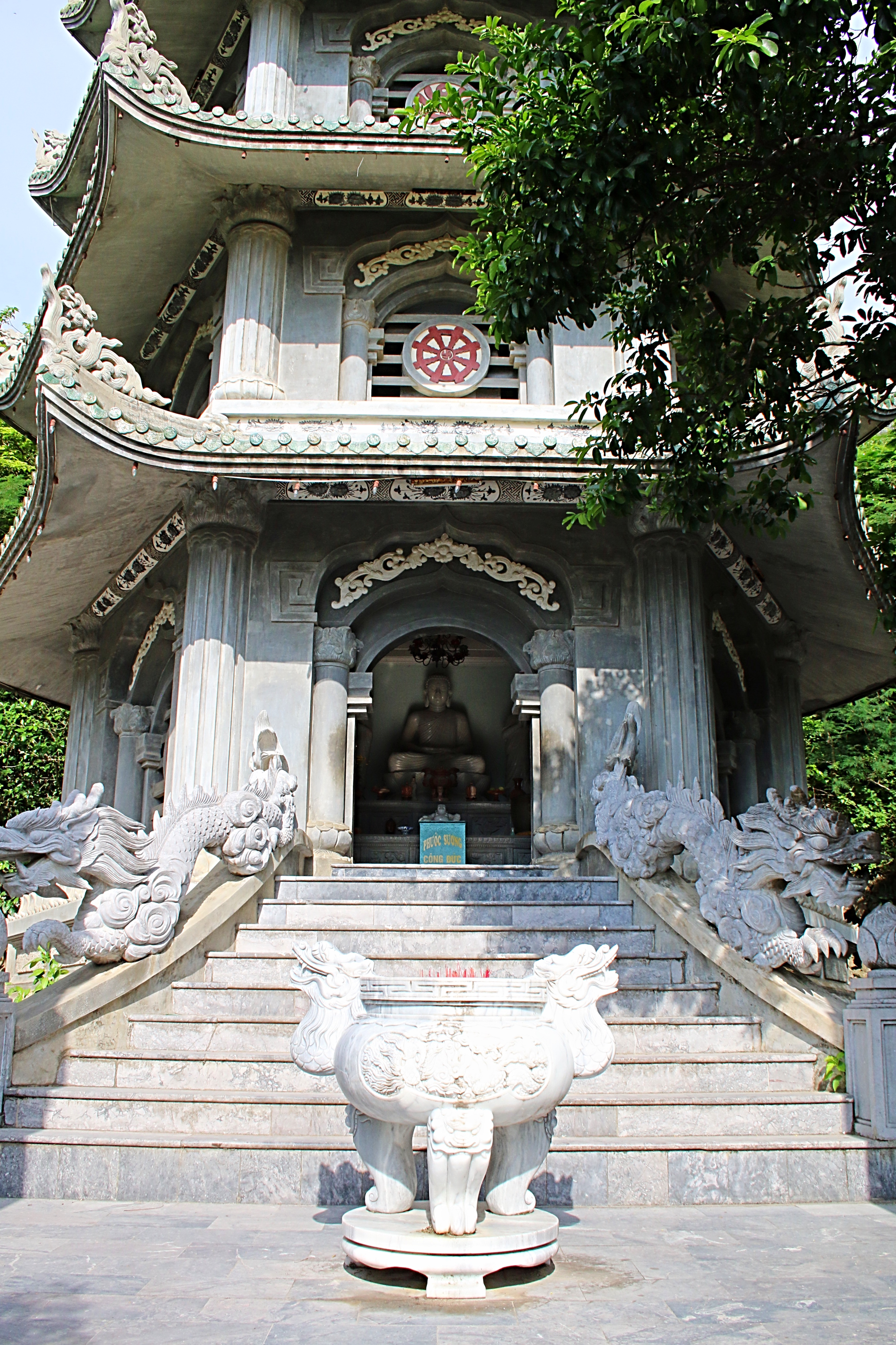
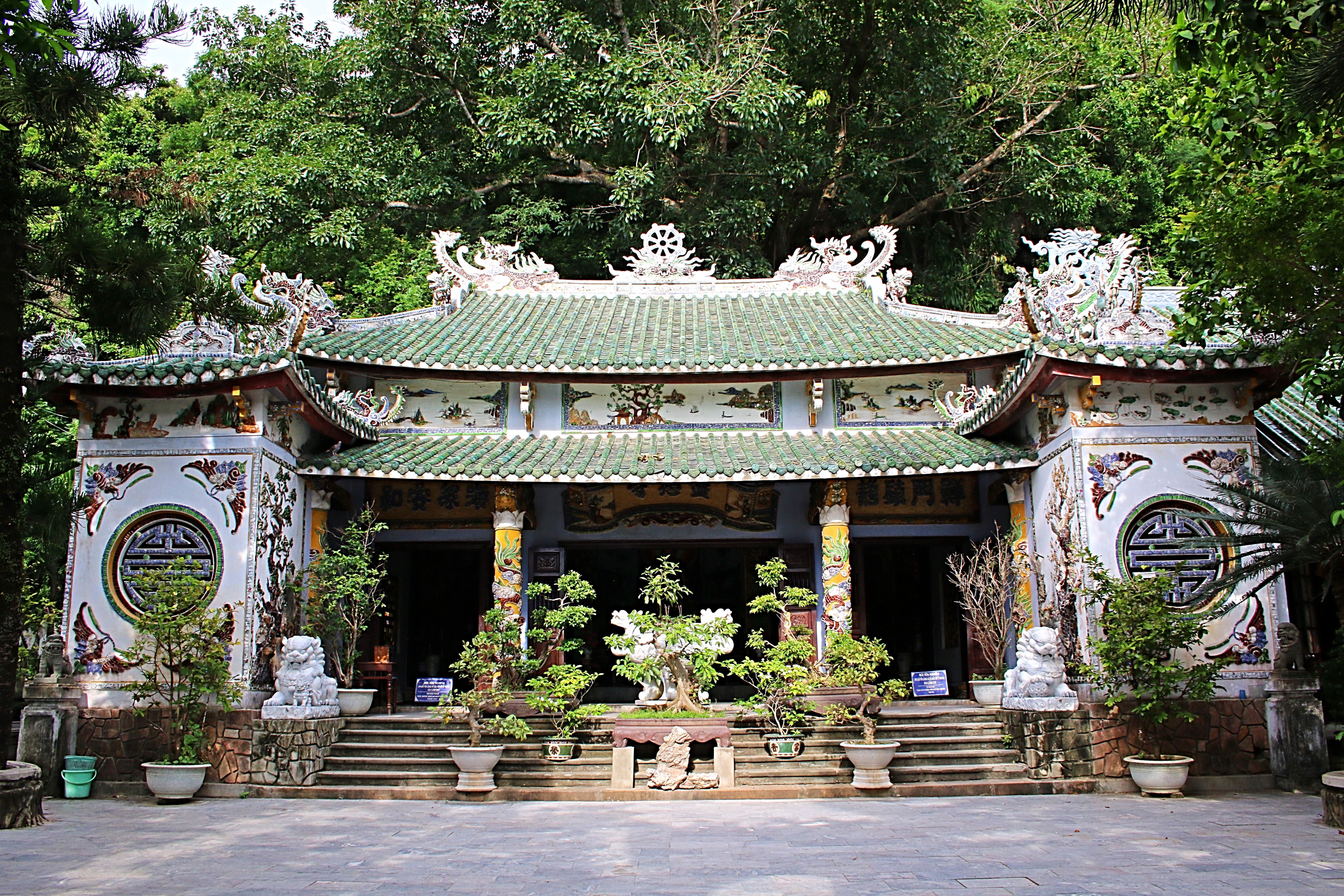
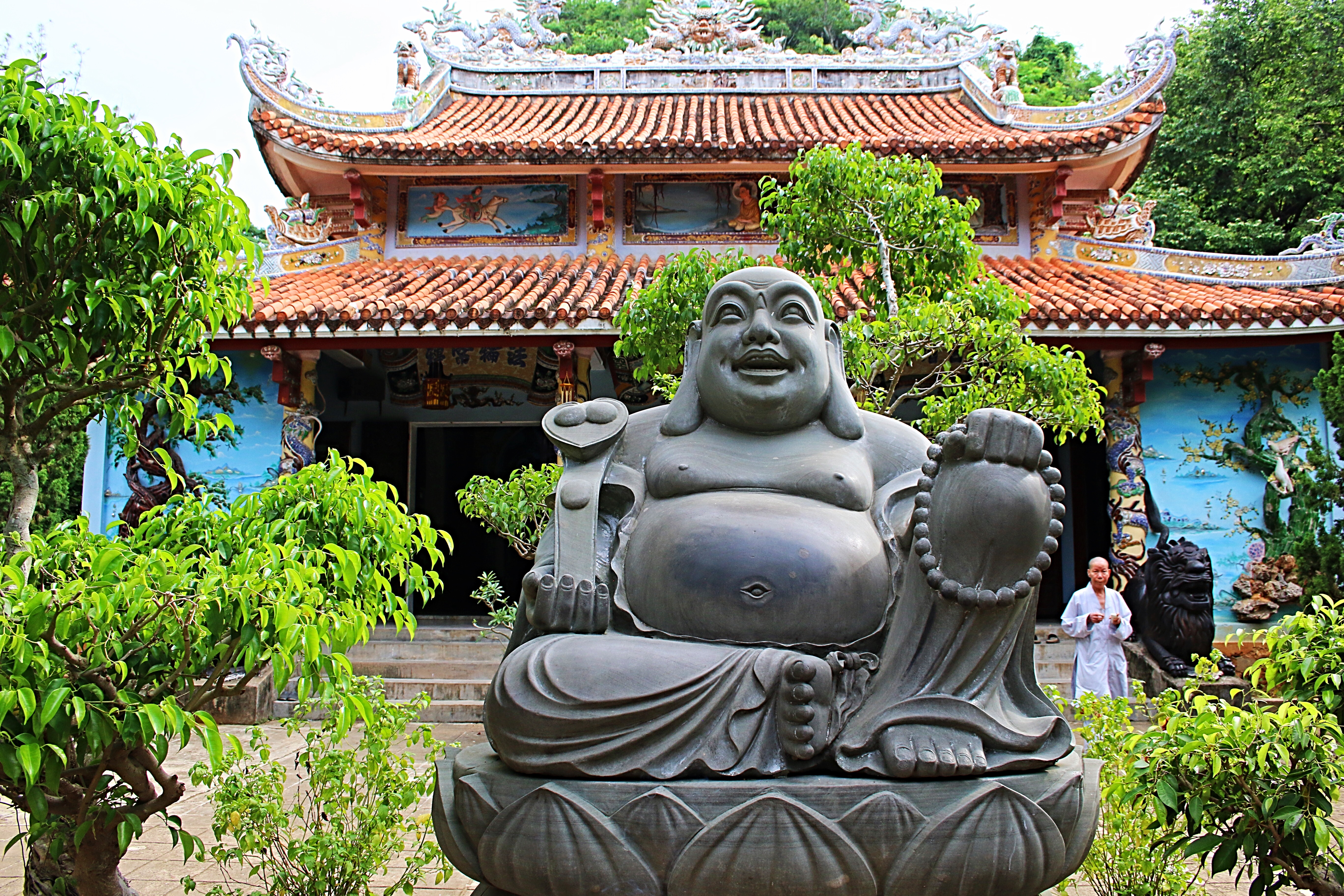
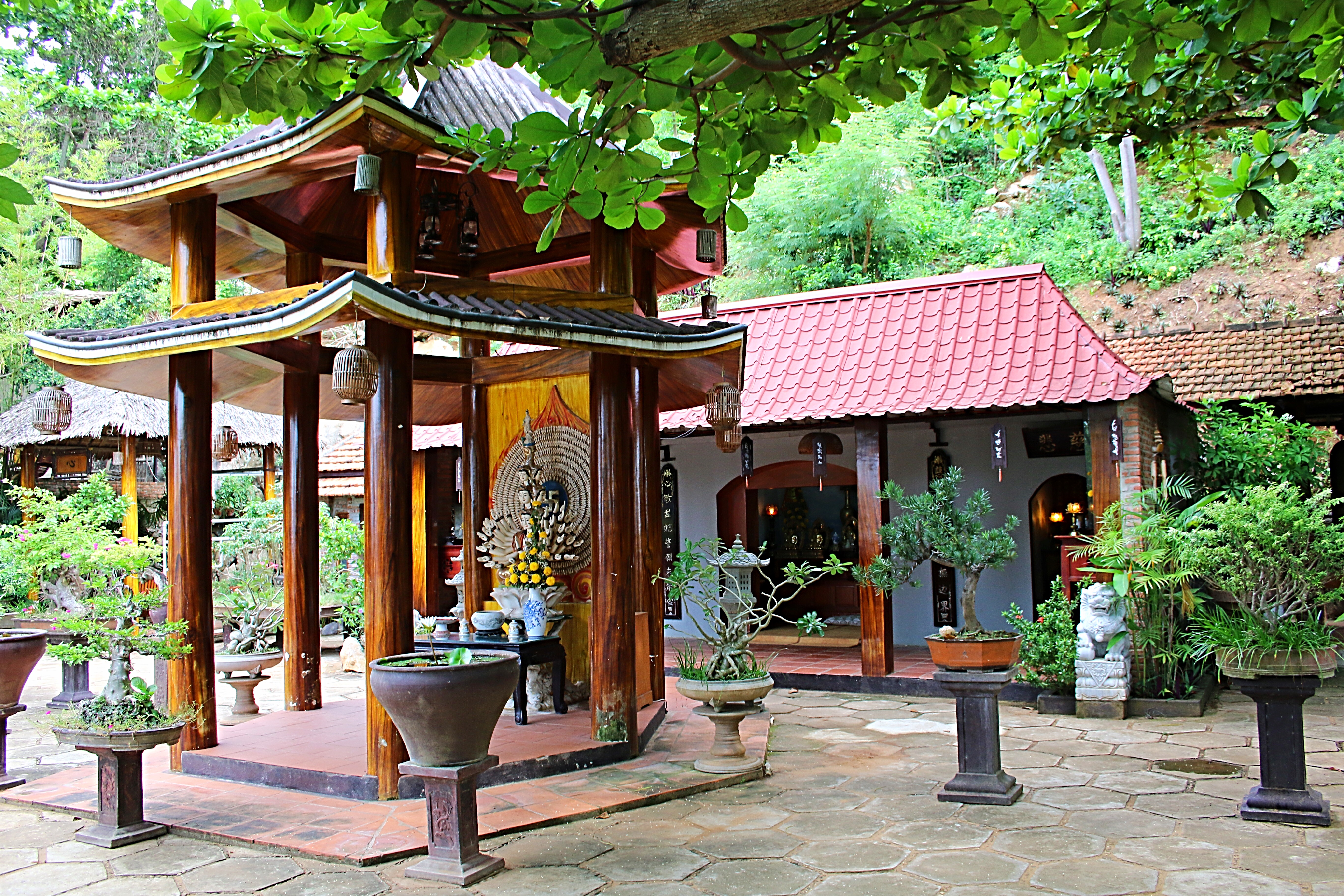
Through an entrance gate and located on the eastern side of Water Mountain, was the Linh Ung Pagoda. Constructed during the Nguyen Dynasty, it contains representations of the three Buddhas; The Buddha of the Past (Amitabha), Buddha of the Present (Sakyamuni) and Buddha of the Future (Maitreya). The pagoda has been designated a national historical and cultural site by the Ministry of Culture, Sports and Tourism.
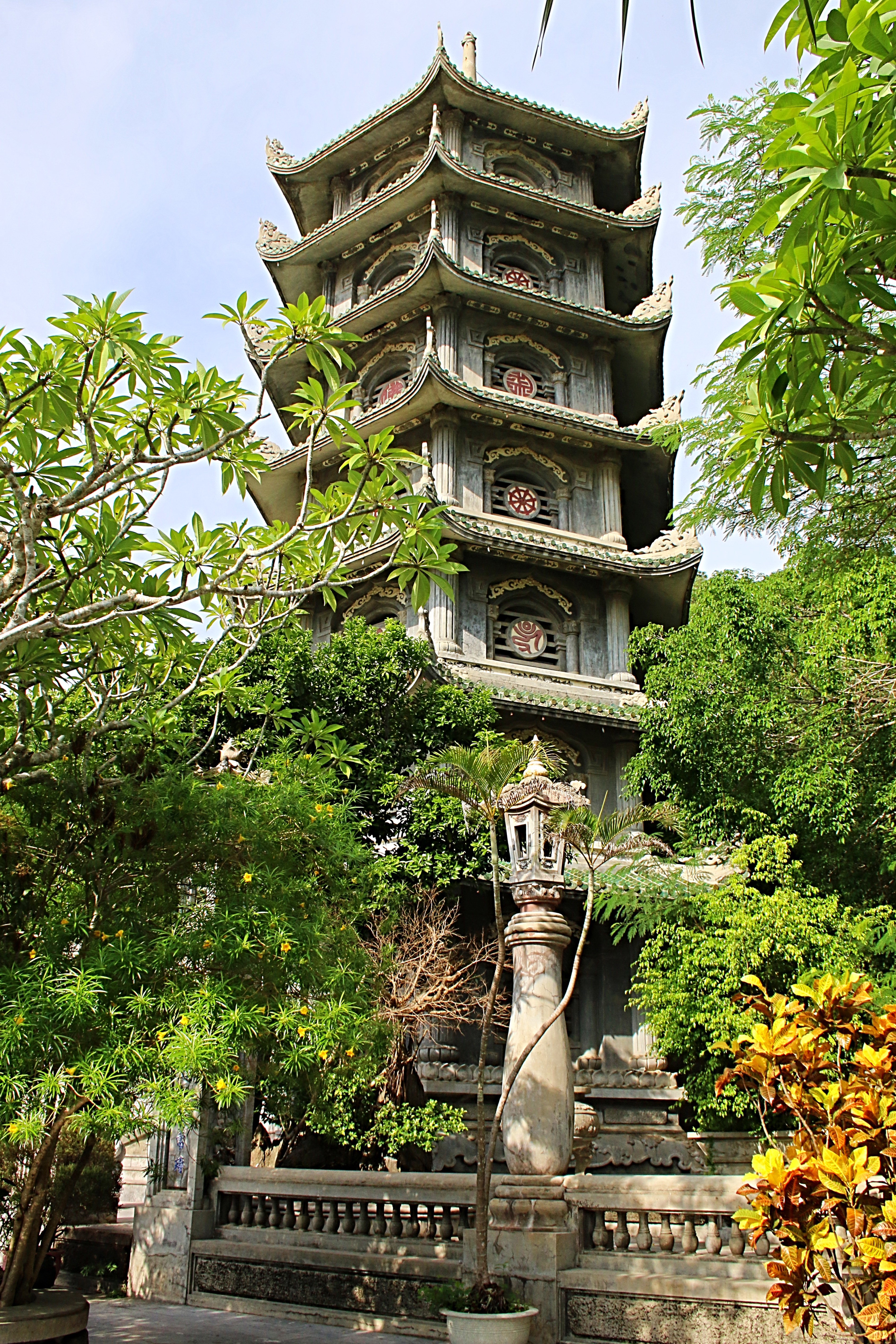
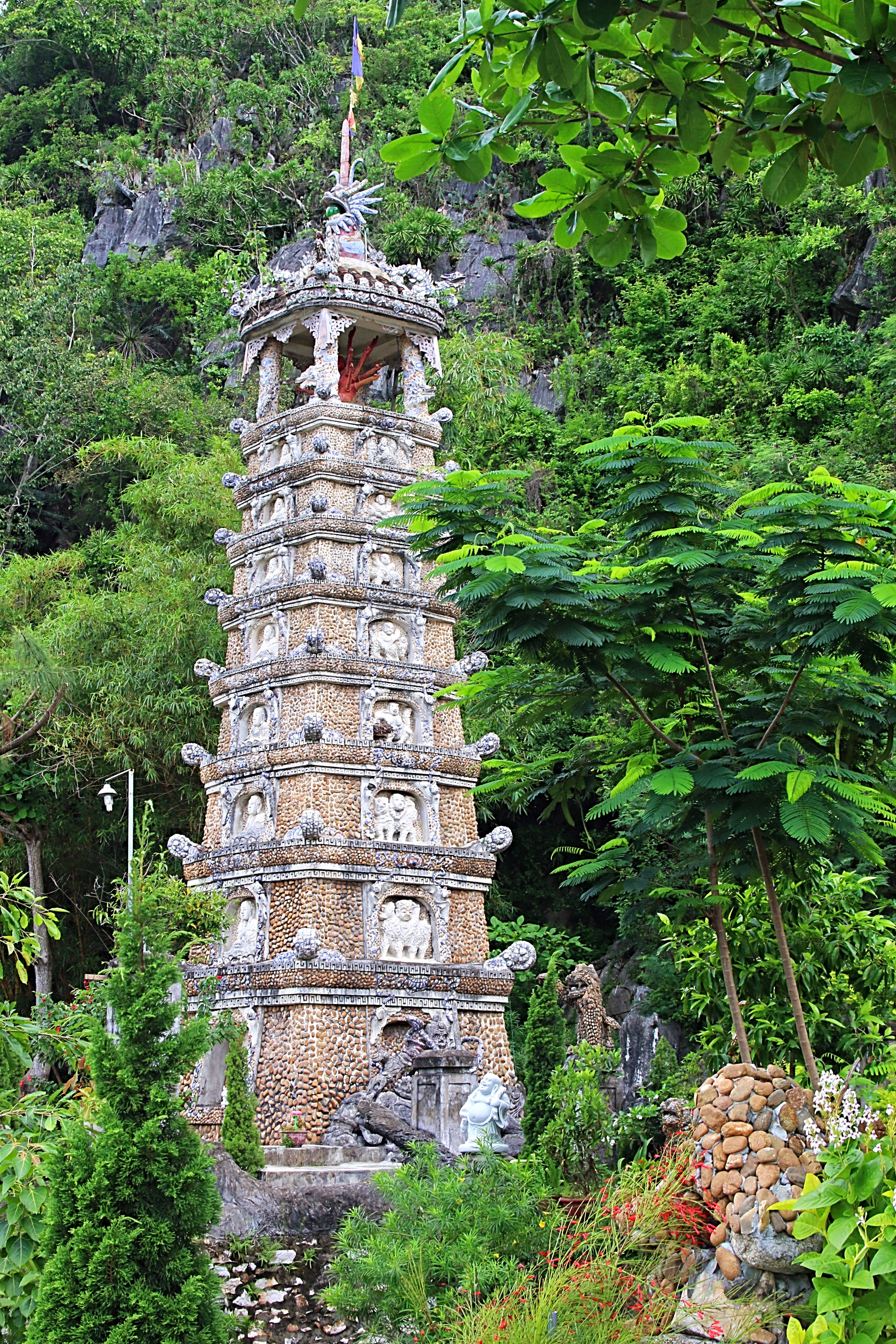
To the right of the pagoda is Vong Hai Dai, the sea-viewing pavilion, which offers an amazing view of Non Nuoc Beach and behind the pagoda is Tang Chon Cave, which has a impressive standing Buddha and Chua Linh Ung Temple. Also in this area is the Xa Loi Tower, a 15 meter tower, built of stone, overlooking the coast.
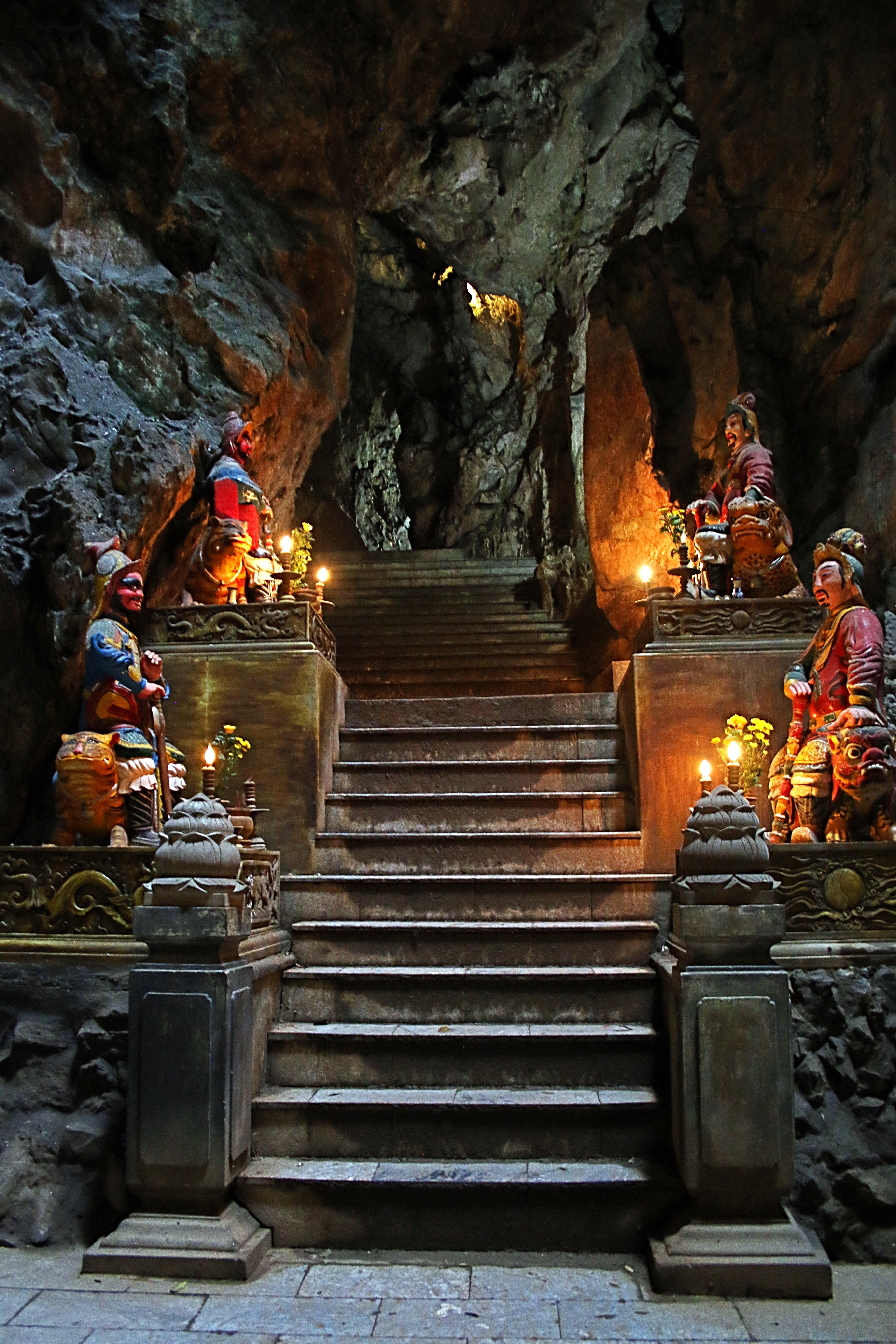
Climbing the mountain further, I encountered Am Phu and Van Thong Caves.
After entering Van Thong Cave, known for its huge statue of Buddha, I found the ascent to be extremely steep and I decided to head on to Am Phu.
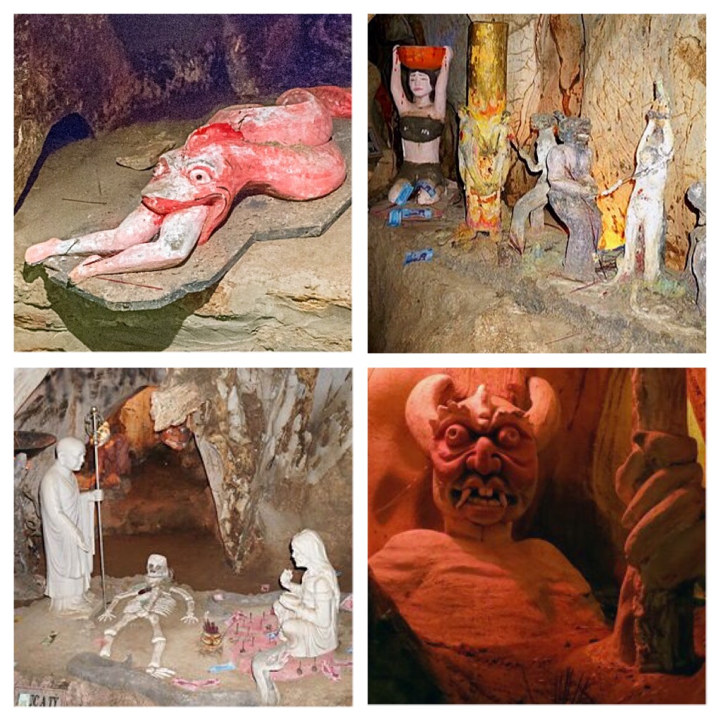
Am Phu, meaning “hell” in Vietnamese was opened to tourists in 2006. The natural rock formations, stalactites and dark tunnels are enhanced with terrifying figures and altars designed by local artists. Not for the faint of heart, visitors can confess their sins and repent at the temple shrine.
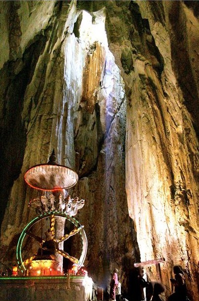
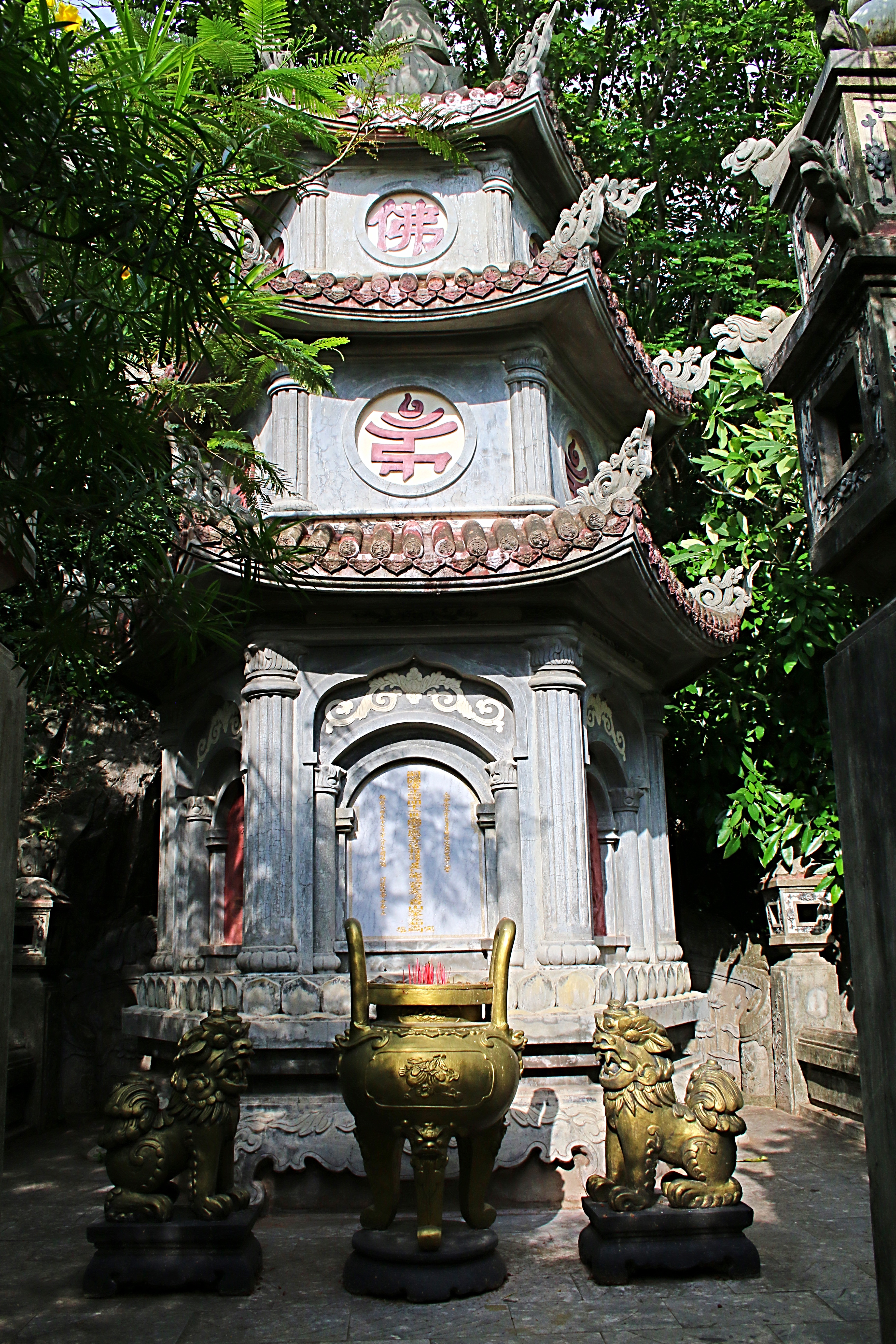
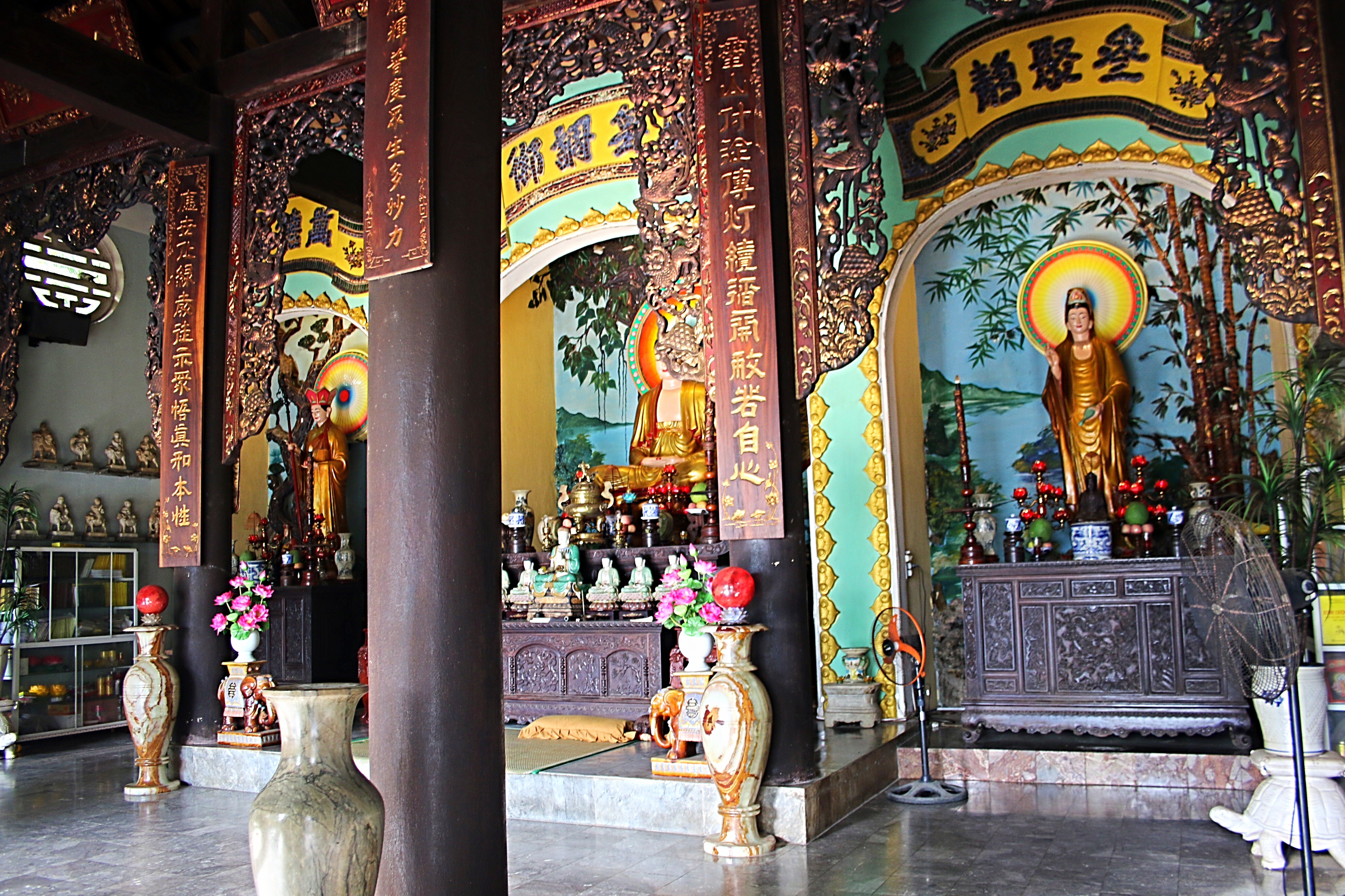
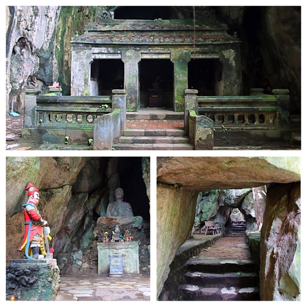
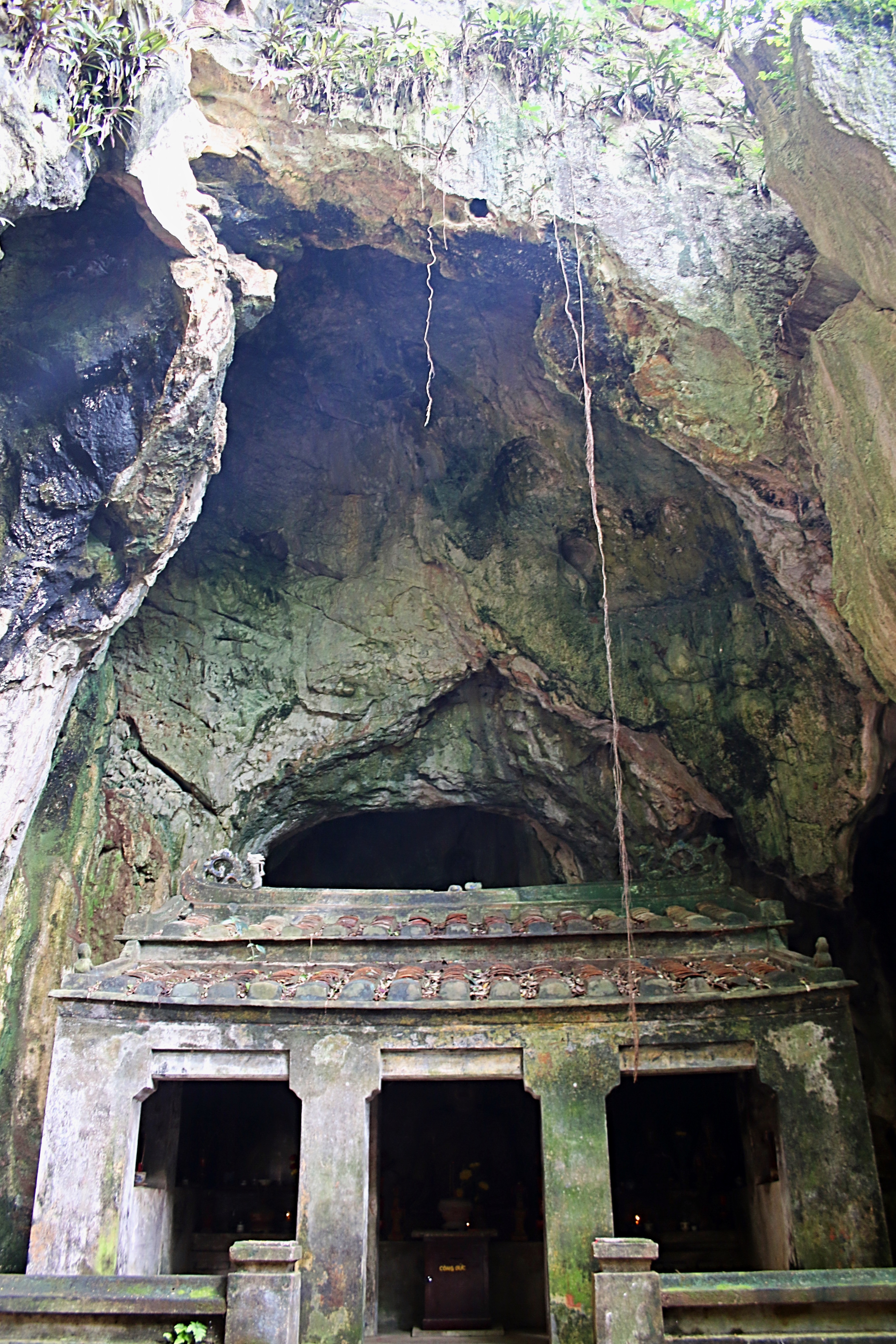
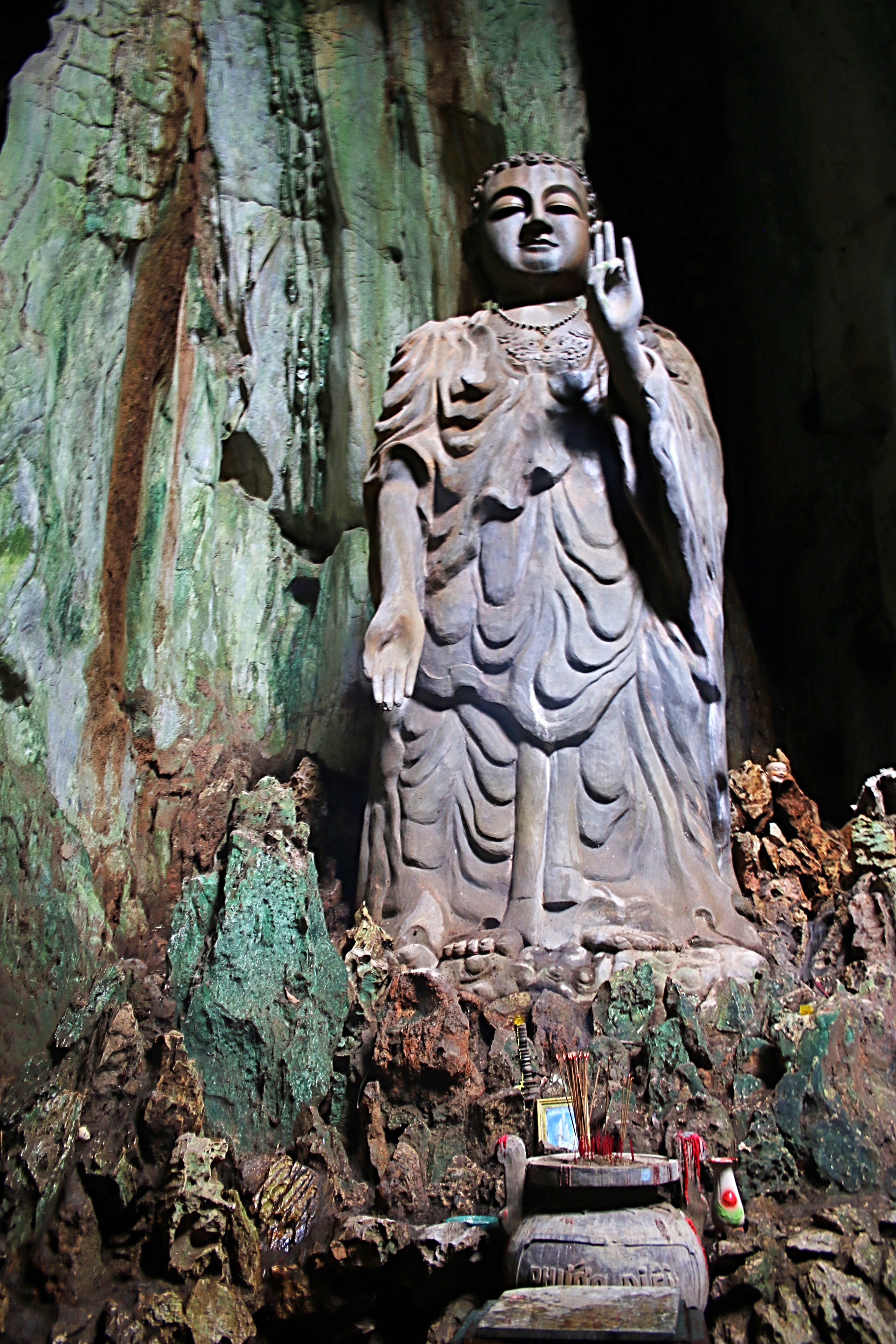
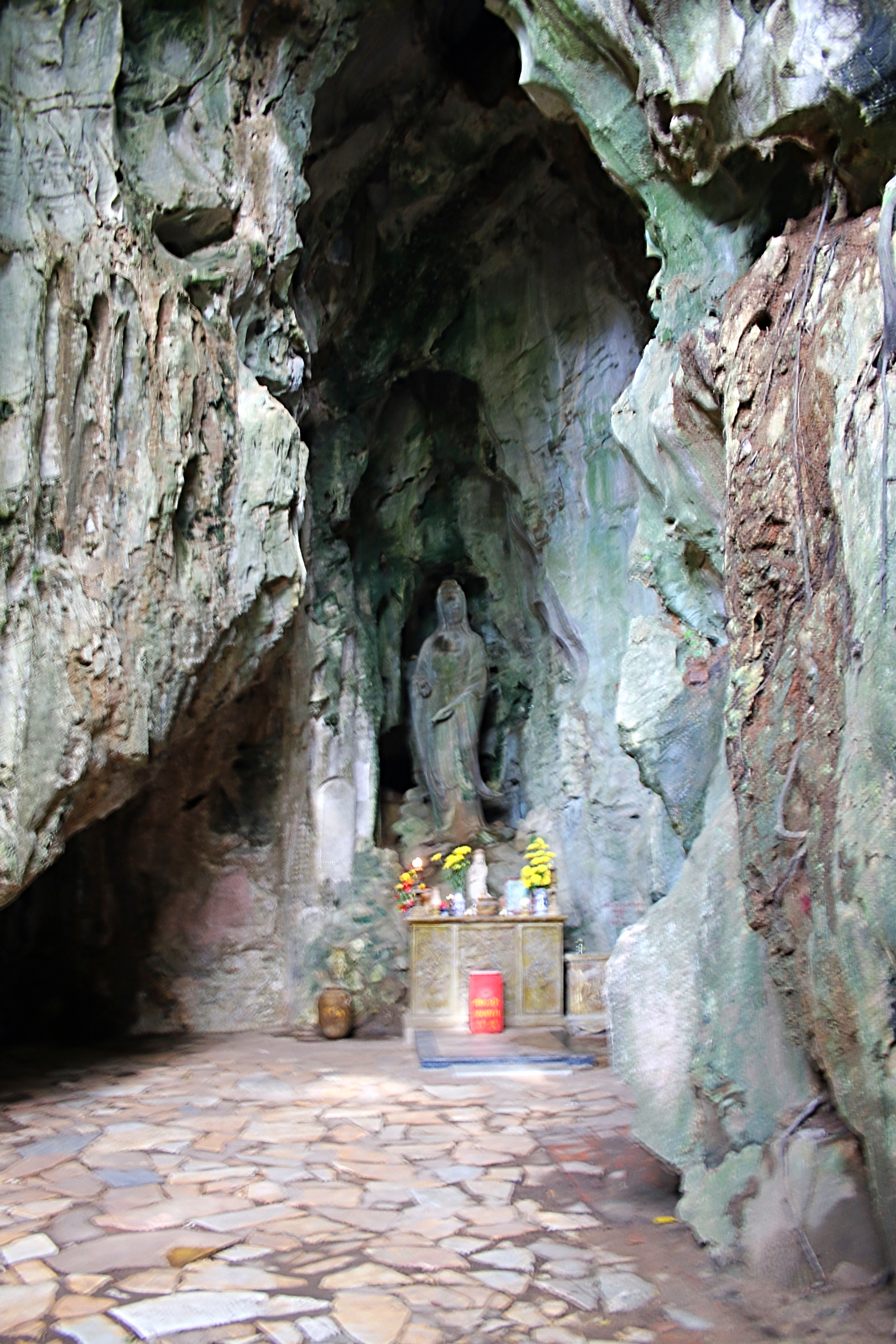
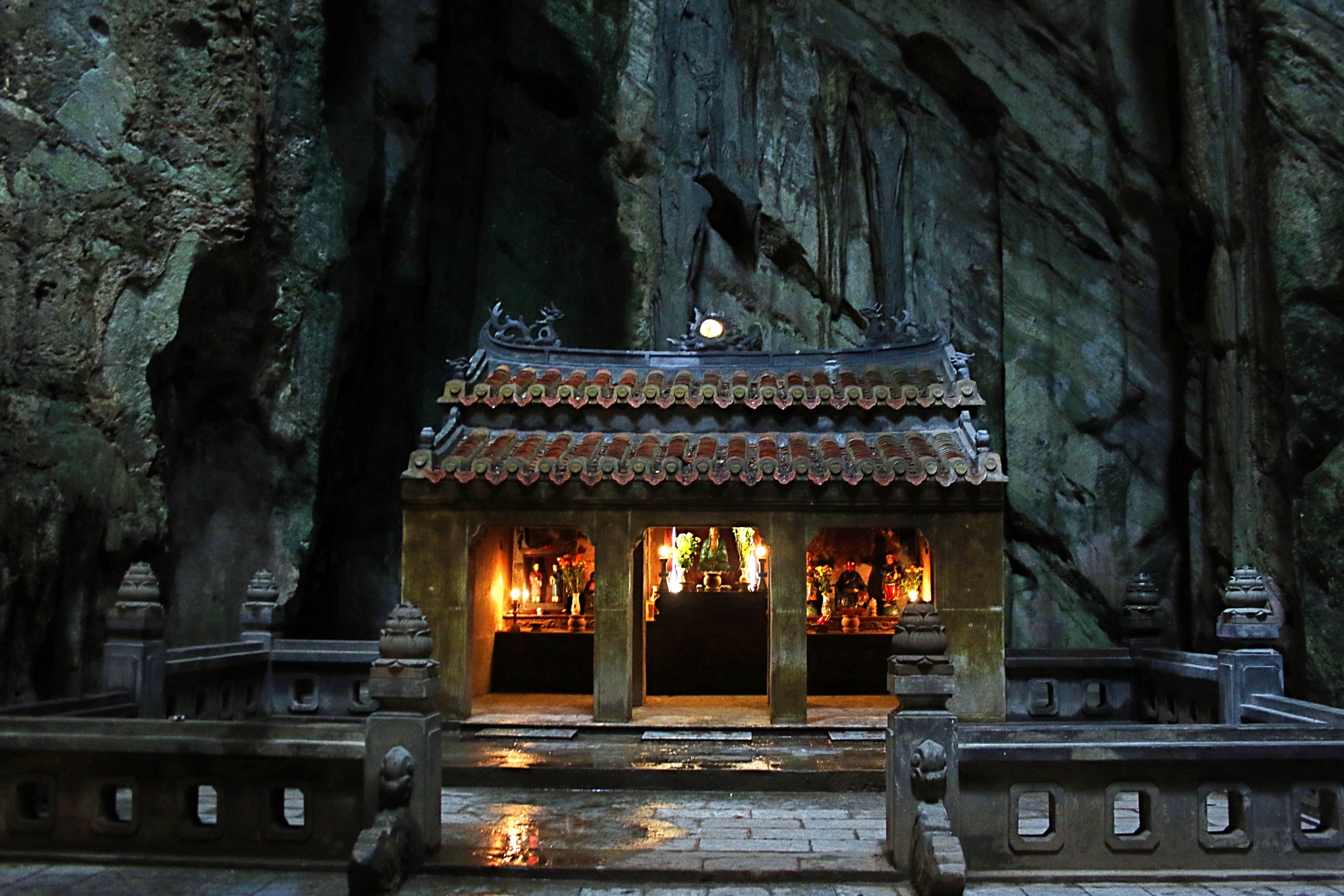
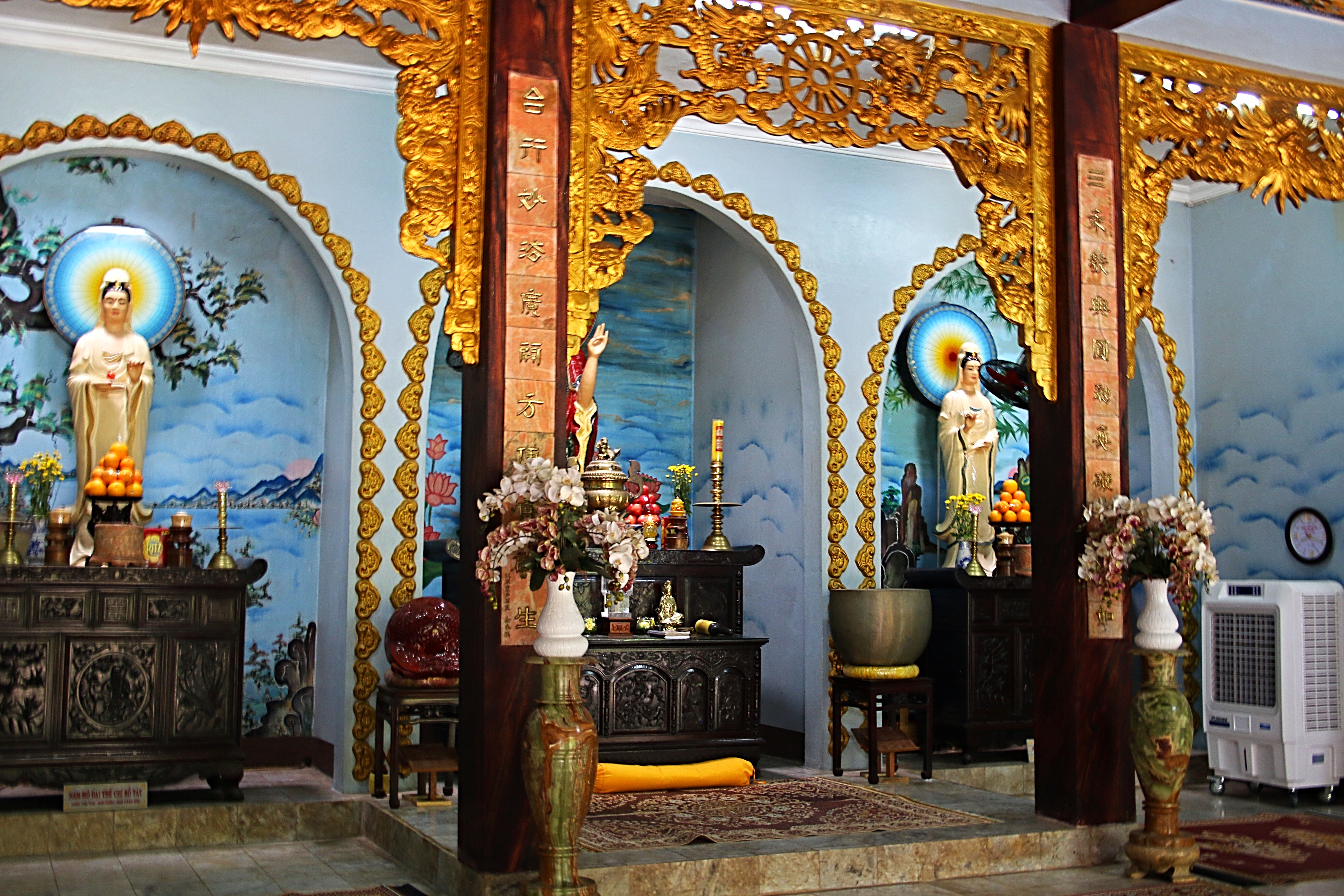
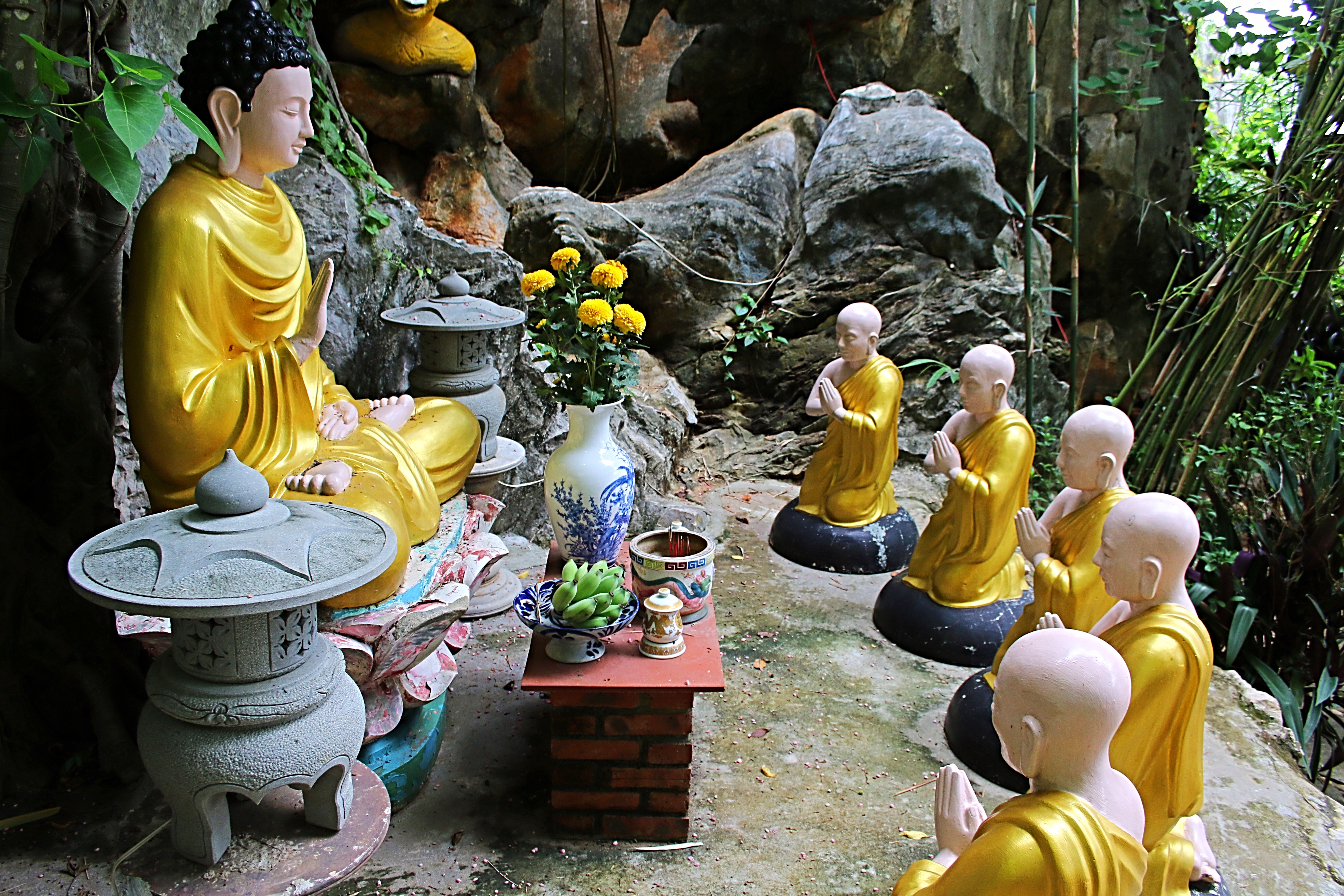
 Further on Water Mountain, upon entering the Hoa Nghiem Cave you are greeted by a large lady Buddha statue, the goddess of mercy. Descending twenty steps, you enter Huyen Khong Cave which contains various Buddist and Confucian shrines. Opposite the entrance is a large Buddha, carved by the famous craftsman, Nguyen Chat in 1960. Below the statue is the altar of “Dia Tang Vuong Bo Tat” (the most powerful Buddha in hell) and to the left, the shrine of “Ngoc Phi” (the goddess of wealth) and on the right, the shrine of “Loi Phi” (the goddess of Mountain and forests).
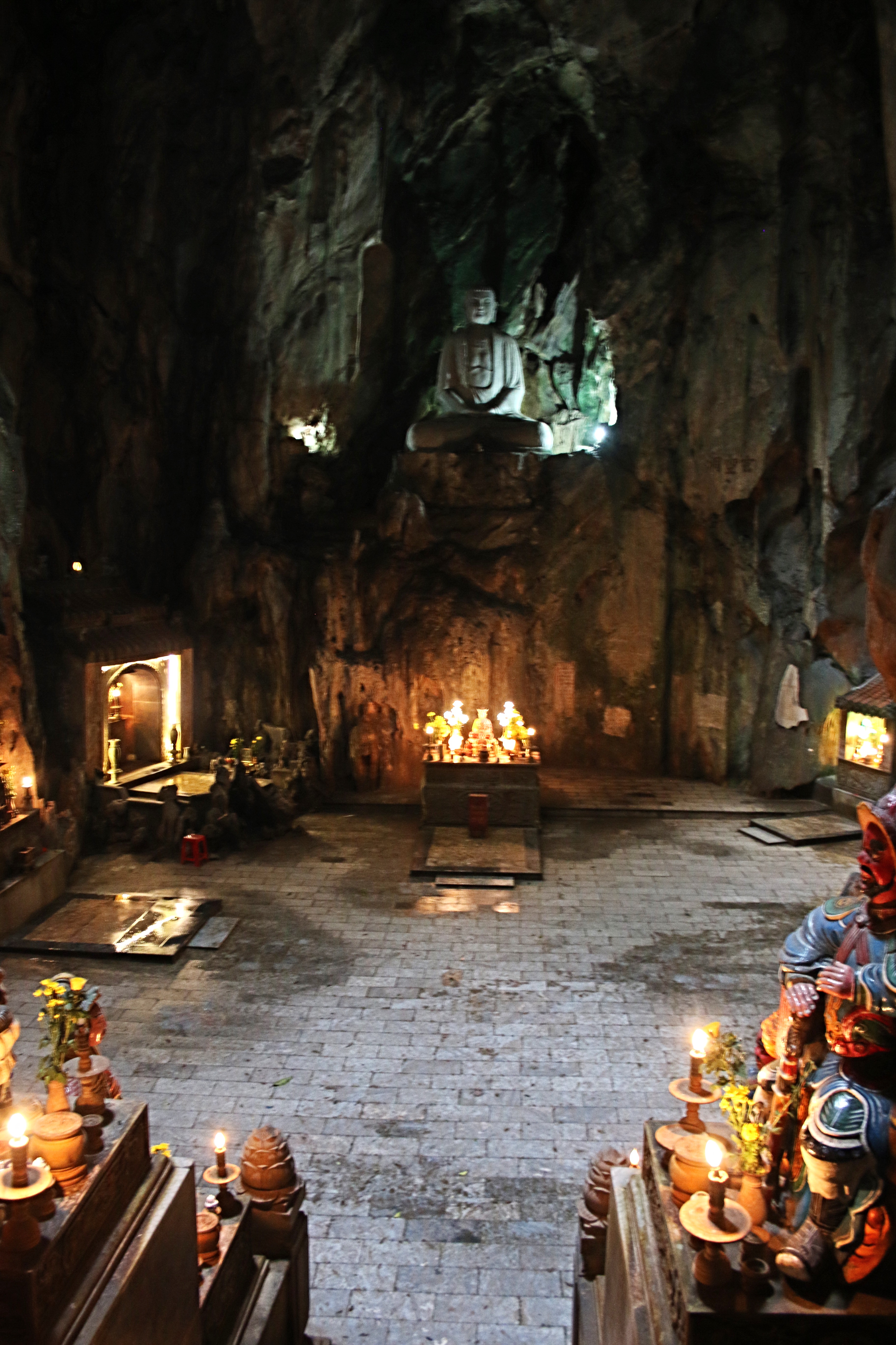
Not only having spiritual value, the cave also has great historical value. When Vietnam was at war with the French, the cave was used as a secret base for local communist leaders and guerrillas. Later, during the Vietnam War, the American military used it as a commando training area and a garrison of the Old South Government and American units.
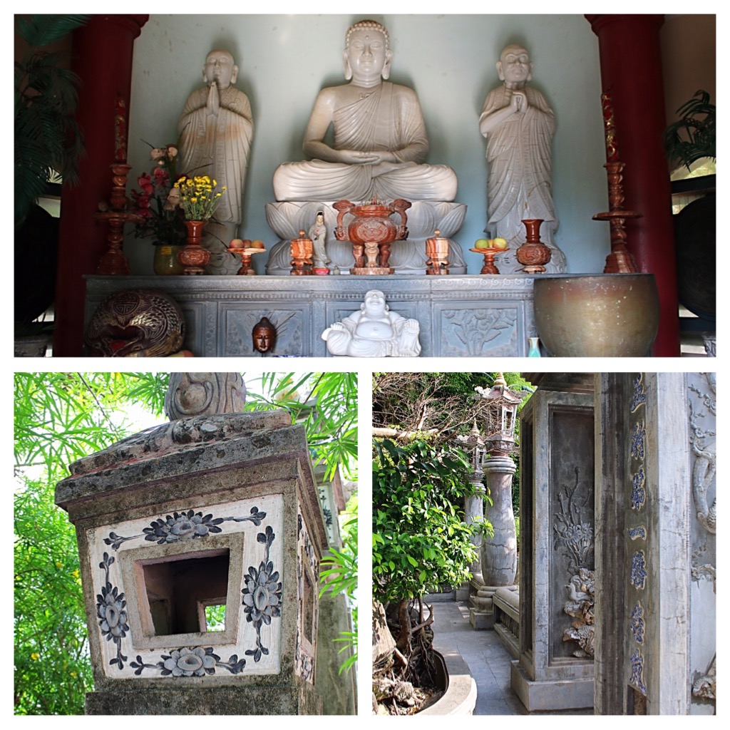
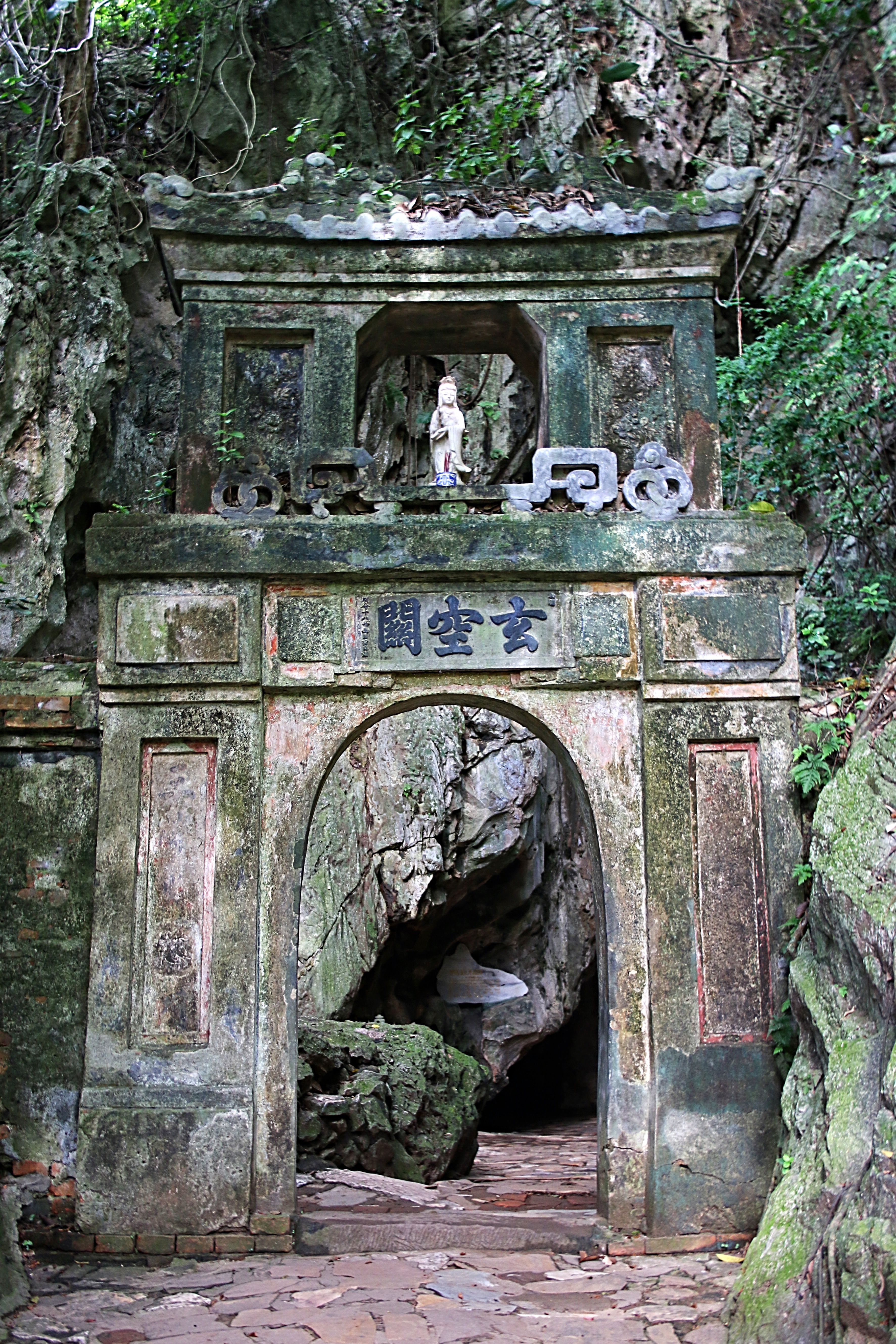
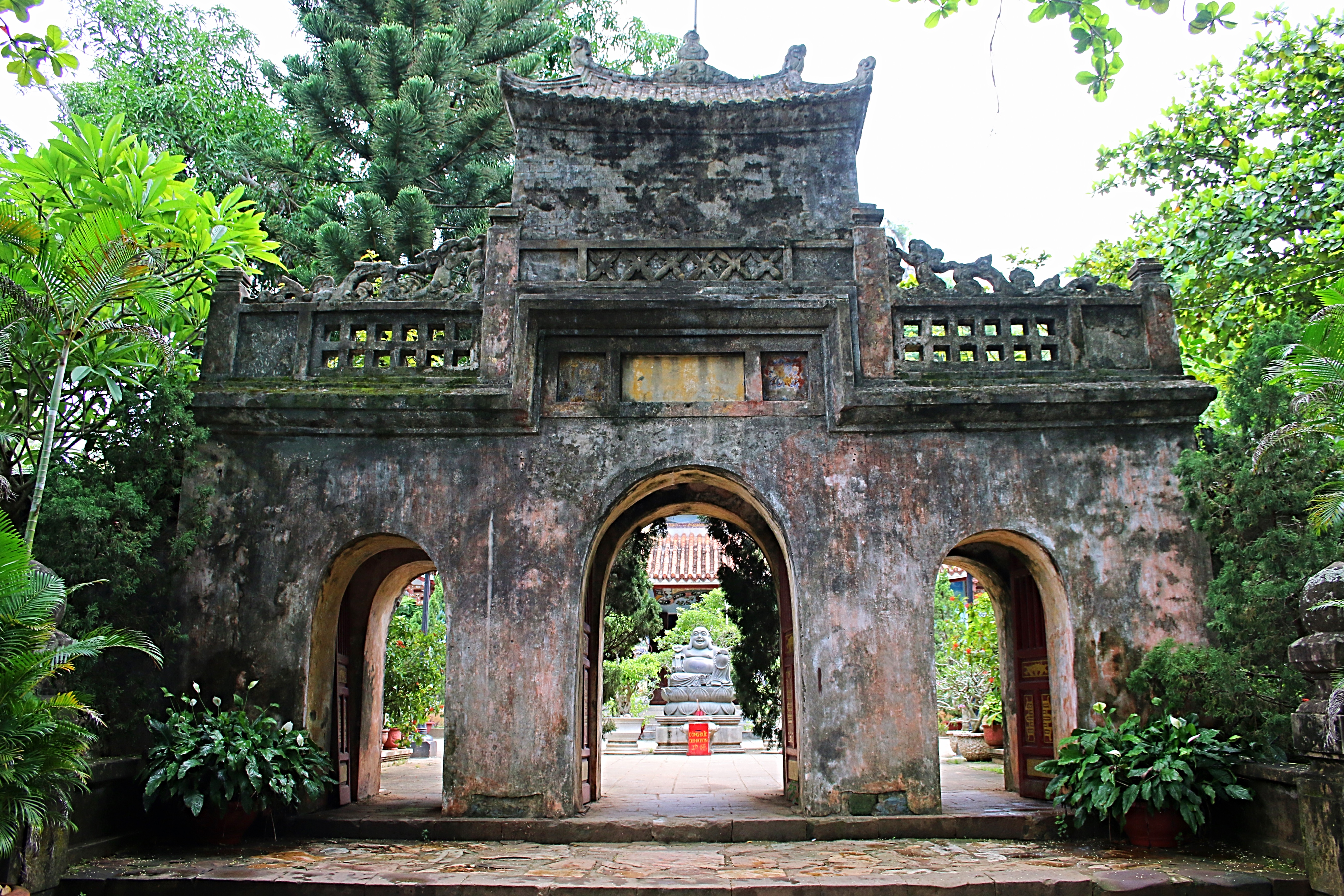
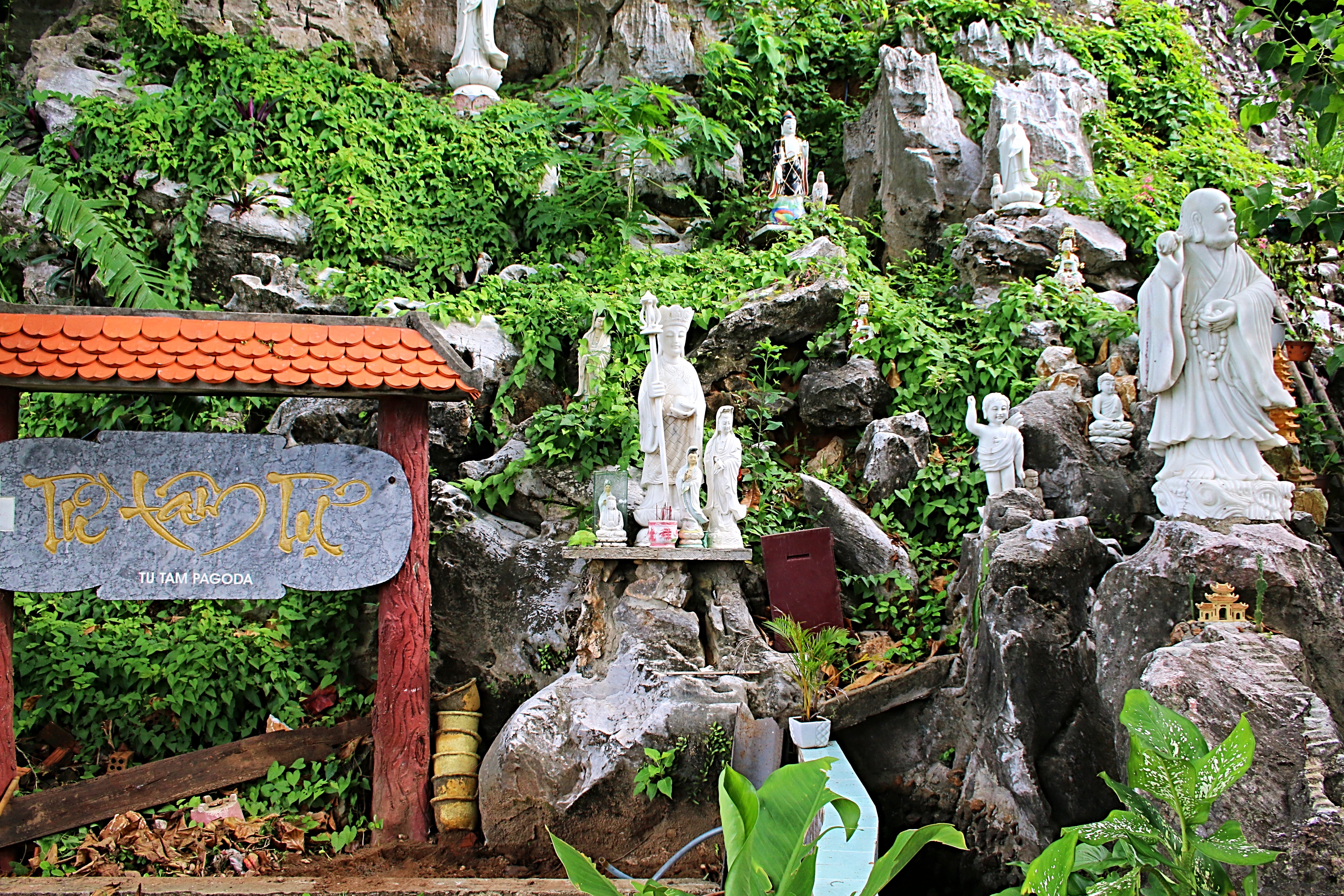
 Although I was given an hour, it was definitely not enough time to see all that there was to offer. Skipping Linh Nham Cave, I stopped to inspect the Tam Thai Pagoda. Looking out to the west, the pagoda was built in the 17th century and has three stories; Thuong Thai, Trung Tai and Ha Thai. Most interesting to check out is the old, mossy entrance gate. Pho Dong Tower, Tu Lam Pagoda and Vong Giang Dai (river view pavilion) are adjacent to the Tam Thai Pagoda. Amazing views of the Truong Giang and Cam Le rivers can be seen from Vong Giang Dai.
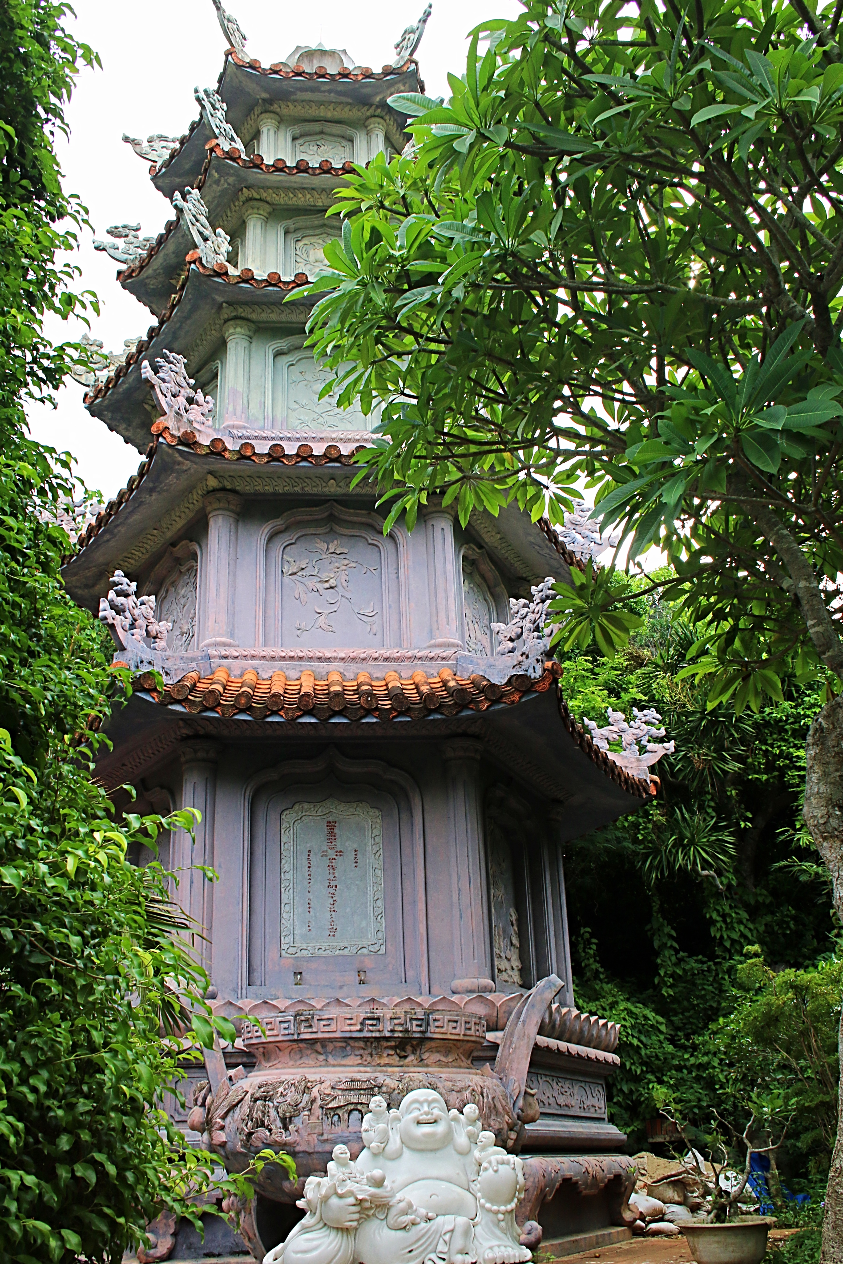

 Making my way from Tam Thai pagoda, I soon found myself heading down the mountain, only, not to the eastern gate. I had moved downhill toward the Tam Ton pagoda. Although I was happy to have seen this tall, beautiful pagoda, time was up and I was needed back at my car to continue our journey. Asking a couple of workers in the area to direct me the right way, they pointed in a general direction and said, “That way.” Seeing no path, I asked again, Pointing toward a field, I walked that way, still seeing no path. Looking upward, I realized that I did not have the time or energy to make my way up toward the Tam Thai pagoda and back down to the eastern gate. Again, I asked another worker and was shown what to do. Now why didn’t I think to climb a small hill of slabs of marble and trudge through a field of weeds where some poisonous snake or rabid animal was surely hiding and waiting to strike?
 Time was a ticking…so I climbed and ran like the wind through the field. Arriving at the main road, I looked to the mountain to get my bearings and made my way back to where I believed my driver was waiting…and thankfully, I found him!
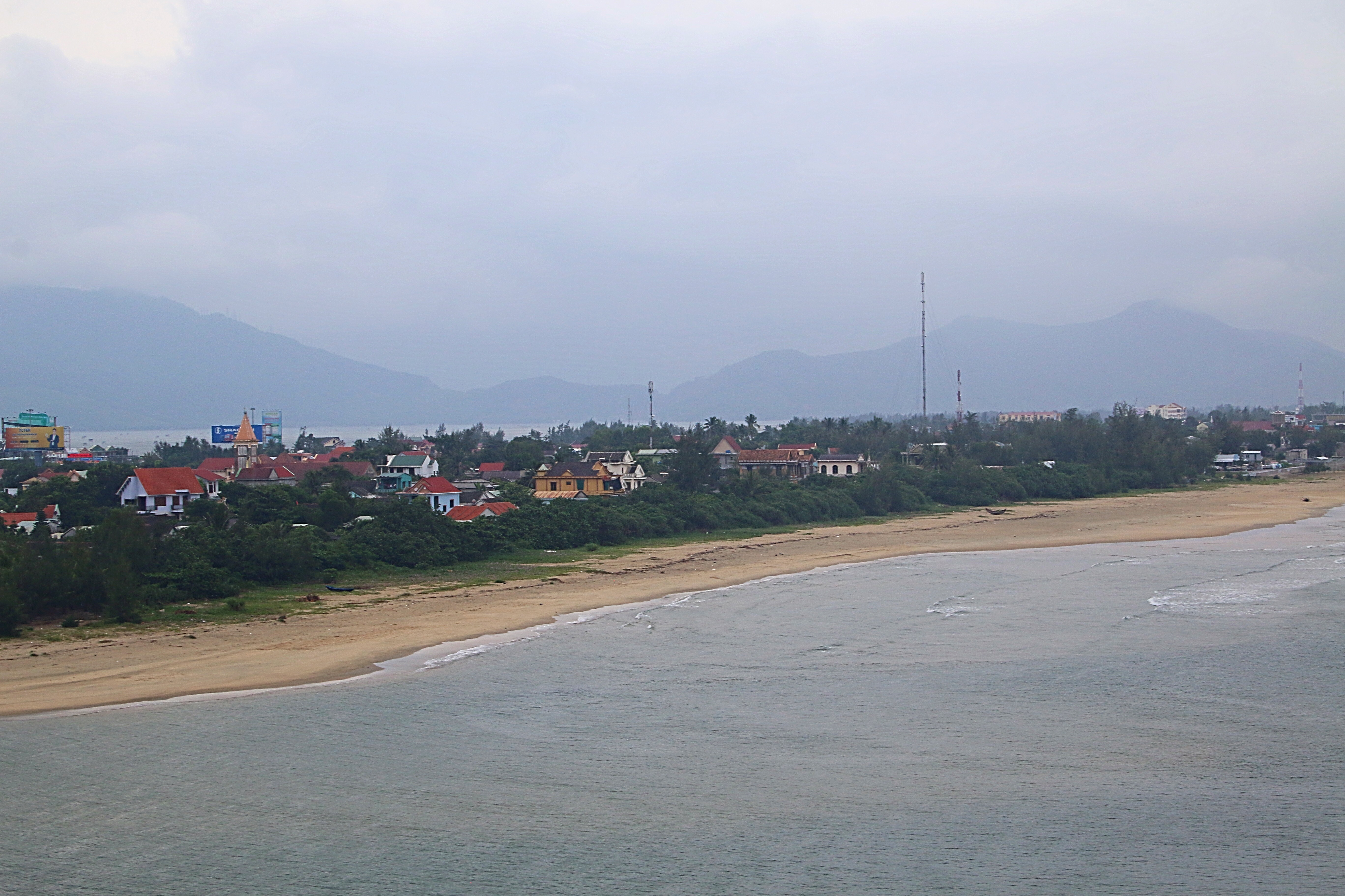
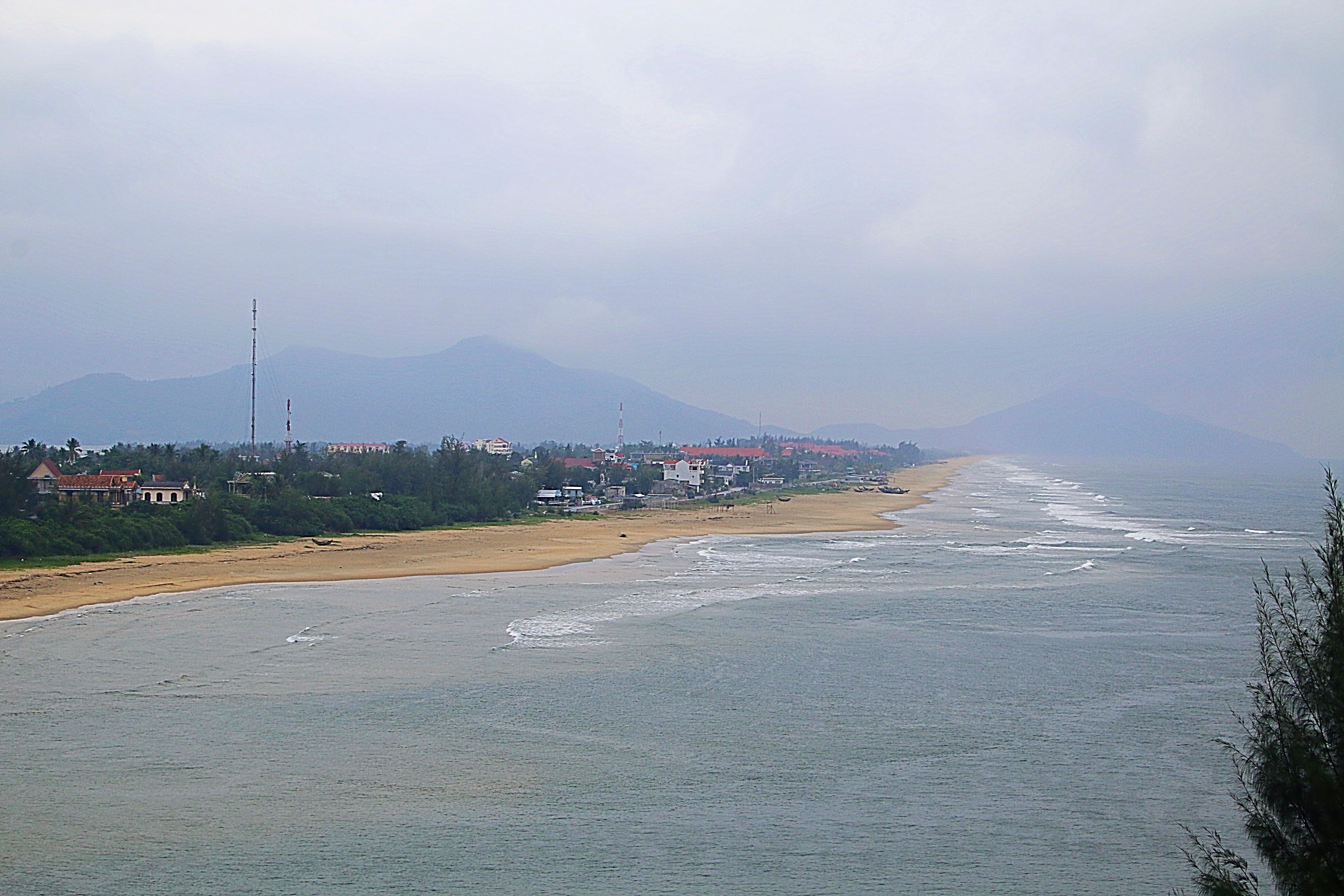
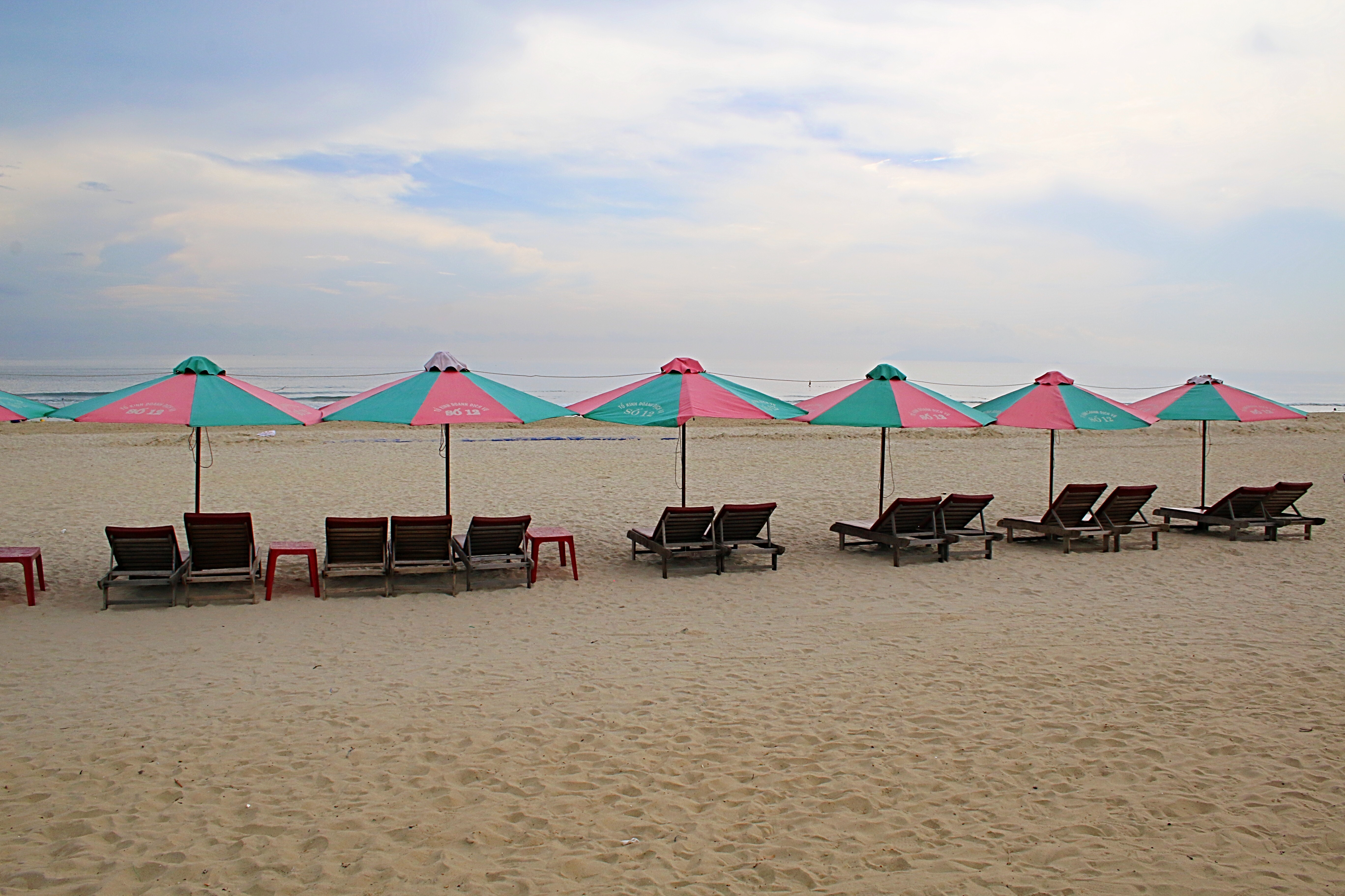 Soon we were on our way, once again, towards Danang. My driver pulled over so that I could take some snapshots of My Khe Beach. This twenty mile stretch of white sandy beach was used by the American troops during the Vietnam War. Nicknamed China Beach, it is considered to be one of Vietnam’s most picturesque beaches.
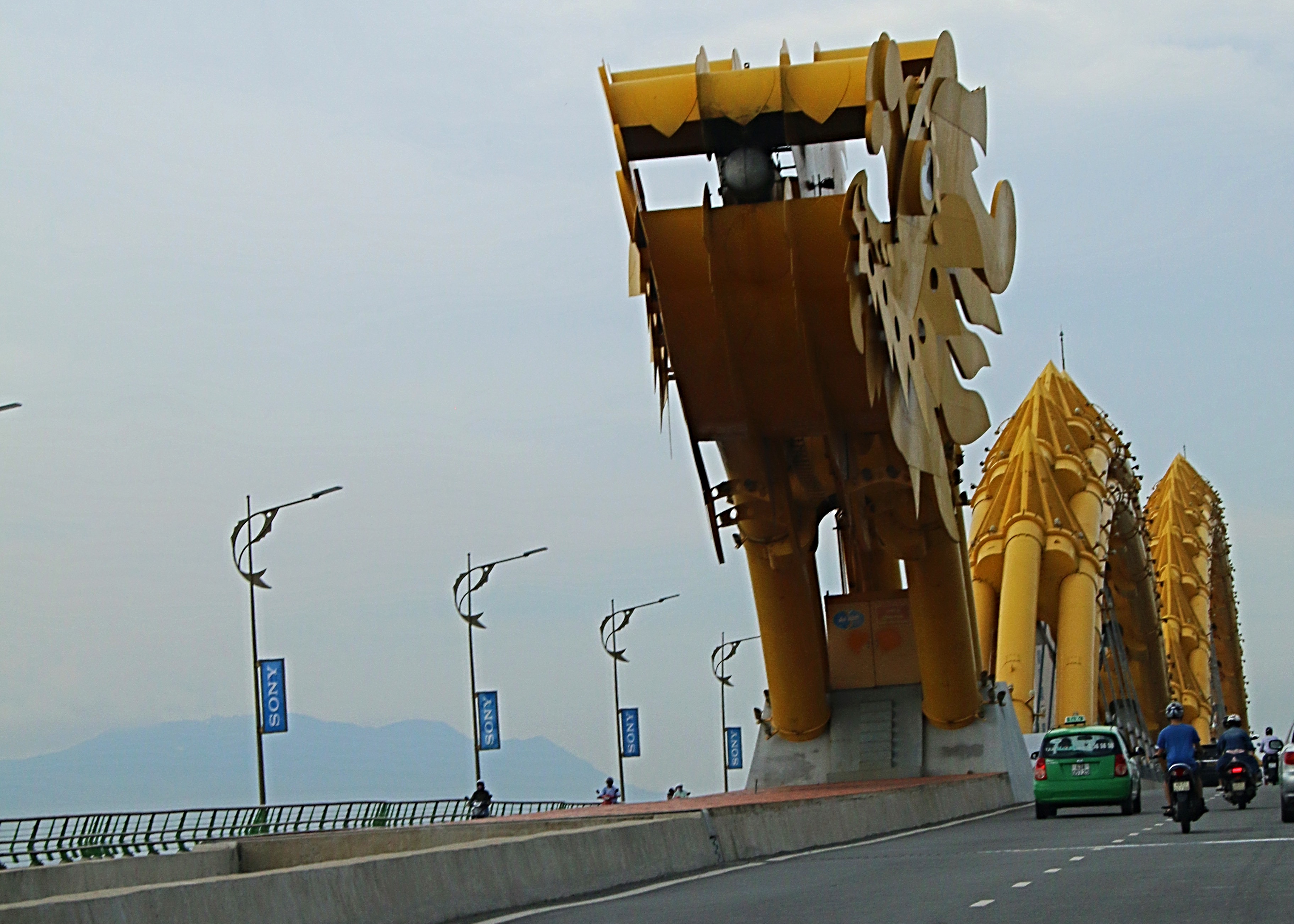 Crossing Danang’s Dragon Bridge over the River Han, we continued into the mountains. The dark clouds that had been threatening all day, soon opened up and offered a light rain. Climbing higher into the mountains, the clouds settled around us and the views of the coast below us became obscured.
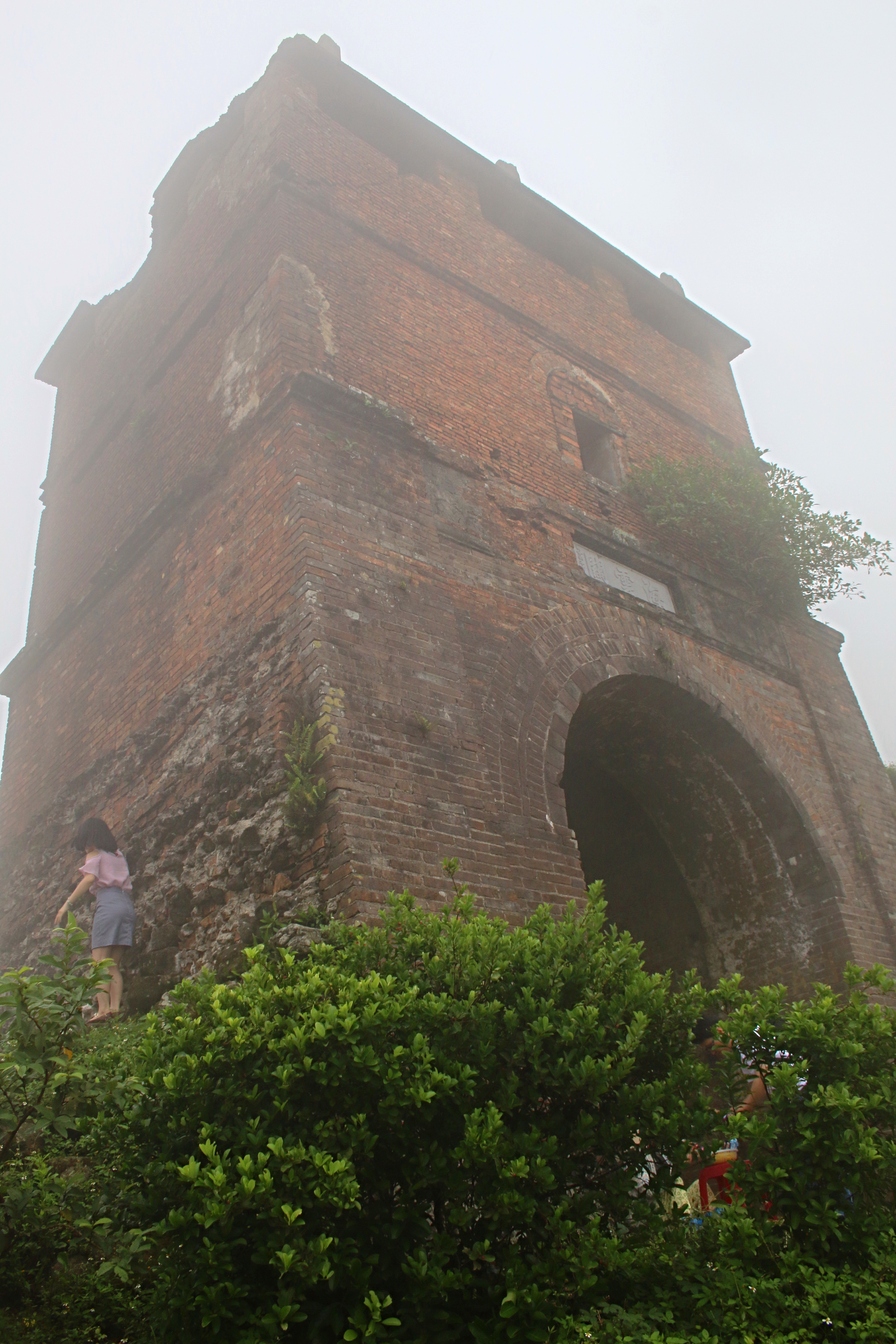
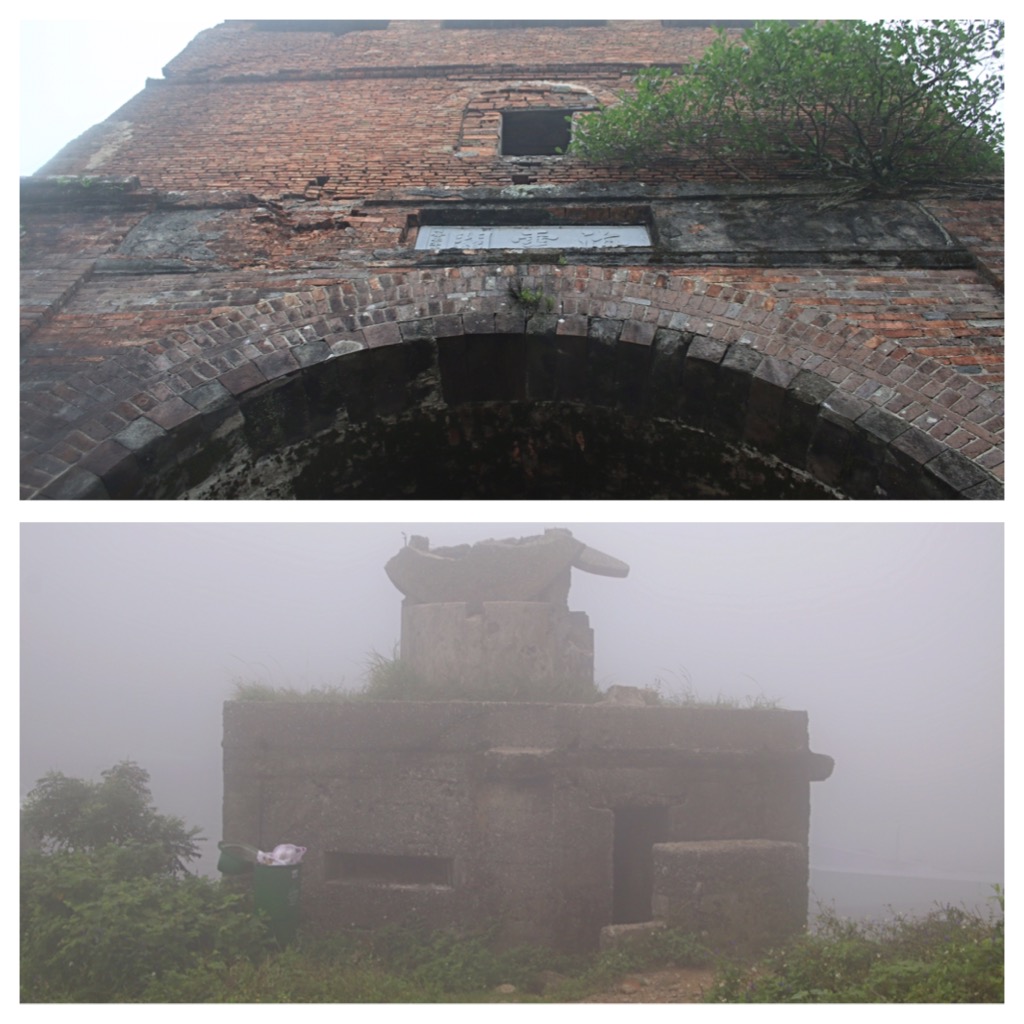 Before long, I noticed the traffic growing heavier both forward and aft of us. Pulling into a tight space between two tour buses, I realized that we were not just at a rest stop. My driver didn’t really communicate with me as to where we were and I glanced around, a little confused. Clouds were low and whipping by making it hard to see the area, but I noticed other tourists crossing the street. Following suite, I climbed the stairs and stood among the many visitors taking pictures in the foggy atmosphere of the ancient Tran Dynasty’s Hai Van Gate, wartime gun towers and French built fort that was later used as a bunker during the Vietnam War.
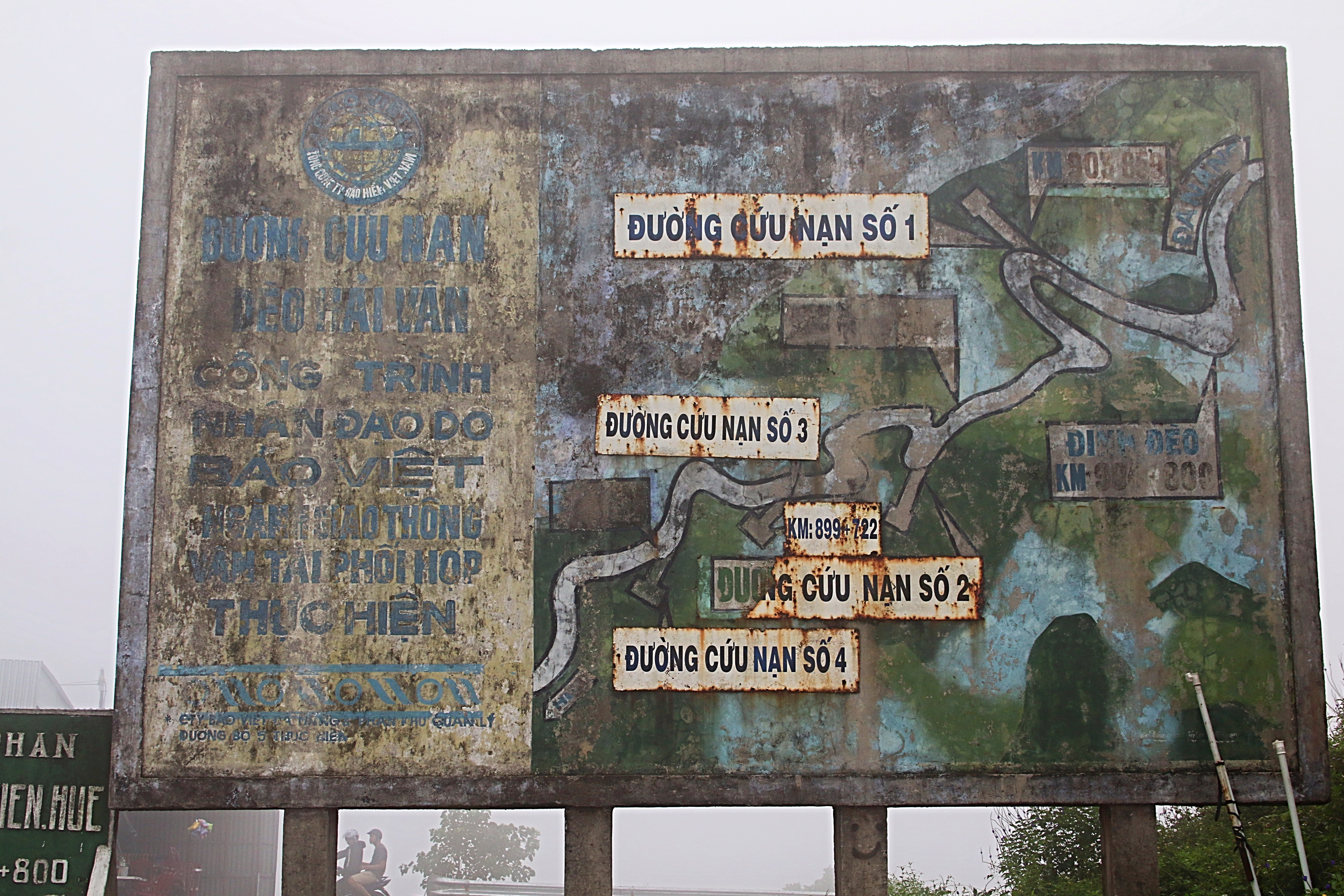
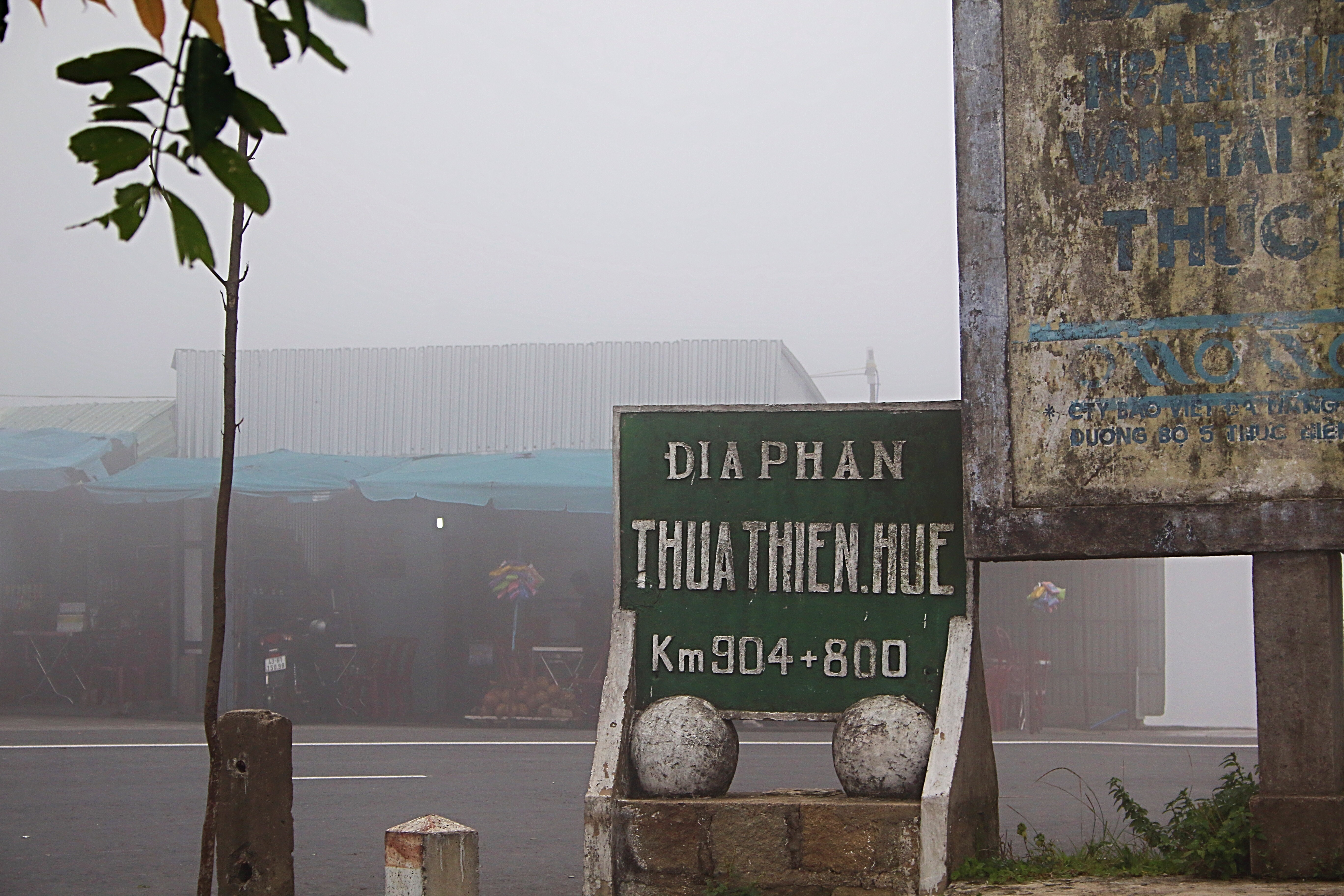
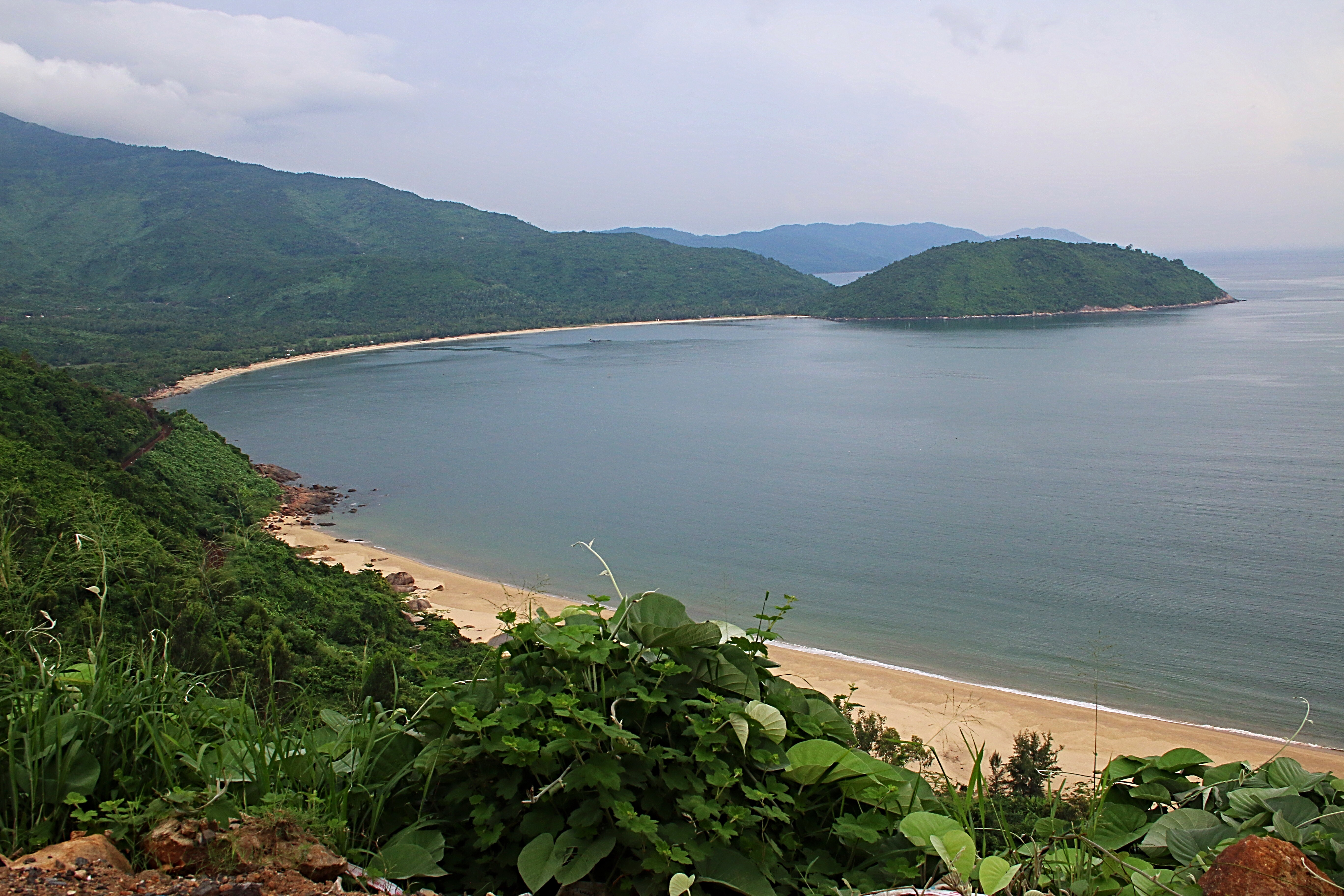
Crossing a spur of the Annamite Range, Hai Van Pass is an approximately 21 km long mountain pass on National Route 1A near Bach Ma National Park. The name Hai Van refers to the mists that rise from the sea, reducing visibility, and that’s just what we had today. Snapping a few pictures, I could only imagine what it would look like here on a clear day.
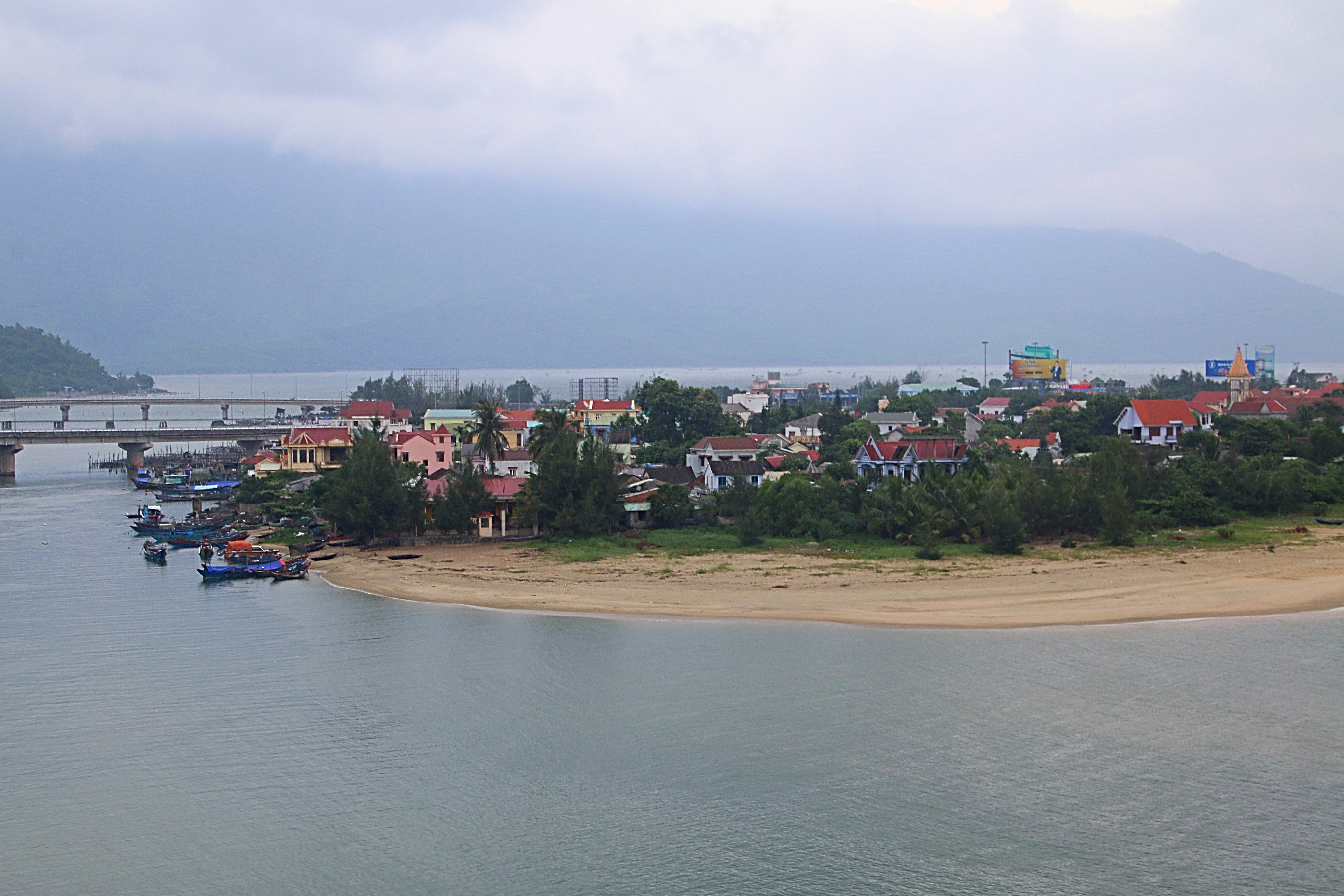
We continued on the twisting road, the rain hampering our progress. Closing my eyes, I rested while we drove on. Soon, my driver pulled over again, and informed me that we were looking down on Lang Co Beach. Since it was still drizzly, I quickly snapped a few photos, thinking that it would be a nice place to visit at another time.
Jumping back into the car, I checked my watch and noted that we had made better time than I had expected. Knowing that Lang Co Beach was not far from Hue, I anticipated another half hour’s journey.
As we left the mountains and rice paddies, I began to see more buildings and businesses. Checking the map on my phone, I realized that we were entering the city of Hue. A few minutes later, we were pulling onto Chu Van An Street and in front of the Orchid Hotel, my base of operations for the next day. Excitedly, I gathered my belongings and headed inside, ready to begin my exploration of Hue.
For more pictures, check out Facebook, Snapping the Globe and Instagram, @snappingtheglobe.
The Marble Mountains
- Address: Hòa Hải, Ngũ Hành Sơn, Da Nang, Vietnam
Hours: 0700-1700 - Admission: 15,000 Vietnamese Dong (about US $ .67)
- Map: Admission: 15,000 Vietnamese Dong (about US $ .67)
- Elevator: 30,000 Vietnamese Dong (about US $1.30)
- Getting There: Bus #1 stops in front of the Marble Mountains and covers the journey from Danang to Hoi An. Catch the bus from the bus station in Danang (Dien Bien Phu no. 33) or from the Hoi An bus station (Le Hong Phong Street junction with Nguyen Tat Thanh). 20,000 Vietnamese Dong (less than US $1). The bus takes 15 minutes from Danang and 40 minutes from Hoi An. Taxi from Danang costs approximately 50,000 Vietnamese Dong. From Hoi An, approximately 200,000 Vietnamese Dong.
