Where the Deer and the Tourists Play

© 2017 Snapping the Globe, L.L.C. All rights reserved.

The Acropolis…check.

Tulum…check.

Ta Prohm…check.

The Coliseum…check.

Petra…check.

Over the years, my eyes have gazed upon some pretty impressive ruins.  Withstanding the test of time (well almost) these magnificent and sometimes mysterious remains mesmerize and captivate.

Honestly, I can’t resist visiting any ruin…big or small…ancient or not so old.  The lure of its history and remaining architecture always draws me in, so when I noticed the words “ruin” on my map of St. John, I knew that I had to find time to see what was there.

Cinnamon Bay Plantation ruins lie just across North Shore Road, directly opposite the appropriately named Cinnamon Bay.  Parking in the Cinnamon Bay Beach parking lot, cross the road to the beginning of the Cinnamon Bay loop trail and begin your exploration of the historic plantation’s sugar factory’s remains.

An important part of St. John’s history dates back to 1717, when the Danes settled on the island.  Founded by Daniel Jensen, the plantation processed sugar cane from the fields into sugar, molasses and rum.  While wandering through the Bay, Calabash and Genip trees, you can observe the horse mill where the juice was extracted from the cut cane stalks, the boiling house, where rows of copper kettles continually condensed the syrup to crystal form and the store rooms or “bagasse sheds” where fresh sugar was dried.  One of the most impressive structures on the premises is the towering chimney…the rum still.

Further along the Loop Trail lay the crypts of a Danish family that perished on the island as well as the remains of the Great House.

The trail is well laid out, evenly leveled, well maintained and a welcomed respite from the hot, Caribbean sun, with its dense tree covering providing maximum shade.  Take some time to wander throughout the interior of the buildings and be on the lookout for the curious deer that meander through the property.

After you are done, cross the road and check out Cinnamon Bay Beach, Resort and Campground where you can rent a cottage, an eco-tent, campsite, kayak, paddleboard or just have a snack or cold beverage at Raintree Cafe.  You can also visit the souvenir shop for a special memento of your visit…but alas…no 1717 rum!

For more pictures, check out Facebook, Snapping the Globe and Instagram, @snappingtheglobe.


Cinnamon Bay Plantation Ruins 

Cinnamon Bay Beach and Resort


A Walk in the Jungle

© 2017 Snapping the Globe, L.L.C. All rights reserved.

Having visited San Gervasio archaeological site twice in the past, it was a place about which I could have said, “Been there, done that”.

Not me…

I love ruins and architecture.  So why would I not go back?

The largest and most important archaeological site on Cozumel is a sanctuary to Ixchel, the goddess of fertility and love.  Located in the center of the island in the middle of a lush jungle, populated with iguanas, flowers and foliage,  the site’s name was taken from the agricultural and cattle ranch, San Gervasio, founded by Mr. Gervasio Novelo on September 14, 1858.

The site’s original name is unknown, but its long history dates back to 100 BC and it continued into the late 16th century, with the arrival of  the Spaniards.

For the duration of San Gervasio’s existence, women have made the obligatory pilgrimage to pay tribute to Ixchel, “She Of the Rainbows”, deity of midwifery, fertility and women.

The site’s entrance is well-marked on Transversal Road, but once turning from the main road, the drive is long and narrow and marked with a speed limit that I think the iguanas could outrun.

A decent parking lot is available for those with rentals and a nice, attendant will keep an eye on your car…be sure, he will remember you and be standing nearby for his tip!

When entering the complex and paying your entrance fee of $4.50, you will first encounter a courtyard, with a few souvenir shops.  Since, I only had a rain slicker, we were trying to purchase a small umbrella for my son.  The shops only carried the long, curved handle type, for $10, which would have been impossible to bring home.  One of the shop owners, offered to lend us one, for a tip…actually a good deal for us and a smart move on her part.  How many times has this umbrella paid for itself?

Another tip I learned later was about bug spray…definitely bring your own.  My son is a mosquito magnet and I did not think of picking up some while in town.  The shop vendors were more than willing to sell us a very expensive can, which we did not purchase due to the size and cost.  Later, I learned that we could have asked for a spray down for a tenth of the cost of the can…something we should have definitely done for my son.

It is in this area that you can hire a guide to take you throughout the complex and the price for the both of us was $20, though we opted not to use this service. Restrooms are also located here and I recommend using the facilities before entering the site.

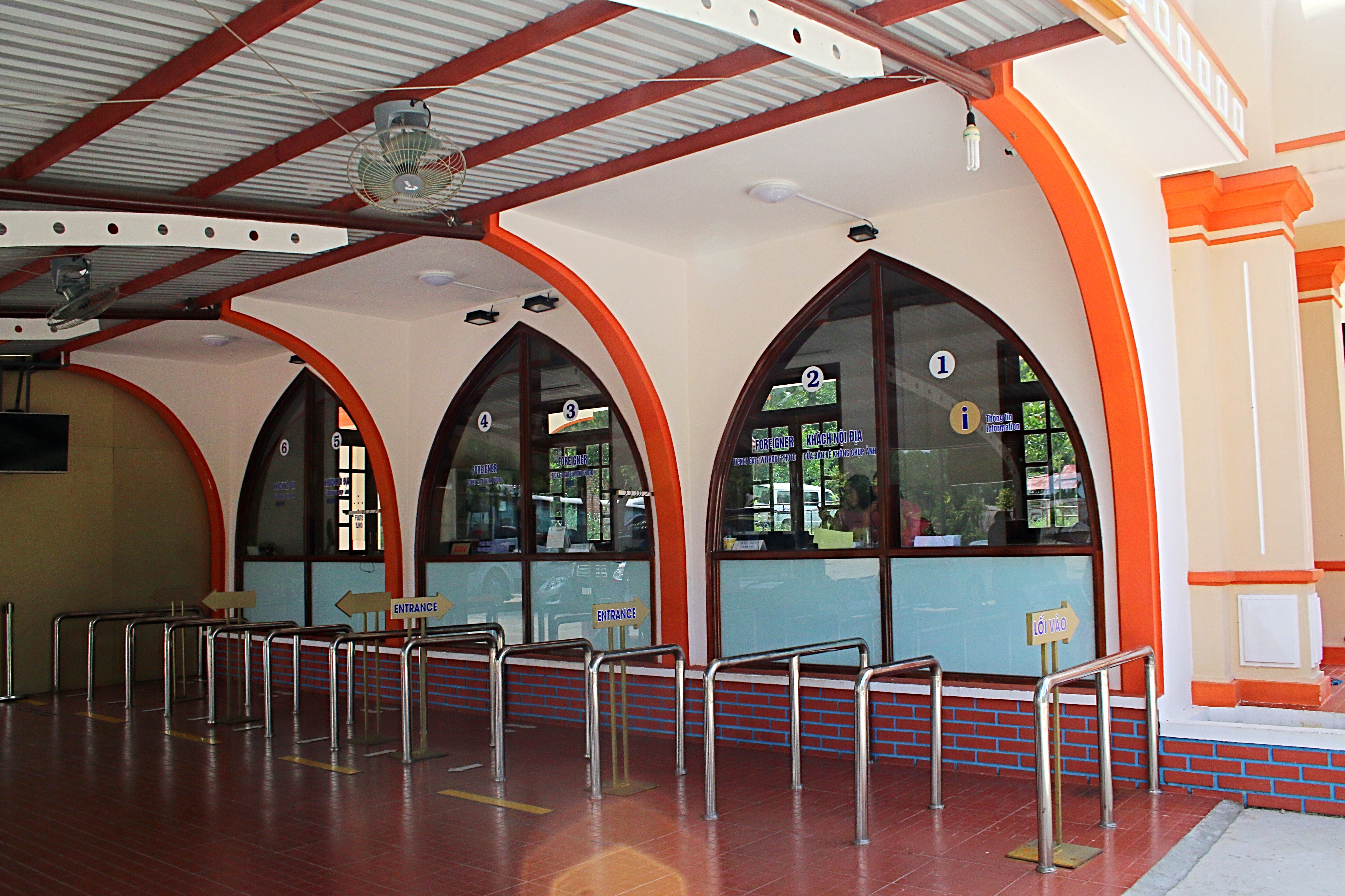
Before entering the actual archaeological site, you encounter another ticket counter.  I don’t understand the logic here…would you seriously pay just to enter the courtyard?  Anyway, here we paid $5 each and received our tickets.

The site is very well laid out, well marked and has sturdy paths to lead you from one area to the next in the front of the complex.

One of the first buildings you encounter is the The Little Hands Structure, so named because of the red colored hand prints that mark the wall.  The temple is comprised of two rooms in which a small temple was built in the interior of one of them.

Another small house-like structure is located nearby, although it is almost certain to have had a ceremonial use.  A small temple is also located in the center of the structure.

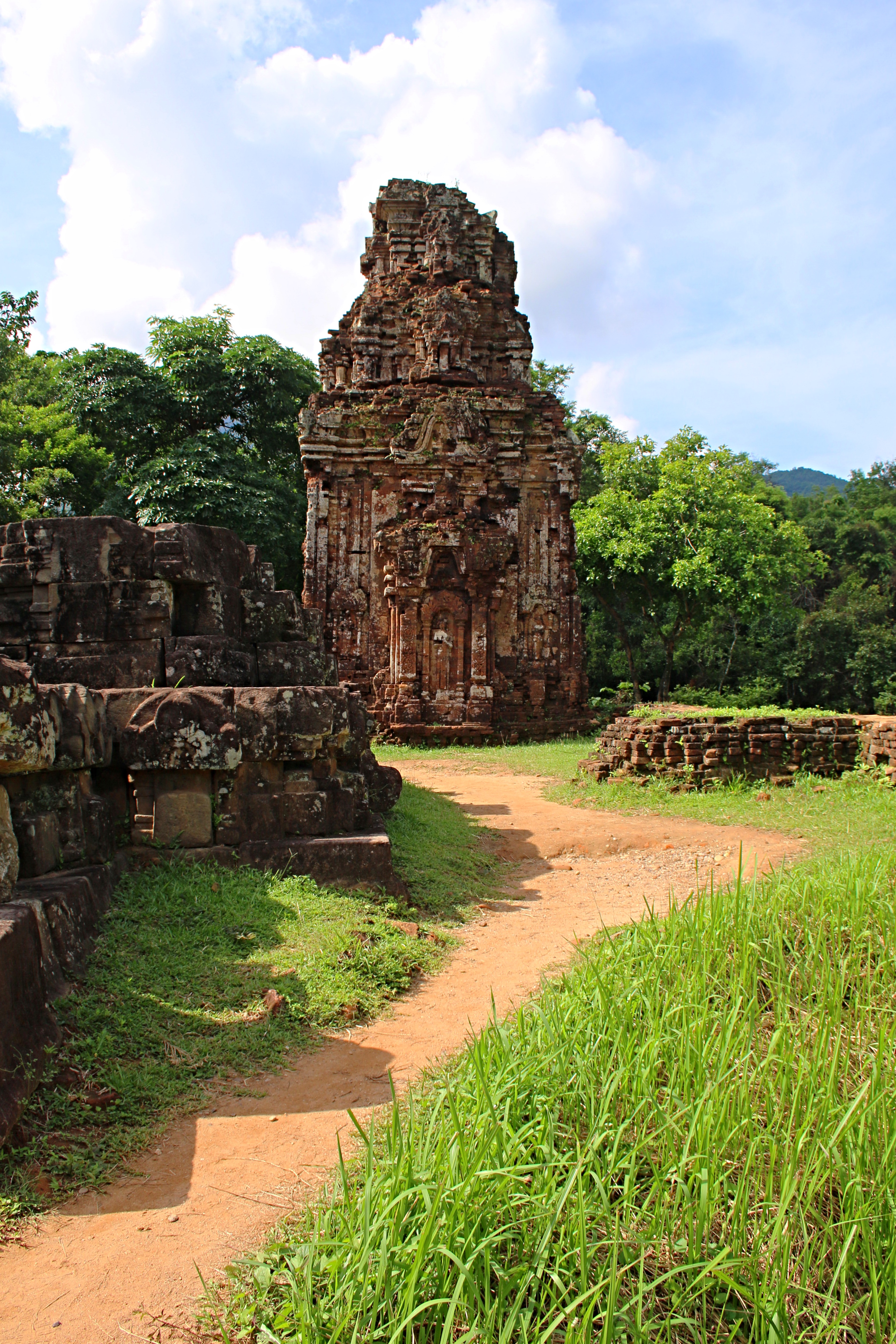
As we continued on, we encountered other small structures, but an impressive arch-like structure, which marked the intersection of two ancient roads  or sacbés, caught my eye.  In pre-hispanic days, The Arch Structure, was the entrance or exit of the central part of San Gervasio.  Pilgrims and traders would reach the famous sanctuary of Ixchel to make an offering at the altar that lies in the middle of the vaulted passageway.  It was here that many statues to Ixchel were found and are still being discovered.  One of the statues, a large ceramic image of Ixchel was believed to have delivered oracles spoken by a hidden priestess for pilgrims with questions.

From this point, we chose one of the two roads to either Pozo or Nohoch Nah.  The paved paths ended here and the road was rocky and a bit muddy from the recent rains.

Nohoch Nah, also known as the the Big House Structure, was quite an impressive one.  An altar in the middle of the enclosure, in which offerings were placed can be seen through the grated metal that covers the doorways.  Most archaeological sites prohibit you from standing on or climbing the structures, however, this one allows for climbing the stairs and walking around the formation giving you a distinct understanding of how the Mayans felt when they utilized the structure.

After a long and drizzly walk through the jungle, complete with massive puddles blocking the path, we soon arrived at Murciélagos y Pet Nah.  The Muciélagos and Round House Structures were the most important buildings in the Late Classic period in San Gervasio.  The principal center of the site was located here and it was also here that the Overlord resided.  The Round House was named as such due to the unusual rounded platforms and its altar which is also round. Again, we were able to climb to the top of the rounded platforms giving us a different perspective of Murciélagos.

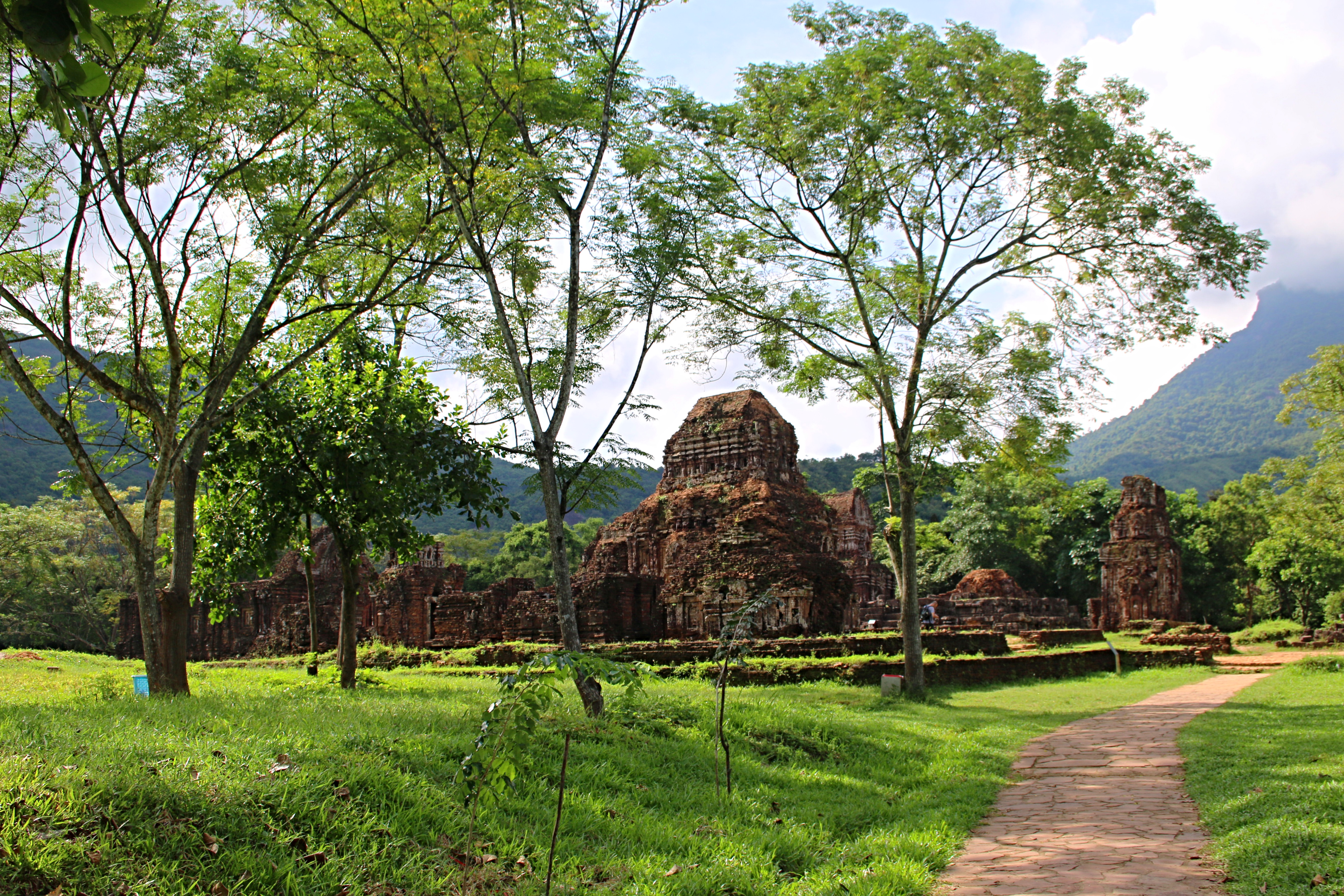
After another long and muddy walk through the jungle, we soon arrived at the final area of San Gervasio, complete with four distinct structures.  The Palace Structure contained colonnaded halls most of which can still be seen standing on the foundation.   Though you were not prohibited from climbing the other structures, here, signs inform you that it is not allowed.

In this wide, grassy area, another structure, is the Ossuary,  The structure was aptly named after numerous human remains were found inside during exploration of the building.  The temple no longer exists, but originally had masonry walls and a a roof.

Another smaller structure also stands here in this area, Structure 25B, which was also another colonnaded hall with a masonry roof.   Different from other colonnaded halls, it only had three pillars with square bases and three columns with round bases.

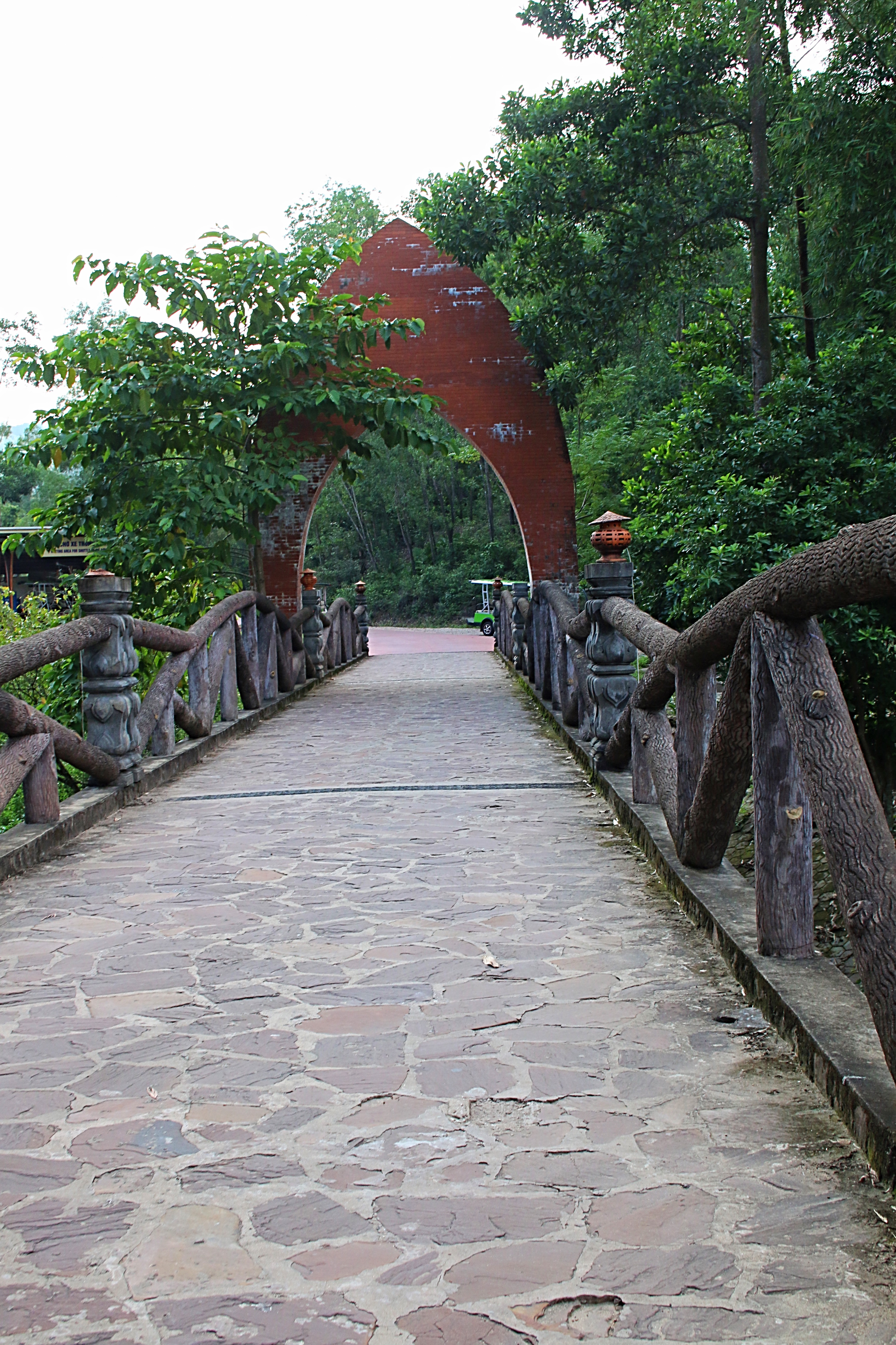
Back to the smooth, paved walkways, we made our way toward the front of the complex returning our umbrella along the way.

Though San Gervasio is not quite as large as Chichen Itza or many of the other massive ruin sites in the Riviera Maya and has not had a lot of restoration, the numerous structures that can be viewed at close range amid the beautiful natural setting makes the off-the-beaten trek, worthwhile.

So…grab your sunglasses, umbrella and bug spray and your sense of adventure…head on over to San Gervasio.

Check out more pictures on Facebook, Snapping the Globe and Instagram, @snappingtheglobe.


San Gervasio

  • http://www.inah.gob.mx/es/zonas/101-zona-arqueologica-san-gervasio
  • Address:  Kilómetro 7.5, Carretera Transversal, Centro, 77600 Cozumel, Q.R., Mexico
  • Hours:  Monday thru Sunday, 0800-1630
  • Admission:  $9.50
  • How To Get There:  By car, head north on Transversal Road from downtown Cozumel.  The entrance is well-marked.  If you are arriving by cruise ship, many taxis will take you to the ruins and wait for about $70 and return you to San Miguel or the cruise ship’s dock.


A Vibrant Village

© 2017 Snapping the Globe, L.L.C. All rights reserved.

Mayan ruins dot the landscape throughout Mexico.

On Cozumel, two archaelogical sites are easily accessible to tourists…

San Gervasio is the largest and located in the central part of Cozumel.

The smallest, but oldest, El Cedral, is located near the south coast.

Having never heard of El Cedral, we were anxious to check out this small fertility temple, dating back to 800 AD.  Once functioning as a jail in the 19th century, it is located in a small village and is thought to have been an important ceremonial site.

As we drove through the arched entrance, it was late afternoon and we wondered if our arrival might be too late.  Passing through a gate, we traveled down a long rural road before arriving at the front of the village.

A central plaza spread before us with a large, covered pavilion, lined with brightly covered flags.  A nearby covered structure contained a large number of inscribed benches and there were a few vendor’s storefronts as well as the Hacienda Tequila Museum, which offers tequila tastings.

Not seeing a ruin or signs directing us to one, we turned left and drove around the village.  What a treat!  Brightly colored houses, with festive crosses and art displays greeted us at every corner.

As we made the full circle, back to the front of the village, a kindly villager stopped our car to direct us to the location of the ruin and showed us a parking location.

Festive statues greeted us at the front of the pavilion and after walking through the pavilion, we found the temple located at the far, left end.  Not very impressive and having no ornamentation, the ruin sits next to the highlight of the village, a small stucco church, which is known to be the first church on the island, the Church of El Cedral.

The church, rather small and simple,  is light and airy although its seating does not appear to be very comfortable.  On the altar were three small garments that appeared to be draped over three crucifixes.  I was quite curious about these, but with no one nearby, I was unable to find out more.

Knowing that the large pavilion in the center of town houses a five-day festival, Féria El Cedral, which brings people from all over Mexico at the end of April or early May, to enjoy the festivities, I had no idea that these crosses had anything to do with it.

Once we had walked around the church, we returned to visit one of the the souvenir shops.  Here, I found out more.

Legend has it that 150 years ago, a young man by the name of Casimiro Cárdenas was attacked during the Caste War in the town of Saban.  Though the enemies killed his companions, Cárdenas survived the massacre by hiding under other bodies, while clutching a cross, an event which came to be known as the Miricle of Saban. So strongly that Cárdenas believed that the cross was the reason he survived that he vowed to honor the cross even as he later settled in El Cedral.  Soon after arriving in the town, he and the other immigrants celebrated the first services to honor the holy cross in which after praying, they received the toche (blessing with the cross).  Invitations were also extended to the residents of the main town of Cozumel, a tradition that still continues.

The pavilion is where the traditional and folkloric events are performed and many other events are held in conjunction with the festival…horse racing, rooster fights, rodeo, concerts and bullfighting.  Large quantities of food are prepared and consumed and commemorative merchandise is sold throughout the event.   The Pigs Head dance, in which dancers carry a decorated pig’s head, is one of the culminating events of the festivities.

After the death of Casimiro Cárdenas, his wife continued the festivities and today, his descendants are the keepers of the holy cross of Sabán.  The festival is held between April 23 with prayers commencing at dawn and end on May 3rd with a traditional dance “Cabeza de Cerdo”, symbolizing Jesus Christ’s sacrifice.

While making the drive around Cozumel, take a half hour out of your day to visit El Cedral, a town steeped in tradition and history.  Very easy to find, it is located 3 km west of Carretera Costera Sur.  The turnoff is near Km 17, across from the Alberto’s Restaurant sign.  And, if you are on the island during festival season, be sure and visit…and tell us about it!


For more pictures, check out Facebook, Snapping the Globe and Instagram, @snappingtheglobe.


El Cedral Village, Church and Archaeological Ruins

  • Hours:  Open daily
  • Admission:  free
  • How to Get There:   Located 3 km west of Carretera Costera Sur.  The turnoff is near Km 17, across from the Alberto’s Restaurant sign.

My Son…My Way

© 2016 Snapping the Globe, L.L.C. All rights reserved.

Last year, Angkor Wat.  This year, My Son.

Always having been a dream of mine to visit Angkor Wat, the largest religious monument in the world, I was finally afforded the opportunity last year.  Having seen the “City of Temples” constructed during the 12th century, I thought that it was one of the oldest in that part of Asia.

image

While cruising the waters of the Thu Bon river with Mr. Seo, he asked me if I had planned to visit the ruins of My Son.  Did I misunderstand him…there were ruins near Hoi An?

Seo, offered a plan.  He could take me to My Son the next day on the back of his motorbike…about an hour’s ride outside of Hoi An towards the mountainous region.  After quoting a price, he waited for an answer.  Although I was really interested in these ruins, I knew nothing about them nor did I know what the going rate was.  And…on a motorbike?  With a guy I hardly knew?  I needed to think on this one.  I would text him later.

As I lounged at the beach that afternoon, I surfed the internet for information about My Son. A UNESCO World Heritage Site since 1999, the ruins are located about 45 kilometers from Hoi An and were built between the 4th and 14th centuries, making them older than Angkor Wat.  I found tours ranging from $16-$40 per person and group sizes ranging from five persons to busloads.  Seo had quoted a price of $35 and we would leave extremely early to avoid the crowds and traffic which would allow me the rest of the day to spend exploring the parts of Hoi An that I had not yet seen.  Not sure if I was making the right decision, I texted Seo and negotiated a lower price.  We agreed on the terms and I planned for my early departure the next day.

imageSeo arrived right on time at 7:15 a.m. and we were on our way, me sitting behind him.  It was a long, sometimes scary and sometimes thrilling ride and I was starting to feeling the effects on my lower back when I saw the first signs for My Son.  Seo parked his motorbike and we crossed the tall bridge to the ticket counter.  After paying my entrance fee, we boarded the tram for the winding trip around the mountain to My Son’s grounds.

image

Extremely hot, even for nine in the morning, I made my way, sweating profusely, toward the main buildings in the middle of the site. My first impression was that of peacefulness.  There were hardly any tourists on the grounds and I had the crumbling buildings all to myself. The temples had beautifully intricate details that were lost to the eye at first glance, however, came to life the more they were studied.  The area was green and fertile and provided a beautiful backdrop  for the structures.  Needless to say, my camera was put to very good use.

image

image

imageSurrounded by high mountains and situated in the heart of a beautiful valley, these buildings were originally built from wood but were destroyed by fire in the 6th century.  During the 7th century, they were rebuilt with bricks and by the 13th century, more than 70 similar buildings had been built.  A sanctuary of Hinduism, the buildings of the complex were used to worship and make offerings to the Hindu gods.

image

image

image

image

Many of the buildings’ entrances were open to enter and some displayed statues and other artwork.  There are four separate areas that were open to visitors and all were connected by paved pathways.

image

image

image

After finishing my walk through all areas of the complex and noticing that more tourists were present, I made my way to the Arts Pavilion where Aspara dancers were performing.  Beautifully choreographed, it was a nice end to my visit at My Son.

imageRejoining Seo, he and I made our way toward the tram, marveling at the number of tourists arriving and traveling down the wooded path.  After the long ride on the back of Seo’s motorbike, I wondered if I had made the right decision.  Had I paid too much?  Maybe I did for a motorbike tour, but watching the busloads of tourists arriving, made me remember how much I dislike tour groups.  The fact that we were able to set our own schedule and arrive earlier than everyone else was worth the price.  I had been able to capture beautifully, unobstructed pictures of the site and well before the hottest temperatures of the day.

image

As the wind blew around me on our return trip, I was happy that I had done My Son…my way.

For more pictures, check out Facebook, Snapping the Globe and Instagram, @snappingtheglobe.


My Son 

  • Admission:  150,000 Vietnamese dong (about US $7.00)
  • Hours:  0600-1700
  • Motorbike parking:  10,000 Vietnamese dong (about US $.45)

my-son-map-1